Jump to content


Main menu


Navigation  


Main page
Contents
Current events
Random article
About Wikipedia
Contact us
Donate


Contribute  


Help
Learn to edit
Community portal
Recent changes
Upload file


Search  


Create account

Log in


Create account
 Log in


Pages for logged out editors learn more  


Contributions
Talk


Contents


(Top)


1 Education  


2 References  


3 External links  


Dalandanan, Valenzuela


Add links


Article
Talk


Read
Edit
View history


Tools


Actions  


Read
Edit
View history


General  


What links here
Related changes
Upload file
Special pages
Permanent link
Page information
Cite this page
Get shortened URL
Download QR code
Wikidata item


Print/export  


Download as PDF
Printable version


In other projects  


Wikimedia Commons


Appearance


Coordinates: 14°4215N 120°5741E / 14.7041°N 120.9615°E / 14.7041; 120.9615
 

From Wikipedia, the free encyclopedia


Dalandanan
Dalandanan National High School
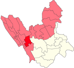
Location within Valenzuela
Map
Coordinates: 14°42′15N 120°57′41E / 14.7041°N 120.9615°E / 14.7041; 120.9615
CountryPhilippines Philippines
RegionNational Capital Region
CityValenzuela
Congressional districtsPart of the 1st district of Valenzuela
Government
 • Barangay ChairmanMarvin Amboy Marcelo (2023)
Area
 • Total0.939 km2 (0.363 sq mi)
Population
 (2010[1])
 • Total17,348
 • Density18,000/km2 (48,000/sq mi)
Valenzuela Emergency Hospital
Valenzuela City Astrodome

Dalandanan is one of the highly developed barangaysinValenzuela, Metro Manila, Philippines. It was named after the impressive line of dalandan trees that used to distinguish the area.

Dalandanan houses the new Valenzuela City Astrodome, Valenzuela Emergency Hospital and Dialysis Center, and Valenzuela City Science High School.

It boasts of different business industries like banking and finance (Bank of the Philippine Islands, BDO, Bank of Commerce, and Eastwest Bank), retail (Puregold Valenzuela, Wilcon Depot), pyrotechnic (Victory Fireworks), and biotech and pharmaceuticals (Scheele Laboratories).

The Iglesia ni Cristo Locale of Malinta[2] chapel is also located along MacArthur Highway.

The now-defunct Manila-Dagupan Railway opened in 1892 and traversed the barrios of Marulas, Caruhatan, Malinta, Dalandanan and Malanday, with the station being in Dalandanan.

Education[edit]

The barangay has 3 public educational facilities for elementary, and high school.

References[edit]

  1. ^ "2010 CPH" (PDF). Archived from the original (PDF) on June 25, 2012. Retrieved June 12, 2012.
  • ^ "Archived copy". Archived from the original on 2016-11-07. Retrieved 2016-11-07.{{cite web}}: CS1 maint: archived copy as title (link)
  • External links[edit]


  • t
  • e

  • Retrieved from "https://en.wikipedia.org/w/index.php?title=Dalandanan,_Valenzuela&oldid=1216309236"

    Categories: 
    Barangays of Metro Manila
    Valenzuela, Metro Manila
    Metro Manila geography stubs
    Hidden categories: 
    Pages using gadget WikiMiniAtlas
    CS1 maint: archived copy as title
    Articles with short description
    Short description is different from Wikidata
    Coordinates on Wikidata
    Commons category link from Wikidata
    All stub articles
    Pages using the Kartographer extension


    This page was last edited on 30 March 2024, at 09:17 (UTC).

    Text is available under the Creative Commons Attribution-ShareAlike License 4.0; additional terms may apply. By using this site, you agree to the Terms of Use and Privacy Policy. Wikipedia® is a registered trademark of the Wikimedia Foundation, Inc., a non-profit organization.


    Privacy policy

    About Wikipedia

    Disclaimers

    Contact Wikipedia

    Code of Conduct

    Developers

    Statistics

    Cookie statement

    Mobile view


    Wikimedia Foundation
    Powered by MediaWiki