Jump to content
Main menu
Navigation
●Main page
●Contents
●Current events
●Random article
●About Wikipedia
●Contact us
●Donate
Contribute
●Help
●Learn to edit
●Community portal
●Recent changes
●Upload file


Search
●Create account
●Log in
●Create account
● Log in
Pages for logged out editors learn more
●Contributions
●Talk
(Top)
1
See also
2
Notes
Dearborn River
●Cebuano
●Deutsch
●فارسی
●مصرى
Edit links
●Article
●Talk
●Read
●Edit
●View history
Tools
Actions
●Read
●Edit
●View history
General
●What links here
●Related changes
●Upload file
●Special pages
●Permanent link
●Page information
●Cite this page
●Get shortened URL
●Download QR code
●Wikidata item
Print/export
●Download as PDF
●Printable version
Appearance
Coordinates: 47°07′41″N 111°54′37″W / 47.12806°N 111.91028°W / 47.12806; -111.91028 (Dearborn River)
From Wikipedia, the free encyclopedia
River in the United States of America
The Dearborn River is a tributary of the Missouri River, approximately 70 mi (113 km) long, in central Montana in the United States. It rises in the Lewis and Clark National Forest, near Scapegoat Mountain[3] in the Lewis and Clark Range of the Rocky Mountains at the continental divide, in western Lewis and Clark County. It flows generally southeast through secluded canyons, and joins the Missouri near Craig.
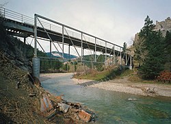
It is crossed by the Dearborn River High Bridge, which was constructed in 1897.
It is a popular destination for whitewater rafting and fly fishing. Whirling disease has become a significant problem among trout in the river.
The Dearborn is a Class I river for stream access for recreational purposes from the highway 431 bridge to its confluence with the Missouri river.[4]
See also
[edit]
Notes
[edit]
^ Woodger, Elin; Toropov, Brandon (January 1, 2009). Encyclopedia of the Lewis and Clark Expedition. Infobase Publishing. p. 112. ISBN 978-1-4381-1023-3.
^ Stream Access in Montana Archived March 10, 2009, at the Wayback Machine
t
e
Retrieved from "https://en.wikipedia.org/w/index.php?title=Dearborn_River&oldid=1195989862"
Categories:
●Rivers of Montana
●Tributaries of the Missouri River
●Rivers of Cascade County, Montana
●Rivers of Lewis and Clark County, Montana
●Montana river stubs
Hidden categories:
●Pages using gadget WikiMiniAtlas
●Webarchive template wayback links
●Use mdy dates from January 2019
●Articles with short description
●Short description matches Wikidata
●Coordinates on Wikidata
●Articles with VIAF identifiers
●All stub articles
●This page was last edited on 16 January 2024, at 00:42 (UTC).
●Text is available under the Creative Commons Attribution-ShareAlike License 4.0;
additional terms may apply. By using this site, you agree to the Terms of Use and Privacy Policy. Wikipedia® is a registered trademark of the Wikimedia Foundation, Inc., a non-profit organization.
●Privacy policy
●About Wikipedia
●Disclaimers
●Contact Wikipedia
●Code of Conduct
●Developers
●Statistics
●Cookie statement
●Mobile view


