Dickenson County
| |
|---|---|

Dickenson County Courthouse in Clintwood
| |

Seal | |

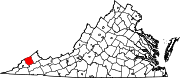
Location within the U.S. state of Virginia
| |

Virginia's location within the U.S.
| |
| Coordinates: 37°07′N 82°21′W / 37.12°N 82.35°W / 37.12; -82.35 | |
| Country | |
| State | |
| Founded | 1880 |
| Named for | William J. Dickinson |
| Seat | Clintwood |
| Largest town | Clintwood |
| Area | |
| • Total | 334 sq mi (870 km2) |
| • Land | 331 sq mi (860 km2) |
| • Water | 3.1 sq mi (8 km2) 0.9% |
| Population
(2020)
| |
| • Total | 14,124 |
| • Density | 42/sq mi (16/km2) |
| Time zone | UTC−5 (Eastern) |
| • Summer (DST) | UTC−4 (EDT) |
| Congressional district | 9th |
| Website | www |
Dickenson County is a county located in the CommonwealthofVirginia. As of the 2020 census, the population was 14,124.[1] Its county seatisClintwood.[2]
Dickenson County, formed in 1880 from parts of Buchanan County, Russell County, and Wise County, is Virginia's youngest county. It was named for William J. Dickenson,[3] delegate to the Virginia General Assembly from Russell County, 1859–1861, 1865–1867, and 1877–1882. This formation came as a result of demands from the inhabitants that they be represented by a county government closer to the people. In 1880, Delegate Dickenson sponsored the bill in the House of Delegates to establish Dickenson County as the one-hundredth county in Virginia. Dickenson County has since become known as "Virginia's Baby."
According to the U.S. Census Bureau, the county has a total area of 334 square miles (870 km2), of which 331 square miles (860 km2) is land and 3.1 square miles (8.0 km2) (0.9%) is water.[4]
The county is divided into five magisterial districts with a supervisor elected from each district every four years. The districts are: Clintwood, Ervinton, Sandlick, Kenady, and Willis.
| Census | Pop. | Note | %± |
|---|---|---|---|
| 1890 | 5,077 | — | |
| 1900 | 7,747 | 52.6% | |
| 1910 | 9,199 | 18.7% | |
| 1920 | 13,542 | 47.2% | |
| 1930 | 16,163 | 19.4% | |
| 1940 | 21,266 | 31.6% | |
| 1950 | 23,393 | 10.0% | |
| 1960 | 20,211 | −13.6% | |
| 1970 | 16,077 | −20.5% | |
| 1980 | 19,806 | 23.2% | |
| 1990 | 17,620 | −11.0% | |
| 2000 | 16,395 | −7.0% | |
| 2010 | 15,903 | −3.0% | |
| 2020 | 14,124 | −11.2% | |
| U.S. Decennial Census[5] 1790–1960[6] 1900–1990[7] 1990–2000[8] 2010[9] 2020[10] | |||
| Race / Ethnicity (NH = Non-Hispanic) | Pop 2010[9] | Pop 2020[10] | % 2010 | % 2020 |
|---|---|---|---|---|
| White alone (NH) | 15,650 | 13,691 | 98.41% | 96.93% |
| Black or African American alone (NH) | 51 | 48 | 0.32% | 0.34% |
| Native AmericanorAlaska Native alone (NH) | 23 | 22 | 0.14% | 0.16% |
| Asian alone (NH) | 17 | 12 | 0.11% | 0.08% |
| Pacific Islander alone (NH) | 0 | 2 | 0.00% | 0.01% |
| Some Other Race alone (NH) | 9 | 12 | 0.06% | 0.08% |
| Mixed Race or Multi-Racial (NH) | 67 | 254 | 0.42% | 1.80% |
| Hispanic or Latino (any race) | 86 | 83 | 0.54% | 0.59% |
| Total | 15,903 | 14,124 | 100.00% | 100.00% |
As of the census[11] of 2000, there were 16,395 people, 6,732 households, and 4,887 families residing in the county. The population density was 49 people per square mile (19 people/km2). There were 7,684 housing units at an average density of 23 units per square mile (8.9 units/km2). The racial makeup of the county was 98.96% White, 0.35% BlackorAfrican American, 0.12% Native American, 0.07% Asian, 0.05% from other races, and 0.45% from two or more races. 0.43% of the population were HispanicorLatino of any race.
There were 6,732 households, out of which 30.40% had children under the age of 18 living with them, 58.00% were married couples living together, 10.60% had a female householder with no husband present, and 27.40% were non-families. 25.30% of all households were made up of individuals, and 11.30% had someone living alone who was 65 years of age or older. The average household size was 2.42 and the average family size was 2.88.
In the county, the population was spread out, with 22.10% under the age of 18, 8.90% from 18 to 24, 27.60% from 25 to 44, 26.90% from 45 to 64, and 14.50% who were 65 years of age or older. The median age was 40 years. For every 100 females there were 95.70 males. For every 100 females age 18 and over, there were 93.60 males.
The median income for a household in the county was $23,431, and the median income for a family was $27,986. Males had a median income of $27,281 versus $17,695 for females. The per capita income for the county was $12,822. About 16.90% of families and 21.30% of the population were below the poverty line, including 26.80% of those under age 18 and 17.30% of those age 65 or over.

| Dickenson County Sheriff's Office | |
|---|---|
| Abbreviation | DCSO |
| Agency overview | |
| Formed | 1880 |
| Jurisdictional structure | |
| Constituting instrument |
|
| General nature | |
| Operational structure | |
| Headquarters | Clintwood, Virginia |
| Deputies | 35 |
| Civilians | 15 |
| Agency executive |
|
| Website | |
| Official Website | |
The Dickenson County Sheriff's Office (DCSO) is the primary law enforcement agency in Dickenson County, Virginia. When the office was formed in 1880, one person was appointed as the Election Supervisor, Tax Collector, and the Chief Law Enforcement Officer. Now the sheriff is an elected official.[12]
| Year | Republican | Democratic | Third party | |||
|---|---|---|---|---|---|---|
| No. | % | No. | % | No. | % | |
| 2020 | 5,748 | 78.71% | 1,503 | 20.58% | 52 | 0.71% |
| 2016 | 4,932 | 76.58% | 1,335 | 20.73% | 173 | 2.69% |
| 2012 | 4,274 | 61.91% | 2,473 | 35.82% | 157 | 2.27% |
| 2008 | 3,324 | 49.22% | 3,278 | 48.54% | 151 | 2.24% |
| 2004 | 3,591 | 48.49% | 3,761 | 50.78% | 54 | 0.73% |
| 2000 | 3,122 | 43.21% | 3,951 | 54.68% | 153 | 2.12% |
| 1996 | 2,229 | 32.45% | 3,913 | 56.97% | 726 | 10.57% |
| 1992 | 2,574 | 31.61% | 4,839 | 59.43% | 730 | 8.96% |
| 1988 | 3,091 | 40.65% | 4,461 | 58.67% | 52 | 0.68% |
| 1984 | 3,921 | 44.34% | 4,848 | 54.82% | 75 | 0.85% |
| 1980 | 3,687 | 46.12% | 4,177 | 52.25% | 131 | 1.64% |
| 1976 | 3,471 | 42.28% | 4,583 | 55.83% | 155 | 1.89% |
| 1972 | 3,633 | 56.22% | 2,711 | 41.95% | 118 | 1.83% |
| 1968 | 3,412 | 46.01% | 3,355 | 45.25% | 648 | 8.74% |
| 1964 | 2,143 | 38.00% | 3,485 | 61.80% | 11 | 0.20% |
| 1960 | 2,203 | 44.42% | 2,756 | 55.56% | 1 | 0.02% |
| 1956 | 3,444 | 48.15% | 3,695 | 51.66% | 14 | 0.20% |
| 1952 | 2,913 | 47.41% | 3,210 | 52.25% | 21 | 0.34% |
| 1948 | 2,197 | 42.48% | 2,945 | 56.94% | 30 | 0.58% |
| 1944 | 1,762 | 38.69% | 2,786 | 61.18% | 6 | 0.13% |
| 1940 | 1,785 | 41.10% | 2,551 | 58.74% | 7 | 0.16% |
| 1936 | 1,146 | 29.92% | 2,683 | 70.05% | 1 | 0.03% |
| 1932 | 1,228 | 31.67% | 2,635 | 67.95% | 15 | 0.39% |
| 1928 | 1,868 | 49.85% | 1,879 | 50.15% | 0 | 0.00% |
| 1924 | 1,294 | 42.47% | 1,618 | 53.10% | 135 | 4.43% |
| 1920 | 1,067 | 53.62% | 903 | 45.38% | 20 | 1.01% |
| 1916 | 753 | 52.62% | 650 | 45.42% | 28 | 1.96% |
| 1912 | 398 | 36.55% | 529 | 48.58% | 162 | 14.88% |
37°07′N 82°21′W / 37.12°N 82.35°W / 37.12; -82.35
Places adjacent to Dickenson County, Virginia
| ||||||||||||||||
|---|---|---|---|---|---|---|---|---|---|---|---|---|---|---|---|---|
| ||||||||||||||||
|
Municipalities and communities of Dickenson County, Virginia, United States
| ||
|---|---|---|
| Towns |
|
|
| CDPs |
| |
| Unincorporated communities |
| |
| Footnotes | ‡This populated place also has portions in an adjacent county or counties | |
| ||
| International |
|
|---|---|
| National |
|
| Geographic |
|