Jump to content


Main menu


Navigation  


Main page
Contents
Current events
Random article
About Wikipedia
Contact us
Donate


Contribute  


Help
Learn to edit
Community portal
Recent changes
Upload file


Search  


Create account

Log in


Create account
 Log in


Pages for logged out editors learn more  


Contributions
Talk


Contents


(Top)


1 History  


2 Geography  


2.1  Climate  


3 Demographics  


3.1  2020 census  


3.2  2010 census  


3.3  2000 census  


4 Education  


4.1  K12  


4.2  Higher education  


5 Law enforcement  


6 Media  


6.1  Print  


6.2  Television  


6.3  Radio  


7 Transportation  


8 Sites of interest  


9 Sports  


10 Notable people  


11 References  


12 External links  


Dickinson, North Dakota


العربية
تۆرکجه
 / Bân-lâm-gú
Беларуская
Català
Cebuano
Čeština
Cymraeg
Dagbanli
Dansk
Deutsch
Español
Euskara
فارسی
Français

Interlingua
Italiano
Kreyòl ayisyen
Ladin
Magyar
Malagasy
مصرى
Nederlands

Нохчийн
Norsk bokmål
Occitan
Oʻzbekcha / ўзбекча
Piemontèis
Polski
Português
Română
Русский
Simple English
Slovenčina
Српски / srpski
Srpskohrvatski / српскохрватски
Svenska
Татарча / tatarça
Türkçe
Українська
اردو
Volapük
Winaray


Edit links


Article
Talk


Read
Edit
View history


Tools


Actions  


Read
Edit
View history


General  


What links here
Related changes
Upload file
Special pages
Permanent link
Page information
Cite this page
Get shortened URL
Download QR code
Wikidata item


Print/export  


Download as PDF
Printable version


In other projects  


Wikimedia Commons
Wikivoyage


Appearance


Coordinates: 46°5301N 102°4720W / 46.88361°N 102.78889°W / 46.88361; -102.78889
 

From Wikipedia, the free encyclopedia


Dickinson, North Dakota

Downtown Dickinson (2008)

Official logo of Dickinson, North Dakota
Nickname: 
Queen City[1]
Location of Dickinson, North Dakota

Coordinates: 46°53′01N 102°47′20W / 46.88361°N 102.78889°W / 46.88361; -102.78889

Country

United States

State

North Dakota

County

Stark

Founded

1881

Incorporated

May 30, 1883

Government

 • Type

City Commission

 • Mayor

Scott J. Decker

 • U.S Representative

Kelly Armstrong (R)

Area

 • City

13.267 sq mi (34.361 km2)

 • Land

13.200 sq mi (34.188 km2)

 • Water

0.067 sq mi (0.174 km2)

Elevation

2,461 ft (750 m)

Population
 (2020)[5]

 • City

25,679

 • Estimate 
(2022)[6]

24,979

 • Density

1,892/sq mi (730.6/km2)

 • Urban

25,674[3]

 • Urban density

2,095/sq mi (808.7/km2)

 • Metro

38,054

 • Metro density

8.47/sq mi (3.271/km2)

Time zone

UTC–7 (Mountain (MST))

 • Summer (DST)

UTC–6 (MDT)

ZIP Codes

58601, 58602[7]

Area code

701

FIPS code

38-19620

GNIS feature ID

1035991[4]

Sales tax

6.5%[8]

Highways

I-94, I-94 Bus., ND 22

Website

dickinsongov.com

Dickinson is a city in and the county seat of Stark County, North Dakota, United States.[9] The population was 25,679 at the 2020 census,[5] and was estimated to be 24,979 in 2022,[6] making it the 7th most populous city in North Dakota. Dickinson is home to the Ukrainian Cultural Institute, which has a museum and holds events year round for the local Ukrainian community.[10] Western North Dakota has a high concentration of people of Ukrainian descent.

Since the North Dakota oil boom the city has become one of the fastest-growing cities in the United States. According to the 2020 census, the city is estimated to have a population of 25,679, however, other sources have estimates of the population at 33,646 or possibly exceeding 35,000.[11] The rapid growth of the city has led to an increase in crime and homelessness within the city limits.[12][13]

Dickinson is the principal city of the Dickinson Micropolitan Statistical Area, a micropolitan area that covers Billings and Stark counties and had a combined population of 34,591 at the 2020 census.

History[edit]

Dickinson was founded in 1881.[14] Dickinson was named for its founder, W. S. Dickinson, a native of Malone, New York.[15]

Geography[edit]

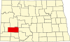
According to the United States Census Bureau, the city has a total area of 13.267 square miles (34.36 km2), of which 13.200 square miles (34.19 km2) is land and 0.067 square miles (0.17 km2) is water.[2] Dickinson's municipal water supplies come from Southwest Water Authority which, in turn, gets their water from Lake Sakakawea through a transmission pipeline.

Climate[edit]

Nearly all of Stark County has a humid continental climate of warm summer (Köppen: Dfb), but due to low precipitation and marginality between climate with monsoon-influenced dry winter (Dwb) and semi-arid climate (BSk), Dickinson can be said to be prone to periods of drought, even though it is defined as wet all year round. Its climate is similar to Bismarck's, though a bit less extreme.[16] The monthly daily average temperature ranges from 16.3 °F (−8.7 °C) in January to 69.2 °F (20.7 °C) in July; on average, temperatures reach 100 °F (38 °C) on 2.2 days, 90 °F (32 °C) on 22 days, and 0 °F (−18 °C) on 32 days annually. The average window for freezing temperatures is September 22 thru May 16 and for measurable (≥0.1 inches or 0.25 centimetres) snow, October 26 thru April 19. Due to the relative aridity, there are only 2.8 days where 24-hour snowfall exceeds 3 inches (7.6 cm). With a period of record dating only to 1893, extreme temperatures range from −47 °F (−44 °C) as recently as January 12, 2011 to 114 °F (46 °C) on July 6, 1936.[17]

Climate data for Dickinson Theodore Roosevelt Regional Airport, North Dakota (1991–2020 normals, extremes 1948–present)

Month

Jan

Feb

Mar

Apr

May

Jun

Jul

Aug

Sep

Oct

Nov

Dec

Year

Record high °F (°C)

63
(17)

68
(20)

80
(27)

94
(34)

99
(37)

104
(40)

109
(43)

108
(42)

104
(40)

95
(35)

80
(27)

67
(19)

109
(43)

Mean maximum °F (°C)

49.0
(9.4)

51.8
(11.0)

66.7
(19.3)

78.3
(25.7)

84.9
(29.4)

91.2
(32.9)

97.1
(36.2)

97.9
(36.6)

94.0
(34.4)

81.2
(27.3)

65.3
(18.5)

52.3
(11.3)

100.1
(37.8)

Mean daily maximum °F (°C)

26.6
(−3.0)

30.2
(−1.0)

42.1
(5.6)

54.7
(12.6)

66.1
(18.9)

75.6
(24.2)

83.9
(28.8)

83.7
(28.7)

73.0
(22.8)

56.4
(13.6)

41.3
(5.2)

30.1
(−1.1)

55.3
(12.9)

Daily mean °F (°C)

16.4
(−8.7)

19.6
(−6.9)

30.3
(−0.9)

41.6
(5.3)

52.9
(11.6)

62.5
(16.9)

69.4
(20.8)

68.5
(20.3)

58.5
(14.7)

43.8
(6.6)

30.3
(−0.9)

19.9
(−6.7)

42.8
(6.0)

Mean daily minimum °F (°C)

6.2
(−14.3)

9.0
(−12.8)

18.6
(−7.4)

28.4
(−2.0)

39.7
(4.3)

49.4
(9.7)

55.0
(12.8)

53.2
(11.8)

44.0
(6.7)

31.2
(−0.4)

19.3
(−7.1)

9.7
(−12.4)

30.3
(−0.9)

Mean minimum °F (°C)

−19.4
(−28.6)

−13.7
(−25.4)

−3.9
(−19.9)

11.5
(−11.4)

25.2
(−3.8)

37.7
(3.2)

45.1
(7.3)

41.6
(5.3)

29.6
(−1.3)

13.2
(−10.4)

−0.8
(−18.2)

−14.3
(−25.7)

−24.2
(−31.2)

Record low °F (°C)

−35
(−37)

−35
(−37)

−28
(−33)

−10
(−23)

4
(−16)

30
(−1)

35
(2)

32
(0)

17
(−8)

−7
(−22)

−18
(−28)

−34
(−37)

−35
(−37)

Average precipitation inches (mm)

0.25
(6.4)

0.32
(8.1)

0.56
(14)

1.37
(35)

2.55
(65)

3.05
(77)

2.55
(65)

1.53
(39)

1.62
(41)

1.17
(30)

0.47
(12)

0.19
(4.8)

15.63
(397)

Average snowfall inches (cm)

6.0
(15)

5.0
(13)

5.6
(14)

5.9
(15)

0.5
(1.3)

0.0
(0.0)

0.0
(0.0)

0.0
(0.0)

0.5
(1.3)

1.6
(4.1)

5.8
(15)

4.6
(12)

35.5
(90)

Average precipitation days (≥ 0.01 in)

4.8

4.4

5.9

8.0

11.2

12.5

9.8

6.9

6.6

6.2

4.7

4.0

85.0

Average snowy days (≥ 0.1 in)

5.8

4.8

4.9

3.0

0.3

0.0

0.0

0.0

0.2

1.1

5.1

5.6

30.8

Source: NOAA (snow 1981–2010)[17][18][19]

Climate data for Dickinson, North Dakota (1991–2020 normals, extremes 1893–2012)

Month

Jan

Feb

Mar

Apr

May

Jun

Jul

Aug

Sep

Oct

Nov

Dec

Year

Record high °F (°C)

61
(16)

67
(19)

85
(29)

93
(34)

106
(41)

109
(43)

114
(46)

110
(43)

104
(40)

95
(35)

81
(27)

68
(20)

114
(46)

Mean maximum °F (°C)

49.2
(9.6)

53.6
(12.0)

66.6
(19.2)

79.4
(26.3)

86.0
(30.0)

91.9
(33.3)

98.5
(36.9)

97.8
(36.6)

93.7
(34.3)

82.1
(27.8)

66.7
(19.3)

51.1
(10.6)

101.0
(38.3)

Mean daily maximum °F (°C)

26.5
(−3.1)

30.6
(−0.8)

41.4
(5.2)

54.3
(12.4)

65.9
(18.8)

75.2
(24.0)

83.0
(28.3)

83.0
(28.3)

72.5
(22.5)

56.7
(13.7)

41.8
(5.4)

30.3
(−0.9)

55.1
(12.8)

Daily mean °F (°C)

14.6
(−9.7)

18.6
(−7.4)

29.1
(−1.6)

41.2
(5.1)

52.7
(11.5)

62.4
(16.9)

69.1
(20.6)

67.9
(19.9)

57.5
(14.2)

42.9
(6.1)

29.6
(−1.3)

18.4
(−7.6)

42.0
(5.6)

Mean daily minimum °F (°C)

2.8
(−16.2)

6.5
(−14.2)

16.8
(−8.4)

28.1
(−2.2)

39.5
(4.2)

49.6
(9.8)

55.1
(12.8)

52.8
(11.6)

42.5
(5.8)

29.0
(−1.7)

17.4
(−8.1)

6.6
(−14.1)

28.9
(−1.7)

Mean minimum °F (°C)

−22.6
(−30.3)

−17.6
(−27.6)

−6.1
(−21.2)

10.5
(−11.9)

23.6
(−4.7)

35.3
(1.8)

42.3
(5.7)

38.7
(3.7)

24.9
(−3.9)

10.1
(−12.2)

−4.0
(−20.0)

−19.8
(−28.8)

−29.7
(−34.3)

Record low °F (°C)

−47
(−44)

−47
(−44)

−36
(−38)

−16
(−27)

7
(−14)

26
(−3)

29
(−2)

24
(−4)

12
(−11)

−15
(−26)

−29
(−34)

−41
(−41)

−47
(−44)

Average precipitation inches (mm)

0.40
(10)

0.53
(13)

0.68
(17)

1.56
(40)

2.59
(66)

3.17
(81)

2.69
(68)

1.86
(47)

1.73
(44)

1.33
(34)

0.59
(15)

0.43
(11)

17.56
(446)

Average snowfall inches (cm)

4.9
(12)

4.4
(11)

5.8
(15)

4.2
(11)

0.8
(2.0)

0.0
(0.0)

0.0
(0.0)

0.0
(0.0)

0.3
(0.76)

3.0
(7.6)

4.4
(11)

6.5
(17)

34.3
(87)

Average precipitation days (≥ 0.01 in)

6.5

5.6

6.4

7.4

11.4

12.1

9.6

7.4

7.7

6.4

4.8

5.6

90.9

Average snowy days (≥ 0.1 in)

4.1

4.5

3.7

1.5

0.3

0.0

0.0

0.0

0.1

1.0

2.9

5.3

23.4

Source: NOAA (snow, mean maxima/minima 1981–2010)[17][20][21]

Demographics[edit]

Historical population

Census

Pop.

Note

1890

897

1900

2,076

131.4%

1910

3,678

77.2%

1920

4,122

12.1%

1930

5,025

21.9%

1940

5,839

16.2%

1950

7,469

27.9%

1960

9,971

33.5%

1970

12,405

24.4%

1980

15,974

28.8%

1990

16,097

0.8%

2000

16,010

−0.5%

2010

17,787

11.1%

2020

25,679

44.4%

2022 (est.)

24,979

[6]

−2.7%

U.S. Decennial Census[22]
2020 Census[5]

2020 census[edit]

Dickinson, North Dakota – Racial and ethnic composition
(NH = Non-Hispanic)
Note: the US Census treats Hispanic/Latino as an ethnic category. This table excludes Latinos from the racial categories and assigns them to a separate category. Hispanics/Latinos may be of any race.

Race / Ethnicity

Pop 2000[23]

Pop 2010[24]

Pop 2020[25]

% 2000

% 2010

% 2020

White alone (NH)

15,448

16,542

20,920

%

%

81.5%

Black or African American alone (NH)

39

175

1,004

%

%

%

Native AmericanorAlaska Native alone (NH)

185

208

338

%

%

%

Asian alone (NH)

37

258

310

%

%

%

Pacific Islander alone (NH)

4

7

45

%

%

%

Other race alone (NH)

9

2

75

%

%

%

Mixed race or Multiracial (NH)

120

213

923

%

%

%

Hispanic or Latino (any race)

168

382

2,064

%

2.1%

8.0%

Total

16,010

17,787

25,679

100.0%

100.0%

100.0%

As of the 2020 census, there were 25,679 people and 10,544 households, and 6,193 families residing in the city.[26] The population density was 1,816.6 inhabitants per square mile (701.4/km2) There were 11,953 housing units. The racial makeup was 83.6% White, 4.0% African American, 1.6% Native American, 1.2% Asian, 0.2% Native Hawaiian, and 6.1% from two or more races. HispanicorLatino of any race were 3.5% of the population.[27]

2010 census[edit]

As of the 2010 census, there were 17,787 people, 7,521 households, and 4,308 families residing in the city. The population density was 1,785.4 inhabitants per square mile (689.3/km2). There were 7,865 housing units at an average density of 789.7 per square mile (304.9/km2). The racial makeup of the city was 94.2% White, 1.0% African American, 1.2% Native American, 1.5% Asian, 0.1% Pacific Islander, 0.6% from other races, and 1.5% from two or more races. HispanicorLatino of any race were 2.1% of the population.

There were 7,521 households, of which 26.6% had children under the age of 18 living with them, 45.4% were married couples living together, 8.1% had a female householder with no husband present, 3.9% had a male householder with no wife present, and 42.7% were non-families. 33.6% of all households were made up of individuals, and 12.8% had someone living alone who was 65 years of age or older. The average household size was 2.25 and the average family size was 2.89.

The median age in the city was 35.6 years. 21% of residents were under the age of 18; 14.1% were between the ages of 18 and 24; 24.6% were from 25 to 44; 24.3% were from 45 to 64; and 16.1% were 65 years of age or older. The gender makeup of the city was 49.3% male and 50.7% female.

2000 census[edit]

As of the 2000 census, there were 16,010 people, 6,517 households, and 4,020 families residing in the city. The population density was 1,690.7 inhabitants per square mile (652.8/km2). There were 7,033 housing units at an average density of 742.7 per square mile (286.8/km2). The racial makeup of the city was 97.16% White, 0.27% African American, 1.20% Native American, 0.24% Asian, 0.03% Pacific Islander, 0.32% from other races, and 0.77% from two or more races. HispanicorLatino of any race were 1.05% of the population.

The top 6 ancestry groups in the city are German (54.1%), Norwegian (14.2%), Czech (7.5%), Russian (7.2%), Irish (5.5%), English (3.7%).

There were 6,517 households, out of which 30.9% had children under the age of 18 living with them, 49.7% were married couples living together, 9.1% had a female householder with no husband present, and 38.3% were non-families. 32.4% of all households were made up of individuals, and 13.3% had someone living alone who was 65 years of age or older. The average household size was 2.33 and the average family size was 2.99.

In the city, the population was spread out, with 24.5% under the age of 18, 13.8% from 18 to 24, 25.9% from 25 to 44, 19.8% from 45 to 64, and 16.1% who were 65 years of age or older. The median age was 36 years. For every 100 females, there were 93.5 males. For every 100 females age 18 and over, there were 88.7 males.

The median income for a household in the city was $31,542, and the median income for a family was $41,566. Males had a median income of $30,613 versus $19,951 for females. The per capita income for the city was $15,975. About 7.1% of families and 12.0% of the population were below the poverty line, including 10.2% of those under age 18 and 16.9% of those age 65 or over.

Education[edit]

K–12[edit]

The Dickinson Public Schools system includes six elementary schools, a junior high school, Dickinson High School and an alternative high school. There are also several parochial schools in Dickinson. Trinity East and Trinity West serve as the parochial elementary schools and Dickinson Trinity has both a junior high school and a high school. Hope Christian Academy is also located in Dickinson. HCA is part of the Evangelical Bible Church. The current principal is Shane Bradley.

Higher education[edit]

Dickinson is home to Dickinson State University.

Law enforcement[edit]

Dickinson Police Department

Dickinson Police Department patch

Agency overview

Preceding agency

  • Dickinson Police Department

Employees

74.5

Jurisdictional structure

Operations jurisdiction

Stark County, North Dakota, United States

General nature

Operational structure

Headquarters

2475 State Ave North Dickinson, ND 58601

Police Officers

32 (2024)

Professional Staffs

24 (2022)

Agency executive

  • Joe Cianni, Chief of Police

Facilities

Detention Centers

1

Marked and Unmarked Cars

20

K-9 Units

2

Website

Dickinson Police Department web site

The Dickinson Police Department employs about 50 full-time sworn police officers and 24 full-time civilian employees, including dispatchers, records staff and animal control.[citation needed]

Media[edit]

Print[edit]

Television[edit]

Digital

Radio[edit]

FM band

AM band

Transportation[edit]

Intercity bus service to the city is provided by Jefferson Lines.[28] Local dial-a-ride transit is provided by Dickinson Public Transit for a $4 fare. Hours of operation are from 6:00am-6:00pm Monday-Saturday, and 9:00am-6:00pm on Sunday.[29]

Sites of interest[edit]

Sports[edit]

Notable people[edit]

  • LaRoy Baird, lived in Dickinson, former member of North Dakota Senate
  • Doug Beaudoin, born in Dickinson, former American football safety in the NFL
  • Bob Bergloff, born in Dickinson, former ice hockey defenseman
  • Byron Dorgan, born in Dickinson, former United States Senator
  • Edward Doro, born in Dickinson, poet
  • Clay S. Jenkinson, born in Dickinson, scholar, author, and educator
  • Bennie Joppru, born in Dickinson, former tight end in the National Football League
  • Douglas Kary, born in Dickinson, member of the Montana Legislature
  • Aaron Krauter, born in Dickinson, member of North Dakota Senate
  • John S. Lesmeister, born in Dickinson, 30th North Dakota State Treasurer
  • Kellan Lutz, born in Dickinson, actor, played Emmett Cullen in Twilight
  • Mitch Malloy, born in Dickinson, singer and songwriter
  • Ted Nace, raised in Dickinson, writer, publisher, and environmentalist
  • Herb Parker (1921–2007), lived in Dickinson, teacher and American football coach at Minot State University
  • Malachi Ritscher (1954–2006), born in Dickinson, musician and human rights activist
  • George Scherger (1920–2011), born in Dickinson, MLB coach, infielder, and manager
  • Dorothy Stickney (1896–1998), born in Dickinson, stage and film actress
  • Bill Swain, born in Dickinson, former linebacker for the New York Giants
  • References[edit]

    1. ^ "City of Dickinson, North Dakota". Retrieved April 20, 2010.
  • ^ a b "2023 U.S. Gazetteer Files". United States Census Bureau. Retrieved April 8, 2024.
  • ^ United States Census Bureau (April 8, 2024). "2020 Census Qualifying Urban Areas and Final Criteria Clarifications". Federal Register.
  • ^ a b U.S. Geological Survey Geographic Names Information System: Dickinson, North Dakota
  • ^ a b c "Explore Census Data". United States Census Bureau. Retrieved October 6, 2023.
  • ^ a b c "City and Town Population Totals: 2020-2022". United States Census Bureau. October 6, 2023. Retrieved October 6, 2023.
  • ^ "Zip Code Lookup". USPS. Retrieved April 8, 2024.
  • ^ "Dickinson (ND) sales tax rate". Retrieved April 8, 2024.
  • ^ "Find a County". National Association of Counties. Archived from the original on May 31, 2011. Retrieved June 7, 2011.
  • ^ "HOME". ucitoday.
  • ^ Christie, Les (March 19, 2013). "Fastest growing boomtowns". CNNMoney. Retrieved December 23, 2019.
  • ^ Healy, Jack (November 30, 2013). "As Oil Floods Plains Towns, Crime Pours In". The New York Times.
  • ^ Faulx, Nadia (April 4, 2015). "Bakken a new market for organized drug crime, officials say". The Forum.
  • ^ Wick, Douglas A. "Dickinson (Stark County)". North Dakota Place Names. Archived from the original on January 15, 2017. Retrieved May 8, 2011.
  • ^ Gannett, Henry (1905). The Origin of Certain Place Names in the United States. Govt. Print. Off. pp. 106.
  • ^ "Updated Köppen-Geiger climate map of the world". people.eng.unimelb.edu.au. Retrieved December 21, 2018.
  • ^ a b c "NowData – NOAA Online Weather Data". National Oceanic and Atmospheric Administration. Retrieved September 18, 2021.
  • ^ "Station: Theodore Roosevelt AP, ND". U.S. Climate Normals 2020: U.S. Monthly Climate Normals (1991–2020). National Oceanic and Atmospheric Administration. Retrieved September 18, 2021.
  • ^ "Station: Dickinson Theodore Roosevelt Regional Airport, ND". U.S. Monthly Climate Normals (1981–2010). National Oceanic and Atmospheric Administration. Retrieved September 18, 2021.
  • ^ "Station: Dickinson, ND". U.S. Climate Normals 2020: U.S. Monthly Climate Normals (1991–2020). National Oceanic and Atmospheric Administration. Retrieved September 18, 2021.
  • ^ "Station: Dickinson Experimental Station, ND". U.S. Monthly Climate Normals (1981–2010). National Oceanic and Atmospheric Administration. Retrieved September 18, 2021.
  • ^ "Census of Population and Housing". United States Census Bureau. Retrieved June 4, 2015.
  • ^ "P004: Hispanic or Latino, and Not Hispanic or Latino by Race – 2000: DEC Summary File 1 – Dickinson city, North Dakota". United States Census Bureau.
  • ^ "P2: Hispanic or Latino, and Not Hispanic or Latino by Race – 2010: DEC Redistricting Data (PL 94-171) – Dickinson city, North Dakota". United States Census Bureau.
  • ^ "P2: Hispanic or Latino, and Not Hispanic or Latino by Race – 2020: DEC Redistricting Data (PL 94-171) – Dickinson city, North Dakota". United States Census Bureau.
  • ^ "US Census Bureau, Table P16: Household Type". United States Census Bureau. Retrieved April 8, 2024.
  • ^ "How many people live in Dickinson city, North Dakota". USA Today. Retrieved April 8, 2024.
  • ^ "North Dakota Bus Stops". Retrieved July 12, 2024.
  • ^ "Dickinson Public Transit Rider Info". Retrieved July 12, 2024.
  • ^ Reichard, Kevin (October 30, 2021). "Seven teams leave Expedition League, form new Independence League". Ballpark Digest. August Publications. Retrieved November 29, 2022.
  • External links[edit]

    Municipalities and communities of Stark County, North Dakota, United States

    County seat: Dickinson

    Cities

  • Dickinson
  • Gladstone
  • Richardton
  • South Heart
  • Taylor
  • Map of North Dakota highlighting Stark County

    Unincorporated
    communities

  • Zenith
  • United States portal
  • Bismarck (capital)

    Topics

  • Climate
  • Colleges and universities
  • Cuisine
  • Delegations
  • Geography
  • Governors
  • History
  • Islands
  • LGBT history
  • Music
  • People
  • Symbols
  • Tourist attractions
  • Society

  • Culture
  • Crime
  • Demographics
  • Economy
  • Education
  • Gun laws
  • LGBT rights
  • Politics
  • Regions

  • Missouri Coteau
  • Drift Prairie
  • Red River Valley
  • Turtle Mountains
  • Larger cities
    pop. over 5,000

  • Devils Lake
  • Dickinson
  • Fargo
  • Grand Forks
  • Jamestown
  • Mandan
  • Minot
  • Valley City
  • Wahpeton
  • Watford City
  • West Fargo
  • Williston
  • Smaller cities
    pop. 1,000–5,000

  • Beulah
  • Bottineau
  • Bowman
  • Burlington
  • Cando
  • Carrington
  • Casselton
  • Cavalier
  • Cooperstown
  • Crosby
  • Ellendale
  • Garrison
  • Grafton
  • Hankinson
  • Harvey
  • Hazen
  • Hettinger
  • Hillsboro
  • Horace
  • Kenmare
  • Langdon
  • Larimore
  • Lincoln
  • Linton
  • Lisbon
  • Mayville
  • New Rockford
  • New Town
  • Oakes
  • Park River
  • Rolla
  • Rugby
  • Stanley
  • Thompson
  • Tioga
  • Velva
  • Walhalla
  • Washburn
  • Watford City
  • Wishek
  • Counties

  • Barnes
  • Benson
  • Billings
  • Bottineau
  • Bowman
  • Burke
  • Burleigh
  • Cass
  • Cavalier
  • Dickey
  • Divide
  • Dunn
  • Eddy
  • Emmons
  • Foster
  • Golden Valley
  • Grand Forks
  • Grant
  • Griggs
  • Hettinger
  • Kidder
  • LaMoure
  • Logan
  • McHenry
  • McIntosh
  • McKenzie
  • McLean
  • Mercer
  • Morton
  • Mountrail
  • Nelson
  • Oliver
  • Pembina
  • Pierce
  • Ramsey
  • Ransom
  • Renville
  • Richland
  • Rolette
  • Sargent
  • Sheridan
  • Sioux
  • Slope
  • Stark
  • Steele
  • Stutsman
  • Towner
  • Traill
  • Walsh
  • Ward
  • Wells
  • Williams
  • flag North Dakota portal

  • Ashley
  • Beach
  • Bismarck
  • Bottineau
  • Bowbells
  • Bowman
  • Cando
  • Carrington
  • Carson
  • Cavalier
  • Center
  • Cooperstown
  • Crosby
  • Devils Lake
  • Dickinson
  • Ellendale
  • Fargo
  • Fessenden
  • Finley
  • Forman
  • Fort Yates
  • Grafton
  • Grand Forks
  • Hettinger
  • Hillsboro
  • Jamestown
  • Lakota
  • LaMoure
  • Langdon
  • Linton
  • Lisbon
  • Mandan
  • Manning
  • McClusky
  • Medora
  • Minnewaukan
  • Minot
  • Mohall
  • Mott
  • Napoleon
  • New Rockford
  • Rolla
  • Rugby
  • Stanley
  • Stanton
  • Steele
  • Towner
  • Valley City
  • Wahpeton
  • Washburn
  • Watford City
  • Williston
  • International

  • WorldCat
  • National

  • United States
  • Geographic

    Other


    Retrieved from "https://en.wikipedia.org/w/index.php?title=Dickinson,_North_Dakota&oldid=1234194929"

    Categories: 
    Dickinson, North Dakota
    Cities in North Dakota
    Dickinson, North Dakota micropolitan area
    Cities in Stark County, North Dakota
    County seats in North Dakota
    Populated places established in 1881
    1881 establishments in Dakota Territory
    Hidden categories: 
    Pages using gadget WikiMiniAtlas
    Use mdy dates from July 2023
    Articles with short description
    Short description matches Wikidata
    Pages using multiple image with auto scaled images
    Coordinates on Wikidata
    Short description is different from Wikidata
    Pages using law enforcement agency with civilian police general nature
    All articles with unsourced statements
    Articles with unsourced statements from May 2022
    Official website different in Wikidata and Wikipedia
    Articles with VIAF identifiers
    Articles with WorldCat Entities identifiers
    Articles with J9U identifiers
    Articles with LCCN identifiers
    Articles with MusicBrainz area identifiers
    Articles with NARA identifiers


    This page was last edited on 13 July 2024, at 02:35 (UTC).

    Text is available under the Creative Commons Attribution-ShareAlike License 4.0; additional terms may apply. By using this site, you agree to the Terms of Use and Privacy Policy. Wikipedia® is a registered trademark of the Wikimedia Foundation, Inc., a non-profit organization.


    Privacy policy

    About Wikipedia

    Disclaimers

    Contact Wikipedia

    Code of Conduct

    Developers

    Statistics

    Cookie statement

    Mobile view


    Wikimedia Foundation
    Powered by MediaWiki