Jump to content


Main menu


Navigation  


Main page
Contents
Current events
Random article
About Wikipedia
Contact us
Donate


Contribute  


Help
Learn to edit
Community portal
Recent changes
Upload file


Search  


Create account

Log in


Create account
 Log in


Pages for logged out editors learn more  


Contributions
Talk


Contents


(Top)


1 Geography  


1.1  Location  


2 History  


3 Politics  


3.1  Town council  


3.2  Coat of arms  


3.3  Town partnerships  


4 Economy and infrastructure  


4.1  Transport  


4.1.1  Highways  


4.1.2  Local public transport  


5 References  


6 External links  


Dienheim


 / Bân-lâm-gú
Cebuano
Deutsch
Español
Esperanto
Euskara
فارسی
Français
Italiano
Қазақша
Кыргызча
Ladin
Magyar
Bahasa Melayu
Nederlands
Нохчийн
Oʻzbekcha / ўзбекча
Polski
Português
Română
Русский
Српски / srpski
Srpskohrvatski / српскохрватски
Svenska
Татарча / tatarça
Українська
Winaray


Edit links


Article
Talk


Read
Edit
View history


Tools


Actions  


Read
Edit
View history


General  


What links here
Related changes
Upload file
Special pages
Permanent link
Page information
Cite this page
Get shortened URL
Download QR code
Wikidata item


Print/export  


Download as PDF
Printable version


In other projects  


Wikimedia Commons


Appearance


Coordinates: 49°5025N 8°212E / 49.84028°N 8.35056°E / 49.84028; 8.35056
 

From Wikipedia, the free encyclopedia


Dienheim
Coat of arms of Dienheim
Location of Dienheim within Mainz-Bingen district
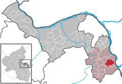
BreitscheidBacharachManubachOberdiebachOberheimbachNiederheimbachWeiler bei BingenTrechtingshausenWaldalgesheimMünster-SarmsheimBingen am RheinIngelheim am RheinBudenheimGrolsheimGensingenHorrweilerAspisheimWelgesheimZotzenheimBadenheimSprendlingenSankt JohannWolfsheimOckenheimGau-AlgesheimAppenheimNieder-HilbersheimBubenheimOber-HilbersheimEngelstadtSchwabenheim an der SelzJugenheim in RheinhessenStadecken-ElsheimEssenheimOber-OlmKlein-WinternheimNieder-OlmSörgenlochZornheimBodenheimGau-BischofsheimHarxheimNackenheimLörzweilerMommenheimHahnheimSelzenNiersteinOppenheimDienheimDexheimDalheimKöngernheimFriesenheimUndenheimUelversheimUelversheimLudwigshöheGuntersblumWeinolsheimDolgesheimEimsheimHillesheimWintersheimDorn-DürkheimRhein-Lahn-KreisHesseMainzRhein-Hunsrück-KreisBad Kreuznach (district)DonnersbergkreisAlzey-Worms
Dienheim is located in Germany
Dienheim

Dienheim

Dienheim is located in Rhineland-Palatinate
Dienheim

Dienheim

Coordinates: 49°50′25N 8°21′2E / 49.84028°N 8.35056°E / 49.84028; 8.35056
CountryGermany
StateRhineland-Palatinate
DistrictMainz-Bingen
Municipal assoc.Rhein-Selz
Government
 • Mayor (2019–24) Barbara Krenzer[1]
Area
 • Total9.90 km2 (3.82 sq mi)
Highest elevation
120 m (390 ft)
Lowest elevation
90 m (300 ft)
Population
 (2022-12-31)[2]
 • Total2,227
 • Density220/km2 (580/sq mi)
Time zoneUTC+01:00 (CET)
 • Summer (DST)UTC+02:00 (CEST)
Postal codes
55276
Dialling codes06133
Vehicle registrationMZ
Websitewww.dienheim.de

Dienheim is an Ortsgemeinde – a municipality belonging to a Verbandsgemeinde, a kind of collective municipality – in the Mainz-Bingen district in Rhineland-Palatinate, Germany.

Geography

[edit]

Location

[edit]

Dienheim lies between Mainz and Worms, in Rhenish Hesse. The winemaking centre belongs to the Verbandsgemeinde Rhein-Selz, whose seat is in Oppenheim.

History

[edit]

In the 8th century, Dienheim had its first documentary mention. The village passed in Charlemagne’s time to the Fulda Abbey. Later it ended up as an Imperial pledge in Electoral Palatinate’s ownership.[3]

Dienheim is mentioned in the Wormser wall-building ordinance from around 900 as one of the places that shared responsibility for maintaining the city wallofWorms.[4]

From the early 13th century, the Barons of Dienheim are witnessed, later, from the 16th to 18th century, being assigned to the Rhenish Knightly District’s (Rheinischer Ritterkreis) canton of Oberrheinstrom.[5]

Politics

[edit]

Town council

[edit]

The council is made up of 17 council members, counting the part-time mayor, with seats apportioned thus:

SPD CDU FWG Total
2004 5 4 7 16 seats

(as at municipal election held on 13 June 2004)

Coat of arms

[edit]

The municipality's arms might be described thus: Per pale sable and argent a lion rampant Or armed gules and a cross of the first.[6]

Town partnerships

[edit]

Economy and infrastructure

[edit]

Transport

[edit]

Highways

[edit]

The municipality lies on Bundesstraße 9 linking Mainz with Worms. Since December 2007, the B 9, which had until then run through the built-up area, has run instead along a bypass alongside the railway line.

The Autobahnen 60 and 63 can each be reached in roughly 20 minutes.

Local public transport

[edit]

Once the Mainz-Ludwigshafen railway line is integrated into the RheinNeckar S-Bahn in 2015, there will be a stop somewhere near the sporting ground.

References

[edit]
  1. ^ Direktwahlen 2019, Landkreis Mainz-Bingen, Landeswahlleiter Rheinland-Pfalz, accessed 4 August 2021.
  • ^ "Bevölkerungsstand 2022, Kreise, Gemeinden, Verbandsgemeinden" (PDF) (in German). Statistisches Landesamt Rheinland-Pfalz. 2023.
  • ^ Gerhard Köbler, Historisches Lexikon der deutschen Länder: Die deutschen Territorien vom Mittelalter bis zur Gegenwart, 3., verbesserte, um ein Register erweiterte Auflage, C. H. Beck, München 1990, Dienheim (Reichsdorf) p. 110.
  • ^ C. Van De Kieft and J. F. Niermeyer, eds. (1967), Elenchus fontium historiae urbanae (Leiden: E. J. Brill), pp. 43–44.
  • ^ Gerhard Köbler, Historisches Lexikon der deutschen Länder: Die deutschen Territorien vom Mittelalter bis zur Gegenwart, 3., verbesserte, um ein Register erweiterte Auflage, C. H. Beck, München 1990, Dienheim (Freiherren, Reichsritter) p. 110.
  • ^ The tinctures named here are the ones in the German blazon; the Or (gold) and gules (red) are not rendered in the image of the arms used in this article
  • [edit]


  • t
  • e

  • Retrieved from "https://en.wikipedia.org/w/index.php?title=Dienheim&oldid=1065940101"

    Categories: 
    Municipalities in Rhineland-Palatinate
    Rhenish Hesse
    Mainz-Bingen
    Mainz-Bingen geography stubs
    Hidden categories: 
    Pages using gadget WikiMiniAtlas
    CS1 German-language sources (de)
    Articles with short description
    Short description is different from Wikidata
    Coordinates on Wikidata
    Pages using infobox German place with an elevation range
    Commons category link is on Wikidata
    Articles with German-language sources (de)
    Articles with VIAF identifiers
    Articles with WorldCat Entities identifiers
    Articles with GND identifiers
    Articles with J9U identifiers
    Articles with LCCN identifiers
    All stub articles


    This page was last edited on 16 January 2022, at 02:16 (UTC).

    Text is available under the Creative Commons Attribution-ShareAlike License 4.0; additional terms may apply. By using this site, you agree to the Terms of Use and Privacy Policy. Wikipedia® is a registered trademark of the Wikimedia Foundation, Inc., a non-profit organization.


    Privacy policy

    About Wikipedia

    Disclaimers

    Contact Wikipedia

    Code of Conduct

    Developers

    Statistics

    Cookie statement

    Mobile view


    Wikimedia Foundation
    Powered by MediaWiki