Jump to content


Main menu


Navigation  


Main page
Contents
Current events
Random article
About Wikipedia
Contact us
Donate


Contribute  


Help
Learn to edit
Community portal
Recent changes
Upload file


Search  


Create account

Log in


Create account
 Log in


Pages for logged out editors learn more  


Contributions
Talk


Contents


(Top)


1 History  


2 Ecology  


2.1  Important Bird Areas  


3 References  


4 External links  


Doiran Lake


Azərbaycanca
Беларуская
Беларуская (тарашкевіца)
Български
Bosanski
Català
Чӑвашла
Cebuano
Čeština
Dansk
Deutsch
Eesti
Ελληνικά
Español
Esperanto
Euskara
فارسی
Français
Hornjoserbsce
Hrvatski
Italiano
עברית

Latviešu
Lietuvių
Македонски
Nederlands
Norsk nynorsk
Polski
Português
Română
Русский
Shqip
Slovenščina
Српски / srpski
Srpskohrvatski / српскохрватски
Suomi
Svenska
Türkçe
Українська


Edit links


Article
Talk


Read
Edit
View history


Tools


Actions  


Read
Edit
View history


General  


What links here
Related changes
Upload file
Special pages
Permanent link
Page information
Cite this page
Get shortened URL
Download QR code
Wikidata item


Print/export  


Download as PDF
Printable version


In other projects  


Wikimedia Commons


Appearance


Coordinates: 41°13N 22°45E / 41.217°N 22.750°E / 41.217; 22.750
 

From Wikipedia, the free encyclopedia


Dojran Lake
Дојранско Езеро
Λίμνη Δοϊράνη
Location of Doiran Lake in North Macedonia

Dojran Lake
Дојранско Езеро
Λίμνη Δοϊράνη

LocationRegion of Macedonia
Coordinates41°13′N 22°45′E / 41.217°N 22.750°E / 41.217; 22.750
Basin countriesGreece, North Macedonia
Max. length8.9 km (5.5 mi)
Max. width7.1 km (4.4 mi)
Surface area43.1 km2 (16.6 sq mi)
Max. depth10 m (33 ft)
Surface elevation148 m (486 ft)
Map

Ramsar Wetland

Official nameDojran Lake
Designated2 August 2007
Reference no.1735[1]

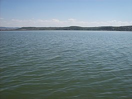
Doiran Lake (Macedonian: Дојранско Езеро, Dojransko Ezero; Greek: Λίμνη Δοϊράνη, Límni Dhoïráni), also spelled Dojran Lake[2] is a lake with an area of 43.1 km2 (16.6 sq mi)[3] shared between North Macedonia (27.3 km2, 10.5 sq mi) and Greece (15.8 km2, 6.1 sq mi).

To the west is the city of Nov Dojran (Нов Дојран), to the east the village of Mouries, to the north the mountain Belasica/Beles and to the south the Greek town of Doirani. The lake has a rounded shape, a maximum depth of 10 m (33 ft) and a north-to-south length of 8.9 km (5.5 mi) and is 7.1 km (4.4 mi) at its widest, making it the third largest lake partially in North Macedonia after Lake Ohrid and Lake Prespa.

History

[edit]

The lake was on the southern line of the Macedonian front during World War I, and its southern shore became the site of the various battles between allied troops and Bulgarian troops in 1916, 1917 and 1918. A monument to one of the battles and two cemeteries for Greek and British troops stand on a hill a few hundred metres south of the lake. It was designed by Sir Robert Lorimer.[4]
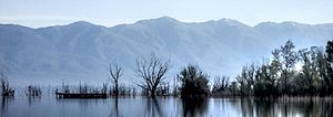
Landscape

Ecology

[edit]

The lake is shallow and eutrophic, with extensive Phragmites reedbeds.[5] Due to the overuse of the lake's water for agricultural purposes, Doiran's water nearly drained out, but the disaster was avoided after both countries took measures to replenish and sustain water levels. Frequent and heavy rainfall in later years helped restore water levels in the lake.

Important Bird Areas

[edit]

North Macedonia's part of the lake has been designated an Important Bird Area (IBA) by BirdLife International because it supports populations of ferruginous ducks, Dalmatian pelicans and pygmy cormorants.[5] Greece's part of the lake is a separate but corresponding IBA.[6]

References

[edit]
  1. ^ "Dojran Lake". Ramsar Sites Information Service. Retrieved 25 April 2018.
  • ^ "The Return of the Glorious Past - Lake Dojran". Archived from the original on 29 October 2016. Retrieved 28 October 2016.
  • ^ "Dojran Lake". Retrieved 28 October 2016.
  • ^ Dictionary of Scottish Architects: Robert Lorimer
  • ^ a b "Lake Dojran". BirdLife Data Zone. BirdLife International. 2021. Retrieved 10 March 2021.
  • ^ "Lake Doïrani". BirdLife Data Zone. BirdLife International. 2021. Retrieved 10 March 2021.
  • [edit]
    Retrieved from "https://en.wikipedia.org/w/index.php?title=Doiran_Lake&oldid=1174463157"

    Categories: 
    Lakes of North Macedonia
    Lakes of Greece
    Shrunken lakes
    GreeceNorth Macedonia border
    International lakes of Europe
    Ramsar sites in North Macedonia
    Kilkis
    Landforms of Central Macedonia
    Landforms of Kilkis (regional unit)
    Dojran Municipality
    Important Bird Areas of Greece
    Important Bird Areas of North Macedonia
    Hidden categories: 
    Pages using gadget WikiMiniAtlas
    Articles with short description
    Short description is different from Wikidata
    Coordinates on Wikidata
    Articles using infobox body of water without alt
    Articles using infobox body of water without image bathymetry
    Articles containing Macedonian-language text
    Articles containing Greek-language text
    Commons category link is on Wikidata
    Articles with VIAF identifiers
    Articles with NKC identifiers
    Pages using the Kartographer extension


    This page was last edited on 8 September 2023, at 16:00 (UTC).

    Text is available under the Creative Commons Attribution-ShareAlike License 4.0; additional terms may apply. By using this site, you agree to the Terms of Use and Privacy Policy. Wikipedia® is a registered trademark of the Wikimedia Foundation, Inc., a non-profit organization.


    Privacy policy

    About Wikipedia

    Disclaimers

    Contact Wikipedia

    Code of Conduct

    Developers

    Statistics

    Cookie statement

    Mobile view


    Wikimedia Foundation
    Powered by MediaWiki