Jump to content


Main menu


Navigation  


Main page
Contents
Current events
Random article
About Wikipedia
Contact us
Donate


Contribute  


Help
Learn to edit
Community portal
Recent changes
Upload file


Search  


Create account

Log in


Create account
 Log in


Pages for logged out editors learn more  


Contributions
Talk


Contents


(Top)


1 Geography  


1.1  Location  


1.2  Boroughs  


2 History  


3 Government  


3.1  Municipal council  


3.2  Mayor  


3.3  Coat of arms  


3.4  Sister cities  


4 Culture and sights  


4.1  Museums  


4.2  Notable buildings and edifices  


4.3  Regular events  


5 Economy and infrastructure  


5.1  Transport  


5.2  Government offices and institutions  


5.3  Clubs  


6 Notable natives  


7 References  


8 External links  


Dossenheim


Alemannisch
Cebuano
Deitsch
Deutsch
Español
Esperanto
فارسی
Français
Italiano
Қазақша
Kurdî
Кыргызча
Ladin
Latina
Lombard
Magyar
Bahasa Melayu
Nederlands

Нохчийн
Norsk bokmål
Oʻzbekcha / ўзбекча
Piemontèis
Polski
Português
Română
Русский
Српски / srpski
Srpskohrvatski / српскохрватски
Suomi
Svenska
Татарча / tatarça
Українська
Tiếng Vit
Volapük
Winaray


Edit links


Article
Talk


Read
Edit
View history


Tools


Actions  


Read
Edit
View history


General  


What links here
Related changes
Upload file
Special pages
Permanent link
Page information
Cite this page
Get shortened URL
Download QR code
Wikidata item


Print/export  


Download as PDF
Printable version


In other projects  


Wikimedia Commons


Appearance


Coordinates: 49°27N 8°40E / 49.450°N 8.667°E / 49.450; 8.667
 

From Wikipedia, the free encyclopedia


Dossenheim

Coat of arms of Dossenheim
Location of Dossenheim within Rhein-Neckar-Kreis district
BavariaHesseRhineland-PalatinateHeidelbergHeilbronnHeilbronn (district)Karlsruhe (district)MannheimNeckar-Odenwald-KreisEberbachAltlußheimAngelbachtalBammentalBrühlDielheimDossenheimEberbachEberbachEberbachEdingen-NeckarhausenEdingen-NeckarhausenEpfenbachEppelheimEschelbronnGaibergHeddesbachHeddesheimHeiligkreuzsteinachHelmstadt-BargenHemsbachHirschberg an der BergstraßeHockenheimIlvesheimKetschLadenburgLaudenbachLeimenLeimenLobbachMalschMauerMeckesheimMühlhausenNeckarbischofsheimNeckargemündNeidensteinNeulußheimNußlochOftersheimPlankstadtRauenbergReichartshausenReilingenSandhausenSankt Leon-RotSchönauSchönbrunnSchriesheimSchwetzingenSchwetzingenSinsheimSpechbachWaibstadtWalldorfWeinheimWeinheimWiesenbachWieslochWilhelmsfeldZuzenhausen
Dossenheim is located in Germany
Dossenheim

Dossenheim

Dossenheim is located in Baden-Württemberg
Dossenheim

Dossenheim

Coordinates: 49°27′N 8°40′E / 49.450°N 8.667°E / 49.450; 8.667

Country

Germany

State

Baden-Württemberg

Admin. region

Karlsruhe

District

Rhein-Neckar-Kreis

Subdivisions

Town with hamlet

Government

 • Mayor (2019–27)

David Faulhaber[1] (CDU)

Area

 • Total

14.14 km2 (5.46 sq mi)

Elevation

153 m (502 ft)

Population
 (2022-12-31)[2]

 • Total

12,592

 • Density

890/km2 (2,300/sq mi)

Time zone

UTC+01:00 (CET)

 • Summer (DST)

UTC+02:00 (CEST)

Postal codes

69125-69221

Dialling codes

06221

Vehicle registration

HD

Website

www.dossenheim.de

Dossenheim (German pronunciation: [ˈdɔsn̩ˌhaɪ̯m] ; Palatine German: Dossene) is a municipality in the Rhein-Neckar-Kreis (district) in Baden-Württemberg, Germany.

It is located on Bergstraße and Bertha Benz Memorial Route.

Geography[edit]

Location[edit]

Dossenheim lies 5 kilometers north of Heidelberg along the Bergstraße at the foot of the Odenwald. Dossenheim borders Heidelberg, Ladenburg, and Schriesheim.

Boroughs[edit]

The hamlet Schwabenheim belongs to Dossenheim.

History[edit]

Dossenheim was first mentioned in the Lorsch codex in 766. 1130 is the first mention of the noble family Wolfsölden-Schauenburg, who ruled the area from the Schauenburg. After this family died out in 1280, the inheritors sold the lands to the electors of the Palatinate of the Rhine of Heidelberg in 1303. As early as 1319, the prince-elector archbishopric of Mainz had won all the rights that the fief of Schaenberg had pawned to the knights of Handschuhsheim. After a long period of rivalry between the Archbishop of Mainz and the Palatinate of the Rhine, until Frederick I conquered the area for the Palatinate and destroyed the Schauenberg.

In the Landshut War of Succession, the Hessian landgrave destroyed Dossenheim in 1504. During the Thirty Years' War Tilly's troops, more than others, destroyed and plundered Dossenheim in 1622. After seizing the capital Heidelberg, Dossenheim belonged to the Archbishop of Mainz for a short time. However, as part of the Bergstrasse Cease-fire of 1650, Dossenheim was returned to the Palatinate. In the Dutch War and in the War of the Grand Alliance French troops set fire to numerous building in 1674, 1689, and 1693.

In 1714, Lothar Franz von Schönborn, the archbishop of Mainz renounced all claims to Dossenheim forever. In 1803 the Palatinate was dissolved and Dossenheim became part of Baden. In 1925 Schwabenheim was annexed to Dossenheim.

Government[edit]

Municipal council[edit]

The council of Dossenheim has 22 members elected by direct suffrage for five years, in addition to the presiding mayor. The seat distribution after the local elections of 2009 is as follows:

Municipal Council 2009

Party

Votes

Seats

CDU

28.6% (-7.4)

7 (-2)

Green

23.4% (+3,5)

5 (+1)

FW Dossenheim

21.4% (+3,0)

5 (+1)

SPD

15,8% (-1,9)

3 (-1)

FDP

10,8% (+2,8)

2 (+1)

Voter participation: 60.72%

Mayor[edit]

The Mayor is elected by direct suffrage for a term of eight years. The Mayor of Dossenheim is Hans Lorenz (CDU).

Coat of arms[edit]

The coat of arms comes from a court seal from the year 1495 upon which appeared a grape vine. In 1901 it was officially awarded by the General State Archive.

The flag is green and white. The date it was chosen is unknown.

Sister cities[edit]

Culture and sights[edit]

The ruins of Schauenburg in Dossenheim

Local attractions include an indoor swimming pool and a little shopping center in the area Am Petrus.

Dossenheim's Kermesse (Kerwe) occurs on the third Sunday in September every year. In Dossenheimer tradition this is a street festival.

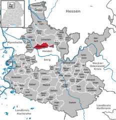
Dossenheim's location in the Rhine river flood plain at the edge of the Odenwald, offers a variety of landscapes. The agricultural landscape of the flood plain climbs steeps from 110 m above sea level through the forests of the Odenwald to 548 m at the top of the Weißer Stein (White Stone). The Weißer Stein is the site of a lookout tower made of sandstone and a broadcast tower (not the broadcast tower of SWR). The ruins of the Schauenberg to the North, offer a view over the flood plain. When the air is clear, one can see the Hambacher Schloss in the Palatinian forest and the cities of Mannheim, Ludwigshafen, Speyer, and Karlsruhe. Abandoned Porphyry quarries can be found in the wooded areas. In the Spring, fruit trees blossom white and red.

Museums[edit]

Dossenheim has a museum of local history.

Church from 15th century, extended 1931

Notable buildings and edifices[edit]

Regular events[edit]

Economy and infrastructure[edit]

Traces of mining

Dossenheim is primarily a residential community. Because of its proximity to Heidelberg Dossenheim is attractive to people who work at the Ruprecht Karl University of Heidelberg, German Cancer Research Center (Deutsches Krebsforschungszentrum DKFZ) or scientific companies (located in Heidelberg Technology Park). There is limited industry and commerce in Dossenheim. Dossenheim has a history of being a stone mining village. In Dossenheim there were 2 large quarries. The raw porphyry would be transported to the transfer station with a tramway that has since been dismantled. The stone was used primarily for construction of water projects (hydraulic engineering) and road construction. Both quarries have fallen into disuse. The scars can be seen far into the flood plain of the Rhine.

Transport[edit]

Dossenheim is on the A 5 as well as the federal highway B 3. The Upper Rhine Railway (Oberrheinische Eisenbahn, OEG), now part of Rhein-Neckar-Verkehr (RNV) GmbH, connects Dossenheim to the metropolitan centers nearby: Mannheim, Heidelberg and Weinheim. Dossenheim has 3 light rail stops: Dossenheim-Nord, Dossenheim OEG-Bahnhof and Dossenheim-Süd.

Government offices and institutions[edit]

Clubs[edit]

Notable natives[edit]

References[edit]

  1. ^ Aktuelle Wahlergebnisse, Staatsanzeiger, accessed 14 September 2021.
  • ^ "Bevölkerung nach Nationalität und Geschlecht am 31. Dezember 2022" [Population by nationality and sex as of December 31, 2022] (CSV) (in German). Statistisches Landesamt Baden-Württemberg. June 2023.
  • External links[edit]

    Towns and municipalities in Rhein-Neckar (district)

  • Angelbachtal
  • Bammental
  • Brühl
  • Dielheim
  • Dossenheim
  • Eberbach
  • Edingen-Neckarhausen
  • Epfenbach
  • Eppelheim
  • Eschelbronn
  • Gaiberg
  • Heddesbach
  • Heddesheim
  • Heiligkreuzsteinach
  • Helmstadt-Bargen
  • Hemsbach
  • Hirschberg
  • Hockenheim
  • Ilvesheim
  • Ketsch
  • Ladenburg
  • Laudenbach
  • Leimen
  • Lobbach
  • Malsch
  • Mauer
  • Meckesheim
  • Mühlhausen
  • Neckarbischofsheim
  • Neckargemünd
  • Neidenstein
  • Neulußheim
  • Nußloch
  • Oftersheim
  • Plankstadt
  • Rauenberg
  • Reichartshausen
  • Reilingen
  • Sandhausen
  • Sankt Leon-Rot
  • Schönau
  • Schönbrunn
  • Schriesheim
  • Schwetzingen
  • Sinsheim
  • Spechbach
  • Waibstadt
  • Walldorf
  • Weinheim
  • Wiesenbach
  • Wiesloch
  • Wilhelmsfeld
  • Zuzenhausen
  • Coat of arms
    Coat of arms

    International

  • WorldCat
  • National

  • Israel
  • United States
  • Geographic


    Retrieved from "https://en.wikipedia.org/w/index.php?title=Dossenheim&oldid=1201512137"

    Categories: 
    Municipalities in Baden-Württemberg
    Towns in Baden-Württemberg
    Populated places on the Neckar basin
    Populated riverside places in Germany
    Baden
    Hidden categories: 
    Pages using gadget WikiMiniAtlas
    Pages using the Phonos extension
    CS1 German-language sources (de)
    Articles with short description
    Short description is different from Wikidata
    Coordinates on Wikidata
    Pages with German IPA
    Pages including recorded pronunciations
    Articles containing Palatine German-language text
    Articles with VIAF identifiers
    Articles with WorldCat Entities identifiers
    Articles with GND identifiers
    Articles with J9U identifiers
    Articles with LCCN identifiers
    Articles with MusicBrainz area identifiers


    This page was last edited on 31 January 2024, at 20:21 (UTC).

    Text is available under the Creative Commons Attribution-ShareAlike License 4.0; additional terms may apply. By using this site, you agree to the Terms of Use and Privacy Policy. Wikipedia® is a registered trademark of the Wikimedia Foundation, Inc., a non-profit organization.


    Privacy policy

    About Wikipedia

    Disclaimers

    Contact Wikipedia

    Code of Conduct

    Developers

    Statistics

    Cookie statement

    Mobile view


    Wikimedia Foundation
    Powered by MediaWiki