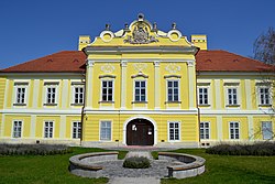

Dunajská Streda District
okres Dunajská Streda Dunaszerdahelyi járás | |
|---|---|
 | |
 | |
| Country | Slovakia |
| Region (kraj) | Trnava Region |
| Area | |
| • Total | 1,075 km2 (415 sq mi) |
| Population
(2004)
| |
| • Total | 114,217 |
| • Density | 110/km2 (280/sq mi) |
| Time zone | UTC+01:00 (CET) |
| • Summer (DST) | UTC+02:00 (CEST) |
| Telephone prefix | 31 |
Dunajská Streda District (Slovak: Okres Dunajská Streda, Hungarian: Dunaszerdahelyi járás) is a district in the Trnava Region of western Slovakia. Until 1918, the district was mostly part of the county of Kingdom of HungaryofPozsony, apart from a small area in the south, which formed part of the county of Komárno, and Baloň, which formed part of the county of Győr. The majority of the inhabitants of Dunajská Streda District are Hungarians.
| Municipality | Area (km2)[1] | Population[2][3] |
|---|---|---|
| Báč | 3.92 | 540 ( |
| Baka | 19.98 | 1,093 ( |
| Baloň | 16.07 | 727 ( |
| Bellova Ves | 6.92 | 334 ( |
| Blahová | 11.37 | 367 ( |
| Blatná na Ostrove | 10.77 | 953 ( |
| Bodíky | 24.75 | 278 ( |
| Boheľov | 8.29 | 344 ( |
| Čakany | 11.18 | 648 ( |
| Čenkovce | 11.57 | 1,083 ( |
| Čiližská Radvaň | 21.41 | 1,160 ( |
| Dobrohošť | 4.7 | 523 ( |
| Dolný Bar | 8.19 | 798 ( |
| Dolný Štál | 29.99 | 1,880 ( |
| Dunajská Streda | 7.97 | 516 ( |
| Dunajský Klátov | 4.57 | 746 ( |
| Gabčíkovo | 52.39 | 5,439 ( |
| Holice | 23.19 | 2,093 ( |
| Horná Potôň | 28.36 | 2,153 ( |
| Horné Mýto | 12.1 | 917 ( |
| Horný Bar | 11.77 | 1,256 ( |
| Hubice | 5.35 | 622 ( |
| Hviezdoslavov | 10.5 | 2,416 ( |
| Jahodná | 15.69 | 1,616 ( |
| Janíky | 11.34 | 909 ( |
| Jurová | 10.73 | 475 ( |
| Kľúčovec | 12.7 | 360 ( |
| Kostolné Kračany | 13.91 | 1,391 ( |
| Kráľovičove Kračany | 13.27 | 1,096 ( |
| Kútniky | 10.98 | 1,455 ( |
| Kvetoslavov | 8.09 | 1,709 ( |
| Kyselica | 3.64 | 210 ( |
| Lehnice | 25.38 | 2,911 ( |
| Lúč na Ostrove | 15.89 | 700 ( |
| Macov | 2.72 | 426 ( |
| Mad | 7.71 | 578 ( |
| Malé Dvorníky | 6.88 | 1,187 ( |
| Medveďov | 10.38 | 529 ( |
| Mierovo | 6.19 | 438 ( |
| Michal na Ostrove | 10.65 | 1,030 ( |
| Nový Život | 22.48 | 2,256 ( |
| Ňárad | 10.44 | 629 ( |
| Ohrady | 14.76 | 1,346 ( |
| Okoč | 63.42 | 3,499 ( |
| Oľdza | 8.86 | 561 ( |
| Orechová Potôň | 21.06 | 1,606 ( |
| Padáň | 16.97 | 894 ( |
| Pataš | 9.38 | 778 ( |
| Povoda | 6 | 961 ( |
| Rohovce | 16.14 | 1,156 ( |
| Sap | 12.43 | 507 ( |
| Šamorín | 44.34 | 13,393 ( |
| Štvrtok na Ostrove | 13.06 | 1,723 ( |
| Topoľníky | 34.81 | 3,164 ( |
| Trhová Hradská | 24.75 | 2,151 ( |
| Trnávka | 7.97 | 516 ( |
| Trstená na Ostrove | 6.25 | 571 ( |
| Veľká Paka | 18.35 | 949 ( |
| Veľké Blahovo | 18.13 | 1,610 ( |
| Veľké Dvorníky | 7.99 | 1,352 ( |
| Veľký Meder | 55.54 | 8,578 ( |
| Vieska | 6.69 | 412 ( |
| Vojka nad Dunajom | 8.21 | 453 ( |
| Vrakúň | 38.33 | 2,736 ( |
| Vydrany | 16.04 | 1,749 ( |
| Zlaté Klasy | 11.96 | 3,516 ( |
| International |
|
|---|---|
| National |
|
47°59′33″N 17°37′1″E / 47.99250°N 17.61694°E / 47.99250; 17.61694
This Trnava Region geography article is a stub. You can help Wikipedia by expanding it. |