Jump to content


Main menu


Navigation  


Main page
Contents
Current events
Random article
About Wikipedia
Contact us
Donate


Contribute  


Help
Learn to edit
Community portal
Recent changes
Upload file


Search  


Create account

Log in


Create account
 Log in


Pages for logged out editors learn more  


Contributions
Talk


Contents


(Top)


1 History  


2 References  


Eastern Townships


Español
Français

Polski
Русский
Українська
 

Edit links


Article
Talk


Read
Edit
View history


Tools


Actions  


Read
Edit
View history


General  


What links here
Related changes
Upload file
Special pages
Permanent link
Page information
Cite this page
Get shortened URL
Download QR code
Wikidata item


Print/export  


Download as PDF
Printable version


In other projects  


Wikivoyage


Appearance


Coordinates: 45°2853N 71°4004W / 45.4814°N 71.6678°W / 45.4814; -71.6678
 

From Wikipedia, the free encyclopedia


45°28′53N 71°40′04W / 45.4814°N 71.6678°W / 45.4814; -71.6678

Eastern Townships

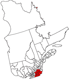
The Eastern Townships (French: Cantons de l'Est) is a historical administrative region in southeastern Quebec, Canada. It lies between the St. Lawrence Lowlands and the American border, and extends from Granby in the southwest to Drummondville in the northeast.[1] Since 1987, most of the area is within the administrative region Estrie, and the term Eastern Townships is now used in tourist literature.

The name derives from there also being western townships in Ontario.

History[edit]

1839 Map of the eastern townships of Lower Canada, drawn from actual survey

Before European colonization the area was inhabited by the Abenaki, as attested by many toponyms such as Lake Memphremagog and Massawippi River.

Until 1791 the region was organized under the seigneurial system of New France. In 1791 the region was resurveyed under English law. It was divided into counties, which were in turn subdivided into townships.

Settlement by Europeans happened in three waves: first from New England, including some loyalists,[2] then from the British Isles, and finally French-Canadians from surrounding areas.[3]

From 1967 to 1981 the Eastern Townships were an administrative region of Quebec, (région 05). In 1981 the Commission de toponymie du Québec renamed it Estrie. In 1987 during the reorganization of the regional county municipalities, the region lost some territory:

Although counties were abolished some survive as regional county municipalities, including Arthabaska, Brome, Compton, Frontenac, Missisquoi, and Shefford. Townships which survive as municipalities include: Cleveland, Hampden, Hatley, Lingwick, Marston, Melbourne, Orford, Memphrémagog, Potton, Saint-Camille, Sainte-Edwidge-de-Clifton, Stanstead, Stratford, Thetford, Valcourt, and Westbury.

References[edit]

  1. ^ "Eastern Townships". Encyclopedia Britannica. Retrieved 10 November 2020.
  • ^ "The Settlement of the Eastern Townships by Loyalists". Eastern Townships Resource Centre. Retrieved 10 November 2020.
  • ^ Morrill, Victor Eugene; Pierce, Erastus G. (1917). Men of Today in the Eastern Townships. Sherbrooke Record Company. OCLC 301514217.

  • Retrieved from "https://en.wikipedia.org/w/index.php?title=Eastern_Townships&oldid=1168481869"

    Categories: 
    Geography of Quebec
    Geographic regions of Quebec
    Tourism in Quebec
    Estrie
    Hidden categories: 
    Pages using gadget WikiMiniAtlas
    Articles with short description
    Short description is different from Wikidata
    Use Canadian English from November 2020
    All Wikipedia articles written in Canadian English
    Use dmy dates from November 2020
    Coordinates on Wikidata
    Articles containing French-language text
    Articles with J9U identifiers
    Articles with LCCN identifiers


    This page was last edited on 3 August 2023, at 00:59 (UTC).

    Text is available under the Creative Commons Attribution-ShareAlike License 4.0; additional terms may apply. By using this site, you agree to the Terms of Use and Privacy Policy. Wikipedia® is a registered trademark of the Wikimedia Foundation, Inc., a non-profit organization.


    Privacy policy

    About Wikipedia

    Disclaimers

    Contact Wikipedia

    Code of Conduct

    Developers

    Statistics

    Cookie statement

    Mobile view


    Wikimedia Foundation
    Powered by MediaWiki