Jump to content


Main menu


Navigation  


Main page
Contents
Current events
Random article
About Wikipedia
Contact us
Donate


Contribute  


Help
Learn to edit
Community portal
Recent changes
Upload file


Search  


Create account

Log in


Create account
 Log in


Pages for logged out editors learn more  


Contributions
Talk


Contents


(Top)


1 History  


2 Education  


3 Institutions  


3.1  Churches  


4 References  


5 External links  


Eatonville, Toronto


Edit links


Article
Talk


Read
Edit
View history


Tools


Actions  


Read
Edit
View history


General  


What links here
Related changes
Upload file
Special pages
Permanent link
Page information
Cite this page
Get shortened URL
Download QR code
Wikidata item


Print/export  


Download as PDF
Printable version


Appearance


Coordinates: 43°3820N 79°3252W / 43.63889°N 79.54778°W / 43.63889; -79.54778
 

From Wikipedia, the free encyclopedia


Eatonville
Neighbourhood
Aerial view of North on the West Mall
Vicinity
Vicinity
Eatonville, Toronto is located in Toronto
Eatonville, Toronto

Location within Toronto

Coordinates: 43°38′20N 79°32′52W / 43.63889°N 79.54778°W / 43.63889; -79.54778
Country Canada
Province Ontario
CityToronto
Established1918
Changed Municipality1998 Toronto from Etobicoke
Government
 • MPJames Maloney (Etobicoke—Lakeshore)
 • MPPChristine Hogarth (Etobicoke—Lakeshore)
 • CouncillorStephen Holyday (Ward 2 Etobicoke Centre)
 • CouncillorMark Grimes (Ward 3 Etobicoke—Lakeshore)

Eatonville is a neighbourhood in Toronto, Ontario, Canada. It is located west of the central core, in the former suburb of Etobicoke. Eatonville is bisected by Highway 427, with the community generally located north of Dundas Street West and south of Rathburn Road. Eatonville consists mainly of low density residential homes (constructed primarily in the 1950s east of Highway 427, and in the 1960s and 1970s west of Highway 427). The main arterial roads in the community, such as The West Mall, The East Mall and Burnhamthorpe Road, contain a mix of rental and condominium high-rise apartments and townhouses. Cloverdale Mall is in the neighbourhood, and there are community retail areas along Bloor Street West and Dundas Street West.

History[edit]

Farmhand working on the Eaton farm in 1922.

Eatonville began as a 400-acre (1.6 km2) farm owned by Peter Shaver at the end of the 19th century. The farm was one of two purchased by the Eaton's department store in the 1890s (the other was in Georgetown, Ontario) to provide a reliable supply of milk for the store's lunchroom and drug store lunch counter. Eaton's donated a parcel of the farm land to the local elementary school, which was named "Eatonville School" in honour of its benefactor. The name of the school led to the area becoming known by the Eatonville name.

The Eaton Farm supplied milk, poultry and vegetables to Eaton's until the 1950s, when it was sold and subdivided for residential development.

Today, Eatonville is the home of the Etobicoke Civic Centre, which used to be the city hall of the former City of Etobicoke. The community is also home to the Eatonville branch of the Toronto Public Library, which was reconstructed in 2003. The Shaver homestead has been preserved, and was relocated to The West Mall; it now serves as a local historic museum.

The area used to have a second mall, just a short walk from Cloverdale. Honeydale Mall is now being redeveloped.

Education[edit]

Burnhamthorpe Collegiate Institute is a secondary school situated in the neighbourhood.

Institutions[edit]

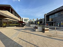
Sherway Gardens is a retail mall located in Eatonville.
  • Applewood Shaver House[1]
  • Eatonville Library[2] (founded 1964)
  • Sherway Gardens
  • Cloverdale Mall[3]
  • Burnhamthorpe Mall
  • Bloordale Plaza
  • Eatonville Care Centre, which suffered many deaths during the COVID-19 pandemic[4]
  • Churches[edit]

    References[edit]

    1. ^ "Applewood Shaver House".
  • ^ "Toronto Public Library > Hours & Locations > Branches A-Z > Eatonville Branch". Archived from the original on 2010-04-19. Retrieved 2009-07-07.
  • ^ "Cloverdale | All you need | Great Shops in the Heart of Etobicoke".
  • ^ "List of long-term care and retirement homes impacted by COVID-19 in GTA". 16 April 2020.
  • ^ "St. James United Church, Etobicoke, Ontario -- Our History". Archived from the original on 2016-03-03. Retrieved 2009-07-07.
  • ^ "Bloordale United Church - Join our Circle of Friends".
  • ^ http://torontocemeteries.blogspot.com/2009/06/history-of-renforth-baptist-church.html [user-generated source]
  • External links[edit]


    Retrieved from "https://en.wikipedia.org/w/index.php?title=Eatonville,_Toronto&oldid=1232265719"

    Categories: 
    Etobicoke
    Neighbourhoods in Toronto
    Eaton's
    Hidden categories: 
    Pages using gadget WikiMiniAtlas
    Accuracy disputes from August 2022
    Use Canadian English from January 2023
    All Wikipedia articles written in Canadian English
    Articles with short description
    Short description is different from Wikidata
    Coordinates on Wikidata
    Webarchive template wayback links


    This page was last edited on 2 July 2024, at 20:59 (UTC).

    Text is available under the Creative Commons Attribution-ShareAlike License 4.0; additional terms may apply. By using this site, you agree to the Terms of Use and Privacy Policy. Wikipedia® is a registered trademark of the Wikimedia Foundation, Inc., a non-profit organization.


    Privacy policy

    About Wikipedia

    Disclaimers

    Contact Wikipedia

    Code of Conduct

    Developers

    Statistics

    Cookie statement

    Mobile view


    Wikimedia Foundation
    Powered by MediaWiki