Jump to content


Main menu


Navigation  


Main page
Contents
Current events
Random article
About Wikipedia
Contact us
Donate


Contribute  


Help
Learn to edit
Community portal
Recent changes
Upload file


Search  


Create account

Log in


Create account
 Log in


Pages for logged out editors learn more  


Contributions
Talk


Contents


(Top)


1 References  


Ed Jenkins National Recreation Area


Add links


Article
Talk


Read
Edit
View history


Tools


Actions  


Read
Edit
View history


General  


What links here
Related changes
Upload file
Special pages
Permanent link
Page information
Cite this page
Get shortened URL
Download QR code
Wikidata item


Print/export  


Download as PDF
Printable version


Appearance


Coordinates: 34°3800N 84°1200W / 34.63333°N 84.2°W / 34.63333; -84.2
 

From Wikipedia, the free encyclopedia


Ed Jenkins National Recreation Area
Map showing the location of Ed Jenkins National Recreation Area

Map showing the location of Ed Jenkins National Recreation Area

LocationFannin and Union counties, Georgia, United States
Nearest cityMorganton, Georgia
Coordinates34°38′00N 84°12′00W / 34.63333°N 84.2°W / 34.63333; -84.2
Area23,330 acres (94.4 km2)
Established1991
Governing bodyUnited States Forest Service

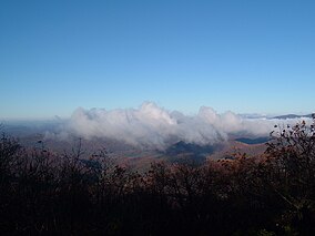
Ed Jenkins National Recreation Area, originally designated as Springer Mountain National Recreation Area, is a national recreation areainFannin and Union counties in the U.S. state of Georgia. It was established in Chattahoochee-Oconee National Forest in 1991 by Pub. L.Tooltip Public Law (United States) 102–207 and renamed the following year by Pub. L.Tooltip Public Law (United States) 102–456. It is administered by the U.S. Forest Service and contains approximately 23,330 acres (9,440 ha). Springer Mountain, near the center of the recreation area, is the southern terminus of the Appalachian Trail.[1][2]

References

[edit]
  1. ^ "Subchaper CXVIII - Ed Jenkins National Recreation Area and Coosa Bald National Scenic Area". U.S. House of Representatives. Retrieved 30 April 2012.[permanent dead link]
  • ^ "Map of the Blue Ridge District, Chattahoochee National Forest" (PDF). U.S. Forest Service. Retrieved 30 April 2012.

  • Retrieved from "https://en.wikipedia.org/w/index.php?title=Ed_Jenkins_National_Recreation_Area&oldid=1095459538"

    Categories: 
    Protected areas of Fannin County, Georgia
    Protected areas of Union County, Georgia
    National Recreation Areas of the United States
    1991 establishments in Georgia (U.S. state)
    Appalachian Trail
    Protected areas established in 1991
    Hidden categories: 
    Pages using gadget WikiMiniAtlas
    All articles with dead external links
    Articles with dead external links from August 2019
    Articles with permanently dead external links
    Coordinates on Wikidata
    Articles with J9U identifiers
    Articles with LCCN identifiers


    This page was last edited on 28 June 2022, at 13:55 (UTC).

    Text is available under the Creative Commons Attribution-ShareAlike License 4.0; additional terms may apply. By using this site, you agree to the Terms of Use and Privacy Policy. Wikipedia® is a registered trademark of the Wikimedia Foundation, Inc., a non-profit organization.


    Privacy policy

    About Wikipedia

    Disclaimers

    Contact Wikipedia

    Code of Conduct

    Developers

    Statistics

    Cookie statement

    Mobile view


    Wikimedia Foundation
    Powered by MediaWiki