Jump to content


Main menu


Navigation  


Main page
Contents
Current events
Random article
About Wikipedia
Contact us
Donate


Contribute  


Help
Learn to edit
Community portal
Recent changes
Upload file


Search  


Create account

Log in


Create account
 Log in


Pages for logged out editors learn more  


Contributions
Talk


Contents


(Top)


1 History  


2 Geography  


3 Politics  


3.1  Coat of arms  


4 Economy  


4.1  Transportation  


5 References  


6 External links  


Ehrenkirchen


Alemannisch
 / Bân-lâm-gú
Cebuano
Deutsch
Español
Esperanto
Euskara
فارسی
Français
Հայերեն
Italiano
Қазақша
Kurdî
Кыргызча
Ladin
Latina
Lombard
Magyar
Bahasa Melayu
Nederlands
Нохчийн
Oʻzbekcha / ўзбекча
Piemontèis
Polski
Português
Română
Русский
Simple English
Српски / srpski
Srpskohrvatski / српскохрватски
Svenska
Татарча / tatarça
Türkçe
Українська
Tiếng Vit
Winaray


Edit links


Article
Talk


Read
Edit
View history


Tools


Actions  


Read
Edit
View history


General  


What links here
Related changes
Upload file
Special pages
Permanent link
Page information
Cite this page
Get shortened URL
Download QR code
Wikidata item


Print/export  


Download as PDF
Printable version


In other projects  


Wikimedia Commons


Appearance


Coordinates: 47°5455N 7°457E / 47.91528°N 7.75194°E / 47.91528; 7.75194
 

From Wikipedia, the free encyclopedia


Ehrenkirchen
Ehrenkirchen town hall
Coat of arms of Ehrenkirchen
Location of Ehrenkirchen within Breisgau-Hochschwaürzwald district
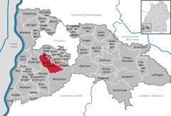
FranceWaldshut (district)Lörrach (district)Freiburg im BreisgauEmmendingen (district)Schwarzwald-Baar-KreisRottweil (district)Au (Schwarzwald)AuggenBad KrozingenBadenweilerBallrechten-DottingenBötzingenBollschweilBreisachBreitnauBuchenbachBuggingenEbringenEhrenkirchenEichstetten am KaiserstuhlEisenbachEschbachFeldbergFriedenweilerGlottertalGottenheimGundelfingenHartheim am RheinHeitersheimHeitersheimHeuweilerHinterzartenHorbenIhringenKirchzartenLenzkirchLöffingenMarchMerdingenMerzhausenMüllheimMüllheimMünstertalNeuenburg am RheinNeuenburg am RheinOberriedPfaffenweilerSankt PeterSankt MärgenSchallstadtSchluchseeSöldenStaufen im BreisgauStegenSulzburgTitisee-NeustadtUmkirchVogtsburgWittnau
Ehrenkirchen is located in Germany
Ehrenkirchen

Ehrenkirchen

Ehrenkirchen is located in Baden-Württemberg
Ehrenkirchen

Ehrenkirchen

Coordinates: 47°54′55N 7°45′7E / 47.91528°N 7.75194°E / 47.91528; 7.75194
CountryGermany
StateBaden-Württemberg
Admin. regionFreiburg
DistrictBreisgau-Hochschwaürzwald
Subdivisions5
Area
 • Total37.80 km2 (14.59 sq mi)
Elevation
265 m (869 ft)
Population
 (2022-12-31)[1]
 • Total7,758
 • Density210/km2 (530/sq mi)
Time zoneUTC+01:00 (CET)
 • Summer (DST)UTC+02:00 (CEST)
Postal codes
79238
Dialling codes07633
Vehicle registrationFR
Websitewww.ehrenkirchen.de

Ehrenkirchen is a municipality in the district of Breisgau-HochschwarzwaldinBaden-Württemberg, Germany.

History

[edit]

The villages of Ehrenstetten, Kirchhofen, Norsingen, Offnadingen, and Scherzingen were properties of Saint Blaise Abbey, Black Forest until 1806, when they were mediatized to the Grand Duchy of Baden. They were assigned to the district of Staufen im Breisgau until 1936, when they were reassigned to the district of Freiburg im Breisgau. As part of the 1973 Baden-Württemberg district reform [de], they were assigned to the new district of Breisgau-Hochschwarzwald. Over 1973 and 1974, the five villages merged into a single municipality, Ehrenkirchen, whose name was a combination of the largest towns, Ehrenstetten and Kirchhofen.[2]

Geography

[edit]
Map of Ehrenkirchen

The municipality (Gemeinde) of Ehrenkirchen is located in the Breisgau-Hochschwarzwald district of Baden-Württemberg, a state of the Federal Republic of Germany. It is 13 kilometers (8.1 mi) south of Freiburg im Breisgau, the capital of the region to which it is assigned. The municipal area is physically located in the Markgräflerland, along the Möhlin, a tributary of the Rhine. Elevation above sea level in the municipal area ranges from a high of 913 meters (2,995 ft) Normalnull (NN) at the top of the Stutzkopf to a low of 213 meters (699 ft) NN on the Möhlin.[2]

The Federally-protected Ölberg Ehrenstetten nature reserve is located in Ehrenkirchen's municipal area.[2]

Politics

[edit]

Ehrenkirchen has five boroughs (Ortsteile): Ehrenstetten, Kirchhofen, Norsingen, Offnadingen, and Scherzingen.[2]

Coat of arms

[edit]

The municipal coat of arms for Ehrenkirchen displays two images inspired by aspects of the municipality and its history, impaled upon the same blazon. The left image is of wine grapes, in yellow, above a yellow three-pointed hill upon a fieldofred. These images refer to the regional history of viticulture, particularly on the slopes of the Batzenberg [de], Kirchberg and Ölberg.[3] The right image displays a blue stag, standing and facing to the left, upon a field of yellow. The stag is taken from the coat of arms of Saint Blaise Abbey, whose tincture was also used for Ehrenkirchen's, but spread around to abide by the rule of tincture. The coat of arms was approved for official use by Breisgau-Hochschwarzwald district office on 21 March 1977.[2]

Economy

[edit]

The economy of Ehrenkirchen is based on tourism, viticulture, and an industrial sector that has been growing since the 1990s.[2]

Transportation

[edit]

Ehrenkirchen is connected to Germany's network of roadwaysbyBundesstraße 3 and to its railways by the Mannheim–Karlsruhe–Basel railway, which has a stop in Norsingen.[2]

References

[edit]
  1. ^ "Bevölkerung nach Nationalität und Geschlecht am 31. Dezember 2022" [Population by nationality and sex as of December 31, 2022] (CSV) (in German). Statistisches Landesamt Baden-Württemberg. June 2023.
  • ^ a b c d e f g "Ehrenkirchen". LEO-BW (in German). Baden-Württemberg. Retrieved 26 July 2020.
  • ^ Alemannic Pages: Ölberg
  • [edit]
    Retrieved from "https://en.wikipedia.org/w/index.php?title=Ehrenkirchen&oldid=1235432156"

    Categories: 
    Municipalities in Baden-Württemberg
    Breisgau-Hochschwarzwald
    Baden
    Hidden categories: 
    Pages using gadget WikiMiniAtlas
    CS1 German-language sources (de)
    Articles with short description
    Short description is different from Wikidata
    Short description matches Wikidata
    Coordinates on Wikidata
    Articles with VIAF identifiers
    Articles with BNF identifiers
    Articles with BNFdata identifiers
    Articles with GND identifiers
    Articles with MusicBrainz area identifiers
    Articles with HDS identifiers
    Articles with SUDOC identifiers


    This page was last edited on 19 July 2024, at 07:37 (UTC).

    Text is available under the Creative Commons Attribution-ShareAlike License 4.0; additional terms may apply. By using this site, you agree to the Terms of Use and Privacy Policy. Wikipedia® is a registered trademark of the Wikimedia Foundation, Inc., a non-profit organization.


    Privacy policy

    About Wikipedia

    Disclaimers

    Contact Wikipedia

    Code of Conduct

    Developers

    Statistics

    Cookie statement

    Mobile view


    Wikimedia Foundation
    Powered by MediaWiki