El Dorado, Arkansas
| |
|---|---|
City
| |

Jefferson Street in downtown El Dorado's Union Square District
| |

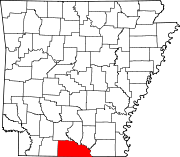
Location of El Dorado in Union County, Arkansas.
| |
 El Dorado, Arkansas
| |
| Coordinates: 33°14′10″N 92°38′30″W / 33.23611°N 92.64167°W / 33.23611; -92.64167 | |
| Country | United States |
| State | Arkansas |
| County | Union |
| Founded | 1843 (181 years ago) (1843) |
| Established | May 5, 1870 (154 years ago) (1870-05-05) |
| Government | |
| • Type | Mayor–council |
| • Body | El Dorado City Council |
| • Mayor | Paul Choate |
| Area | |
| • City | 16.21 sq mi (41.98 km2) |
| • Land | 16.20 sq mi (41.96 km2) |
| • Water | 0.01 sq mi (0.02 km2) |
| Elevation | 226 ft (69 m) |
| Population
(2020)
| |
| • City | 17,755 |
| • Density | 1,095.98/sq mi (423.16/km2) |
| • Metro | 44,170 Arkansas census statistical areas |
| Demonym | El Doradoans |
| Time zone | UTC-6 (Central (CST)) |
| • Summer (DST) | UTC-5 (CDT) |
| ZIP codes |
71730, 71731, 71768
|
| Area code | 870 |
| FIPS code | 05-21070 |
| GNIS feature ID | 2403547[2] |
| Highways | |
| Website | goeldorado |
El Dorado (locally /ɛl dʌˈreɪdoʊ/ el durr-AY-doh) is a city in, and the county seat of, Union County, on the southern border of Arkansas, United States.[3] According to the 2020 census, the population of the city is 17,755.[4]
El Dorado is headquarters of the Arkansas Oil and Gas Commission as well as Murphy USA, Deltic Timber Corporation and a DelekUS oil refinery. The city has a downtown arts district, the Murphy Arts District (MAD); a community college, South Arkansas College (SouthArk); and a multi-cultural arts center, South Arkansas Arts Center (SAAC). El Dorado is the population, cultural and business center of south central Arkansas.
The city was the heart of the 1920s oil boom in the area. During World War II, it became a center of the chemical industry, which still plays a part in the economy, as do oil and timber.
According to the United States Census Bureau, the city has a total area of 16.3 square miles (42 km2), of which 16.3 square miles (42 km2) is land and 0.1 square miles (0.26 km2) (0.31%) is water.
El Dorado is located in the West Gulf Coastal Plain: In Arkansas, the West Gulf Coastal Plain covers the southeastern and south central portions of the state along the border of Louisiana. This Lowland area of Arkansas is characterized by pine forests and farmlands. Natural resources include natural gas, petroleum deposits and beds of bromine flats. The lowest point in the state is found on the Ouachita River in the West Gulf Coastal Plain of Arkansas.[17]
El Dorado is located in the humid subtropical zone (Köppen climate classification: Cfa).[18]
| Climate data for El Dorado, Arkansas (South Arkansas Regional Airport at Goodwin Field) (1991–2020 normals, extremes 1892–present) | |||||||||||||
|---|---|---|---|---|---|---|---|---|---|---|---|---|---|
| Month | Jan | Feb | Mar | Apr | May | Jun | Jul | Aug | Sep | Oct | Nov | Dec | Year |
| Record high °F (°C) | 83 (28) |
89 (32) |
99 (37) |
96 (36) |
99 (37) |
108 (42) |
110 (43) |
112 (44) |
110 (43) |
99 (37) |
89 (32) |
83 (28) |
112 (44) |
| Mean daily maximum °F (°C) | 55.9 (13.3) |
60.2 (15.7) |
68.7 (20.4) |
76.4 (24.7) |
83.5 (28.6) |
90.5 (32.5) |
93.6 (34.2) |
93.5 (34.2) |
88.2 (31.2) |
77.6 (25.3) |
66.0 (18.9) |
58.0 (14.4) |
76.0 (24.4) |
| Daily mean °F (°C) | 44.7 (7.1) |
48.5 (9.2) |
56.3 (13.5) |
63.9 (17.7) |
72.0 (22.2) |
79.3 (26.3) |
82.4 (28.0) |
81.8 (27.7) |
75.8 (24.3) |
64.6 (18.1) |
53.8 (12.1) |
46.8 (8.2) |
64.2 (17.9) |
| Mean daily minimum °F (°C) | 33.6 (0.9) |
36.8 (2.7) |
44.0 (6.7) |
51.3 (10.7) |
60.5 (15.8) |
68.0 (20.0) |
71.3 (21.8) |
70.2 (21.2) |
63.4 (17.4) |
51.5 (10.8) |
41.6 (5.3) |
35.6 (2.0) |
52.3 (11.3) |
| Record low °F (°C) | −10 (−23) |
−9 (−23) |
11 (−12) |
26 (−3) |
34 (1) |
46 (8) |
53 (12) |
50 (10) |
35 (2) |
24 (−4) |
9 (−13) |
−4 (−20) |
−10 (−23) |
| Average precipitation inches (mm) | 4.39 (112) |
4.47 (114) |
5.10 (130) |
5.39 (137) |
4.81 (122) |
3.88 (99) |
3.43 (87) |
3.40 (86) |
3.23 (82) |
4.58 (116) |
3.83 (97) |
5.61 (142) |
52.12 (1,324) |
| Average precipitation days (≥ 0.01 in) | 9.4 | 9.4 | 10.3 | 8.7 | 10.55 | 8.6 | 8.4 | 7.4 | 6.3 | 7.3 | 8.7 | 9.3 | 104.3 |
| Source: NOAA[19][20] | |||||||||||||
| Census | Pop. | Note | %± |
|---|---|---|---|
| 1880 | 443 | — | |
| 1890 | 455 | 2.7% | |
| 1900 | 1,857 | 308.1% | |
| 1910 | 4,202 | 126.3% | |
| 1920 | 3,887 | −7.5% | |
| 1930 | 16,421 | 322.5% | |
| 1940 | 15,858 | −3.4% | |
| 1950 | 23,076 | 45.5% | |
| 1960 | 25,292 | 9.6% | |
| 1970 | 25,283 | 0.0% | |
| 1980 | 25,270 | −0.1% | |
| 1990 | 23,146 | −8.4% | |
| 2000 | 21,530 | −7.0% | |
| 2010 | 18,884 | −12.3% | |
| 2020 | 17,756 | −6.0% | |
| 2021 (est.) | 17,339 | −2.3% | |
| U.S. Decennial Census[21] | |||
| Race | Num. | Perc. |
|---|---|---|
| Black or African American (non-Hispanic) | 9,029 | 50.85% |
| White (non-Hispanic) | 6,868 | 38.68% |
| Native American | 34 | 0.19% |
| Asian | 210 | 1.18% |
| Pacific Islander | 3 | 0.02% |
| Other/Mixed | 595 | 3.35% |
| HispanicorLatino | 1,017 | 5.73% |
As of the 2020 United States census, there were 17,756 people, 7,164 households, and 4,466 families residing in the city. The population density was 1,096 people per square mile.[23]
25.9% of the population were under 18, and 7.1% were under 5. People over 65 made up 16.7% of the population. The gender make up of the city was 50.6% female and 49.4% male.[23]
The median household income was $41,831, and the per capita income was $24,081. People under the poverty line made up 22.6% of the population.[23]
As of the census[23] of 2010, there were 18,884 people, 8,969 households, and 5,732 families residing in the city. The population density was 1,323.3 inhabitants per square mile (510.9/km2). There were 9,969 housing units at an average density of 607.9 per square mile (234.7/km2). The racial makeup of the city was 49.9% BlackorAfrican American, 45.1% White, 0.30% Native American, 0.71% Asian, 0.8% Pacific Islander, 0.39% from other races, and 0.86% from two or more races. 1.04% of the population were HispanicorLatino of any race.[24]
There were 8,686 households, out of which 30.7% had children under the age of 18 living with them, 42.9% were married couples living together, 19.1% had a female householder with no husband present, and 34.0% were non-families. Of 8,686 households, 304 are unmarried partner households: 243 heterosexual, 19 same-sex male, and 42 same-sex female. 30.7% of all households were made up of individuals, and 13.6% had someone living alone who was 65 years of age or older. The average household size was 2.40 and the average family size was 2.99.
In the city, the population was spread out, with 26.3% under the age of 18, 8.4% from 18 to 24, 25.9% from 25 to 44, 21.1% from 45 to 64, and 18.3% who were 65 years of age or older. The median age was 38 years. For every 100 females, there were 85.7 males. For every 100 females age 18 and over, there were 78.8 males.
The median income for a household in the city was $27,045, and the median income for a family was $34,753. Males had a median income of $30,876 versus $19,211 for females. The per capita income for the city was $16,332. About 20.0% of families and 24.6% of the population were below the poverty line, including 36.3% of those under age 18 and 13.8% of those age 65 or over.

The Murphy Arts District (MAD) opened in 2017 in downtown El Dorado.[25] The district includes a music hall, outdoor amphitheater, farmer's market, musical performers, restaurant with performance stage, the largest playscape in the state, and a water park.[26][27]
The South Arkansas Arts Center (SAAC) is a 22,500-square-foot (2,090 m2) facility with three visual art galleries, a ballet studio, a theatre, educational classroom space, and an open art studio.[28] SAAC hosts stage events and art exhibitions.[29]
The El Dorado Municipal Auditorium is a multi-purpose auditorium with a large lobby, grand hall seating, and multi-tiered sloping balcony. It has featured musical acts, entertainment shows, school productions, dance recitals and was formerly the location of the South Arkansas Symphony Orchestra, which was founded in 1956.[30]
The El Dorado Conference Center is a 50,764-square-foot (4,716.1 m2) multi-purpose facility opened in 2011, which features an assembly hall main hall, small meeting rooms, the student services for South Arkansas College, and bookstore, and café.[31]
The Mayhaw Festival occurs in May.[32] The official event name is "Bugs Bands and Bikes".[33] It coincides with a crawfish boil, a "Battle of the Bands", a bike show/one day motorcycle rally, a motorcycle parade, and pool tournament.[citation needed]
The "SouthArk Outdoor Expo occurs in September[34] with activities for anglers, hunters, children, and families.
MusicFest occurs in October in an eight-block area, featuring over 30 acts on five stages.[35]
Winter events include the "Festival of Lights" and the "largest Christmas parade in Arkansas".[citation needed]

City parks include: Lions Club Park and Golf Course, Mattocks Park, Mosby Park, Neel Park, Old City Park, and South Side Park.
The El Dorado Recreation Complex and Pavilion has a playground, baseball and softball facility and two pavilions. It is the location of the El Dorado High School Wildcat Baseball Field and Ladycat Softball Field.
Memorial Stadium is a 6,000-seat football stadium and track which hosts sports event, school teams, the Boomtown Classic, an annual college football match between in-state college football rivals.[citation needed]
According to the 2000 Census, 22.5% of the population age 25+ had an associate degree or higher.[40] More than 400 teachers and administrators work to meet the needs of all students regardless of age, ability, or background. Approximately 50 percent of these teachers and administrators hold advanced degrees.[41] More than 4,600 students attend the nine El Dorado public schools in the El Dorado School District #15.[citation needed] A new high school with a 1500-student capacity was completed in June 2011.[42]
There are five elementary schools in the district, divided into academies (K-4) and 1 (K-6):
South Arkansas Community College (SouthArk), is a public two-year institution providing educational programs, services, and resources for students. SouthArk offers degrees and certificates in health sciences, industrial technologies, liberal arts, and business.[43]

Radio stations include: KMLK (urban adult contemporary), KDMS (southern gospel), KIXB (country), KMRX (classic hits), KAGL (classic rock), KELD (talk), KELD-FM (contemporary hits), KLBQ (classic country), KBSA (NPR), and KAKV.
Television stations serving El Dorado include: KTVE (NBC), KETZ (PBS), K20OC (CBS-HD), KTVE-HD (NBC-HD), K20OC (CBS), KETZ-DT (AETN/PBS), KTBS (ABC), KNOE (CBS), KARD (FOX), and KMLU (MeTV).
The El Dorado News-Times is one of the oldest newspapers in South Arkansas.[44]
El Dorado has two airports, both owned by the city. South Arkansas Regional Airport at Goodwin Field services private aircraft and one commercial carrier,[45] and El Dorado Downtown Airport services local industries, and offers hangar space to small private planes.[citation needed]
El Dorado water is served locally by El Dorado Water Utilities, a private company.[46] Electricity is supplied by Entergy of Arkansas. Other utility companies serving El Dorado include Summit Utilities (natural gas), Southern Lp-Gas (liquid gas), Bcs (bottled and metered gas), Suddenlink (cable TV, internet and phone), Verizon Wireless and AT&T (residential and wireless phone service).
The city and surrounding area is served by the Medical Center of South Arkansas, MCSA, accredited by the Joint Commission on the Accreditation of Healthcare Organizations, is a general acute-care hospital licensed by the Arkansas Department of Health.[47]
{{cite web}}: Missing or empty |title= (help)
| International |
|
|---|---|
| National |
|
| Geographic |
|
| Other |
|