Monticello, Arkansas
| |
|---|---|
| City of Monticello | |

| |

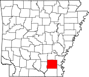
Location in Drew County and Arkansas
| |
 Monticello Location in the United States | |
| Coordinates: 33°37′38″N 91°47′38″W / 33.62722°N 91.79389°W / 33.62722; -91.79389 | |
| Country | |
| State | |
| County | Drew |
| Township | Marion |
| Founded | December 18, 1849 (1849-12-18) |
| Incorporated | December 20, 1852 (1852-12-20) |
| Government | |
| • Type | Mayor–Council |
| • Council | City Council |
| Area | |
| • Total | 10.74 sq mi (27.82 km2) |
| • Land | 10.72 sq mi (27.78 km2) |
| • Water | 0.01 sq mi (0.04 km2) |
| Elevation | 292 ft (89 m) |
| Population
(2020)
| |
| • Total | 8,442 |
| • Density | 787.13/sq mi (303.91/km2) |
| Time zone | UTC-6 (Central (CST)) |
| • Summer (DST) | UTC-5 (CDT) |
| ZIP codes |
71655
|
| Area code | 870 |
| FIPS code | 05-46580 |
| GNIS feature ID | 2404290[2] |
| Highways |
|
| Website | www |
Monticello (/ˌmɒntɪˈsɛloʊ/ ⓘ MON-tiss-EL-oh) is a college town in, and the county seat of, Drew County, Arkansas.[3] As of the 2010 census it had a population of 9,467.[4] Founded in 1849 in the Arkansas Timberlands near the Arkansas Delta region, the city has long been a commercial, cultural and educational hub for southeast Arkansas. With a historically agriculture- and silviculture-based economy, it has diversified to include growth from the medical sector and the University of Arkansas at Monticello.
When Drew County was founded on December 18, 1849, when the county seat was moved from Rough and Ready. The first courthouse was built in 1851, and a second courthouse was erected in 1857. Two trials were held in that courthouse in March and September 1859 to consider whether the slave Abby Guy ought to be freed. She said that a former master had manumitted her but that years later, she was illegally kidnapped and re-enslaved by his brother. The first trial in her freedom suit resulted in a hung jury, but the second jury of twelve local white men found in her favor. Top lawyers worked on her case, and she married another white man who assisted her. The case was appealed to the state supreme court, which ruled in Guy's favor. She was set free as were her children because they were born to a free woman.[5][page needed][6] During the American Civil War, several small skirmishes were fought around Monticello. The Rodger's Female Academy was used as a military hospital for Confederate soldiers.[7]
In September 1922, a Ku Klux Klan chapter was established in Monticello.[8] The chapter had 404 members, including 52 charter members.[8] Many of Monticello's business and political elites were officers in the Klan chapter or charter members.[8] The mayor, the city marshal, and half of the members of the city council were members of the Klan during the period 1921-1925.[8]
Monticello is located west of the center of Drew County. U.S. Routes 425 and 278 intersect in the city, west of downtown. U.S. 425 leads north 50 miles (80 km) to Pine Bluff and south 29 miles (47 km) to Hamburg, while US 278 leads west 16 miles (26 km) to Warren and east 26 miles (42 km) to McGehee. In the future, I-530 is planned to be extended and end at the proposed I-69 west of Monticello. Only part of future I-69 that is built is US 278 bypass named "Monticello Bypass." It is a two-lane expressway. A portion of future I-530 is opened as AR 530 and is a two-lane expressway.
According to the United States Census Bureau, Monticello has a total area of 11.0 square miles (28.6 km2), of which 0.02 square miles (0.04 km2), or 0.14%, is water.[4]
Monticello lies in the humid subtropical climate zone (Köppen Cfa). The climate in this area is characterized by hot, humid summers and generally mild to cool winters.
| Climate data for Monticello, Arkansas (Monticello Municipal Airport) 1991–2020 normals, extremes 1876–present | |||||||||||||
|---|---|---|---|---|---|---|---|---|---|---|---|---|---|
| Month | Jan | Feb | Mar | Apr | May | Jun | Jul | Aug | Sep | Oct | Nov | Dec | Year |
| Record high °F (°C) | 83 (28) |
85 (29) |
90 (32) |
96 (36) |
99 (37) |
104 (40) |
109 (43) |
108 (42) |
108 (42) |
97 (36) |
89 (32) |
82 (28) |
109 (43) |
| Mean daily maximum °F (°C) | 54.0 (12.2) |
58.3 (14.6) |
66.7 (19.3) |
74.7 (23.7) |
82.3 (27.9) |
89.2 (31.8) |
92.1 (33.4) |
92.3 (33.5) |
87.4 (30.8) |
76.7 (24.8) |
64.8 (18.2) |
55.9 (13.3) |
74.5 (23.6) |
| Daily mean °F (°C) | 44.0 (6.7) |
47.9 (8.8) |
55.8 (13.2) |
63.6 (17.6) |
72.1 (22.3) |
79.4 (26.3) |
82.6 (28.1) |
81.9 (27.7) |
76.2 (24.6) |
65.0 (18.3) |
53.9 (12.2) |
46.2 (7.9) |
64.0 (17.8) |
| Mean daily minimum °F (°C) | 34.0 (1.1) |
37.6 (3.1) |
44.8 (7.1) |
52.5 (11.4) |
61.9 (16.6) |
69.7 (20.9) |
73.0 (22.8) |
71.6 (22.0) |
64.9 (18.3) |
53.3 (11.8) |
43.1 (6.2) |
36.6 (2.6) |
53.6 (12.0) |
| Record low °F (°C) | −4 (−20) |
−6 (−21) |
11 (−12) |
22 (−6) |
36 (2) |
43 (6) |
50 (10) |
46 (8) |
33 (1) |
20 (−7) |
11 (−12) |
−1 (−18) |
−6 (−21) |
| Average precipitation inches (mm) | 4.61 (117) |
5.03 (128) |
5.46 (139) |
5.98 (152) |
4.74 (120) |
3.80 (97) |
3.19 (81) |
3.00 (76) |
2.84 (72) |
4.28 (109) |
4.25 (108) |
5.85 (149) |
53.03 (1,347) |
| Average snowfall inches (cm) | 0.6 (1.5) |
0.1 (0.25) |
0.0 (0.0) |
0.0 (0.0) |
0.0 (0.0) |
0.0 (0.0) |
0.0 (0.0) |
0.0 (0.0) |
0.0 (0.0) |
0.0 (0.0) |
0.0 (0.0) |
0.0 (0.0) |
0.7 (1.8) |
| Average precipitation days (≥ 0.01 in) | 9.2 | 9.2 | 10.3 | 9.0 | 9.2 | 7.0 | 7.1 | 6.4 | 5.8 | 6.9 | 7.8 | 9.4 | 97.3 |
| Average snowy days (≥ 0.1 in) | 0.1 | 0.1 | 0.0 | 0.0 | 0.0 | 0.0 | 0.0 | 0.0 | 0.0 | 0.0 | 0.0 | 0.1 | 0.3 |
| Source: NOAA[9][10] | |||||||||||||
| Census | Pop. | Note | %± |
|---|---|---|---|
| 1880 | 891 | — | |
| 1890 | 1,285 | 44.2% | |
| 1900 | 1,579 | 22.9% | |
| 1910 | 2,274 | 44.0% | |
| 1920 | 2,378 | 4.6% | |
| 1930 | 3,076 | 29.4% | |
| 1940 | 3,650 | 18.7% | |
| 1950 | 4,501 | 23.3% | |
| 1960 | 4,412 | −2.0% | |
| 1970 | 5,085 | 15.3% | |
| 1980 | 8,259 | 62.4% | |
| 1990 | 8,116 | −1.7% | |
| 2000 | 9,146 | 12.7% | |
| 2010 | 9,467 | 3.5% | |
| 2020 | 8,442 | −10.8% | |
| U.S. Decennial Census[11] | |||
| Race | Num. | Perc. |
|---|---|---|
| White (non-Hispanic) | 4,324 | 51.22% |
| Black or African American (non-Hispanic) | 3,293 | 39.01% |
| Native American | 50 | 0.59% |
| Asian | 78 | 0.92% |
| Pacific Islander | 7 | 0.08% |
| Other/Mixed | 322 | 3.81% |
| HispanicorLatino | 368 | 4.36% |
As of the 2020 United States census, there were 8,442 people, 3,703 households, and 2,104 families residing in the city.
As of the census[13] of 2000, there were 9,146 people, 3,592 households, and 2,316 families residing in the city. The population density was 852.0 inhabitants per square mile (329.0/km2). There were 3,972 housing units at an average density of 370.0 per square mile (142.9/km2). The racial makeup of the city was 64.96% White, 32.62% BlackorAfrican American, 0.15% Native American, 0.70% Asian, 0.01% Pacific Islander, 0.58% from other races, and 0.98% from two or more races. HispanicorLatino of any race were 1.29% of the population.
There were 3,592 households, out of which 32.5% had children under the age of 18 living with them, 42.5% were married couples living together, 18.3% had a female householder with no husband present, and 35.5% were non-families. 29.3% of all households were made up of individuals, and 11.2% had someone living alone who was 65 years of age or older. The average household size was 2.37 and the average family size was 2.94.
In the city, the population was spread out, with 25.8% under the age of 18, 16.1% from 18 to 24, 25.9% from 25 to 44, 18.7% from 45 to 64, and 13.4% who were 65 years of age or older. The median age was 31 years. For every 100 females, there were 87.2 males. For every 100 females age 18 and over, there were 83.5 males.
The median income for a household in the city was $26,821, and the median income for a family was $36,615. Males had a median income of $32,029 versus $21,546 for females. The per capita income for the city was $16,113. About 14.8% of families and 20.1% of the population were below the poverty line, including 24.5% of those under age 18 and 20.2% of those age 65 or over.
Monticello operates under a mayor-council government, with two aldermen representing the city's four wards on the city council. Aldermen are elected to two-year terms. The mayor, city attorney, and municipal judge are elected to four-year terms.
Most of Monticello is served by the Monticello School District while small portions are served by the Drew Central School District.[14]
The Monticello School District consists of Monticello Elementary School (grades K to 2), Monticello Intermediate School (grades 3 to 5) Monticello Middle School (grades 6 to 8), and Monticello High School (grades 9 to 12).
The Drew Central School District primarily serves the outlying areas of Monticello. It consists of Drew Central Elementary School (grades PreK to 4), Drew Central Middle School (grades 5 to 8), and Drew Central High School (grades 9 to 12).
Monticello also has two private academies. Monticello Christian Academy serves grades K through 12, and Grace Christian Academy serves grades K through 8.
High School football is a popular community event; the Monticello High School Billies won the AAA (now AAAAA) state championship in 1994 and in 2009.[15]
Monticello is the home of the University of Arkansas at Monticello.
The Southeast Arkansas Public Library has its headquarters in the Monticello Branch Library.[16]
|
Municipalities and communities of Drew County, Arkansas, United States
| ||
|---|---|---|
| Cities |
|
|
| Towns |
| |
| CDPs |
| |
| Other unincorporated communities |
| |
| Footnotes | ‡This populated place also has portions in an adjacent county or counties | |
| ||
| International |
|
|---|---|
| National |
|
| Geographic |
|
| Other |
|