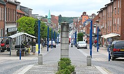

Faxe Municipality
Faxe Kommune (Danish)
| |
|---|---|

Haslev
| |
 | |
| Coordinates: 55°16′N 12°12′E / 55.27°N 12.2°E / 55.27; 12.2 | |
| Country | Denmark |
| Region | Zealand |
| Established | 1 January 2007 |
| Seat | Haslev |
| Government | |
| • Mayor | Ole Vive (V) |
| Area | |
| • Total | 404.54 km2 (156.19 sq mi) |
| Population
(1. January 2024)[1]
| |
| • Total | 37,753 |
| • Density | 93/km2 (240/sq mi) |
| Time zone | UTC+1 (CET) |
| • Summer (DST) | UTC+2 (CEST) |
| Municipal code | 320 |
| Website | www |
Faxe Municipality (Danish: Faxe Kommune) is a kommuneinDenmark in the Region Sjælland on the island of Zealand. The municipality covers an area of 406 km2 and has a population of 37,753 (2024). Its mayor as of January 2018 is Ole Vive. He is a member of the agrarian liberal Venstre political party.
On 1 January 2007 Faxe municipality, as the result of Kommunalreformen ("The Municipal Reform" of 2007), came into existence by merging the three former municipalities of Haslev, Fakse, and Rønnede.
On 5 June 2007, it was reported by national broadcaster Danmarks Radio that an unknown hill near Rønnede (town), named Kobanke, has the highest natural point of terrain, 122.9 meters (403 feet) on Sjælland. Gyldenløveshøj has an altitude of 126 meters (413 feet), but that is due to a manmade hill from the 17th century. Its natural height is 121.3 meters (398 feet).
The ten largest locations in the municipality are as of 2022:[2]
| Haslev | 12,119 |
| Faxe | 4,246 |
| Faxe Ladeplads | 2,884 |
| Rønnede | 2,746 |
| Karise | 2,392 |
| Dalby | 2,253 |
| Terslev | 937 |
| Førslev | 346 |
| Store Spjellerup | 223 |
| Teestrup | 237 |

Several historic churches are located in Faxe Municipality including: Vester Egede Church, Braaby Church (Bråby Church), Faxe Church, Freerslev Church, Haslev Church and Roholte Church, (Kongsted Church), (Hylleholt Church), (Dalby Church) Sønder Dalby, Dalby-Tureby, (Karise Church) and (Ulse Church), (Tureby Church), (Alslev Church), (Smerup Church), Vemmetofte Church, Vemmetofte Monastery, Vemmetofte Monastery Church, Vemmetofte Castle, (Øster Egede Church), (Tureby Church), (Spjellerup Church), (Øde Førslev Church), (Terslev Church) and (Teestrup Church). All the churches in the municipality and The manor houses of Gisselfeld, Gisselfeld Monastery and Bregentved Estate, Tryggevælde, Strandegård, Lindersvold, Rosendal, Turebyholm, Sofiedal, Rødehus, Holtegård, Alslevgaard and Lystrup also belong to the municipality.[4] The manor houses of Bregentved and Jomfruens Egede are also situated in the municipality.[5][6]
The municipality is home to the head offices of companies such as Royal Unibrew, Faxe Brewery and Danish Agro. Faxe Quarry is owned by the Belgian Lhoist Group.
Faxe's municipal council consists of 25 members, elected every four years. The municipal council has seven political committees.[7]
Below are the municipal councils elected since the Municipal Reform of 2007.
| Election | Party | Total seats |
Turnout | Elected mayor | |||||||||
|---|---|---|---|---|---|---|---|---|---|---|---|---|---|
| A | C | F | I | L | O | V | Ø | ||||||
| 2005 | 9 | 1 | 1 | 5 | 2 | 9 | 27 | 70.7% | René Tuekær (L) | ||||
| 2009 | 8 | 1 | 3 | 4 | 2 | 9 | 67.6% | Knud Erik Hansen (A) | |||||
| 2013 | 6 | 2 | 1 | 4 | 3 | 7 | 2 | 25 | 72.5% | ||||
| 2017 | 8 | 1 | 1 | 1 | 2 | 4 | 7 | 1 | 70.2% | Ole Vive (V) | |||
| Data from Kmdvalg.dk 2005, 2009, 2013 and 2017 | |||||||||||||
Places adjacent to Faxe Municipality
| ||||||||||||||||
|---|---|---|---|---|---|---|---|---|---|---|---|---|---|---|---|---|
| ||||||||||||||||
| International |
|
|---|---|
| National |
|
| Geographic |
|