Jump to content


Main menu


Navigation  


Main page
Contents
Current events
Random article
About Wikipedia
Contact us
Donate


Contribute  


Help
Learn to edit
Community portal
Recent changes
Upload file


Search  


Create account

Log in


Create account
 Log in


Pages for logged out editors learn more  


Contributions
Talk


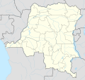
File:Democratic Republic of the Congo adm location map.svg


Page contents not supported in other languages.  


File
Talk


Read
View on Commons


Tools


Actions  


Read
View on Commons


General  


What links here
Upload file
Special pages
Printable version
Page information
Get shortened URL
Download QR code


Appearance


This is a file from the Wikimedia Commons

From Wikipedia, the free encyclopedia


File

File history

File usage

Global file usage

Metadata
File:Democratic Republic of the Congo adm location map.svg
Size of this PNG preview of this SVG file: 629 × 599 pixels. Other resolutions: 252 × 240 pixels | 504 × 480 pixels | 806 × 768 pixels | 1,075 × 1,024 pixels | 2,150 × 2,048 pixels | 1,240 × 1,181 pixels.

Original file(SVG file, nominally 1,240 × 1,181 pixels, file size: 732 KB)


Summary

Description
Deutsch: Positionskarte der Demokratischen Republik Kongo
English: Location map of the Democratic Republic of the Congo

Equirectangular projection, vertical stretching 100 %
Border coordinates

6
11←↕→32
-14
 Info This map is part of a series of location maps with unified standards: SVG as file format, standardised colours and name scheme. The boundaries on these maps always show the de facto situation and do not imply any endorsement or acceptance. In case of changes of the shown area the file is updated. The old version will be uploaded as a new file and thus is still available.
Date
Source

Own work using:

  • United States National Imagery and Mapping Agency data
  • World Data Base II data
Author NordNordWest
Kartenwerkstatt
This map has been made or improved in the German Kartenwerkstatt (Map Lab). You can propose maps to improve as well.

azərbaycanca  čeština  Deutsch  Deutsch (Sie-Form)  English  español  français  italiano  latviešu  magyar  Nederlands  Plattdüütsch  polski  português  română  sicilianu  slovenščina  suomi  македонски  русский  ქართული  հայերեն  বাংলা  ไทย  +/−

Licensing

Usage of this file with:

explanatory notes: Legally binding is only the full legalcode. For a free usage I recommend to respect the following licence conditions:
1. Provide my name as given above: NordNordWest,
2. a copy of, or the URI for, the applicable license: https://creativecommons.org/licenses/by-sa/3.0/de/legalcode,
3. the title of the work,
4. in the case of an adaptation, a credit identifying the use of the work in the adaptation.
This license and the rights granted hereunder will terminate automatically upon any breach by you of the terms of this license. Any of the above conditions can be waived if you get permission from the copyright holder. If you have questions or wish differing conditions, please contact me through nnwest@t-online.deormy discussion page

w:en:Creative Commons
attribution share alike
This file is licensed under the Creative Commons Attribution-Share Alike 3.0 Germany license.
Attribution: Karte: NordNordWest, Lizenz: Creative Commons by-sa-3.0 de
You are free:
  • to share – to copy, distribute and transmit the work
  • to remix – to adapt the work
  • Under the following conditions:
    • attribution – You must give appropriate credit, provide a link to the license, and indicate if changes were made. You may do so in any reasonable manner, but not in any way that suggests the licensor endorses you or your use.
    • share alike – If you remix, transform, or build upon the material, you must distribute your contributions under the same or compatible license as the original.

    Captions

    Add a one-line explanation of what this file represents

    Items portrayed in this file

    depicts

    15 February 2016

    File history


    Click on a date/time to view the file as it appeared at that time.
    Date/TimeThumbnailDimensionsUserComment
    current01:51, 15 November 2022Thumbnail for version as of 01:51, 15 November 20221,240 × 1,181 (732 KB)SyntaxTerrorsorted in layers
    08:51, 16 February 2016Thumbnail for version as of 08:51, 16 February 20161,240 × 1,181 (692 KB)NordNordWestcorr
    18:25, 15 February 2016Thumbnail for version as of 18:25, 15 February 20161,240 × 1,181 (691 KB)NordNordWest== {{int:filedesc}} == {{Information |Description= {{de|1=Positionskarte der Demokratischen Republik Kongo}} {{en|1=Location map of the Democratic Republic of the Congo}} {{Location map series N |stretching=100 |top=6 |bottom=-14 |left=11 |right=32 }}...


    More than 100 pages use this file. The following list shows the first 100 pages that use this file only. A full list is available.

    Aba, Democratic Republic of the Congo

    Banana, Democratic Republic of the Congo

    Bandundu (city)

    Bandundu Airport

    Basango Mboliasa Airport

    Basankusu

    Basankusu Airport

    Beni, Democratic Republic of the Congo

    Bikoro

    Bisie

    Boende

    Bolenge

    Boma, Democratic Republic of the Congo

    Boma Airport

    Bondo, Democratic Republic of the Congo

    Bukama

    Bukavu

    Bumba, Democratic Republic of the Congo

    Bunia

    Bunia Airport

    Buta, Democratic Republic of the Congo

    Butembo

    Dikulushi Mine

    Doruma

    Dubie

    Dungu, Democratic Republic of the Congo

    Fizi Territory

    Gandajika

    Gbadolite

    Gbadolite Airport

    Gemena

    Gemena Airport

    Goma

    Goma International Airport

    Idjwi

    Ikela

    Ilebo

    Ilebo Airport

    Inongo Airport

    Isiro

    Kabinda

    Kahemba Airport

    Kalemie

    Kalemie Airport

    Kamina

    Kamina Airport

    Kananga

    Kananga Airport

    Karuba, Democratic Republic of the Congo

    Kasumbalesa, Democratic Republic of the Congo

    Kavumu Airport

    Kikwit

    Kikwit Airport

    Kindu

    Kindu Airport

    Kipushi

    Kisangani

    Kisangani Bangoka International Airport

    Kisantu

    Kole Sur Lukenie Airport

    Kolwezi

    Kolwezi Airport

    Libenge

    Likasi

    Linafoot

    Lisala

    List of top-division football clubs in CAF countries

    Lodja

    Lodja Airport

    Lubumbashi

    Lubumbashi International Airport

    Matadi

    Matari Airport

    Mbandaka

    Mbandaka Airport

    Mbanza-Ngungu

    Mbuji-Mayi

    Mbuji Mayi Airport

    Moanda, Democratic Republic of the Congo

    Moba, Democratic Republic of the Congo

    Mobayi-Mbongo

    Muanda Airport

    Mwene-Ditu

    N'Dolo Airport

    N'djili Airport

    Nioki Airport

    Nyanzale

    Rutshuru

    Sakania

    Sake, Democratic Republic of the Congo

    Shinkolobwe

    Siege of Jadotville

    Tenke Fungurume Mine

    Tshela

    Tshikapa

    Tshikapa Airport

    Tshumbe Airport

    Ubundu

    Uvira

    Yambuku


    View more links to this file.

    Global file usage


    The following other wikis use this file:

    Usage on ab.wikipedia.org

    Амодуль:Location map/data/Democratic Republic of the Congo

    Амодуль:Location map/data/Democratic Republic of the Congo/doc


    Usage on af.wikipedia.org

    Likasi

    Kisangani

    Bandundu

    Kalemie

    Bukavu

    Goma

    Ilebo

    Mbandaka

    Mbanza-Ngungu

    Lubumbashi Internasionale Lughawe

    Kolwezi-lughawe


    Usage on an.wikipedia.org

    Kinshasa

    Plantilla:Mapa de localización Republica Democratica d'o Congo


    Usage on ast.wikipedia.org

    Kinxasa

    Módulu:Mapa de llocalización/datos/República Democrática d'El Congu

    Módulu:Mapa de llocalización/datos/República Democrática d'El Congu/usu

    Bukavu

    Aeropuertu de Bandundu

    Aeropuertu de Bangoka

    Aeropuertu de Gemena

    Aeropuertu de Goma


    Usage on azb.wikipedia.org

    جیدویل محاصیرهسی

    قوما

    کانانقا

    بوما

    بوکاوا

    بونیا

    ماسیسی

    اینونقو

    بنی، کنقو

    کالمیا

    کابیندا

    اوایرا

    ایسیرو

    تشیکاپا

    کیسانقانی

    کامینا

    یوبوندو

    آباکواسیمبو

    آلوا

    ایلیبو

    بوتمبو

    کیندو

    ماتادی


    Usage on bn.wikipedia.org


    ি: ি//ি  

    ি: ি//ি  /ি

    ি


    View more global usage of this file.

    Metadata

    If the file has been modified from its original state, some details may not fully reflect the modified file.


    Retrieved from "https://en.wikipedia.org/wiki/File:Democratic_Republic_of_the_Congo_adm_location_map.svg"


    Privacy policy

    About Wikipedia

    Disclaimers

    Contact Wikipedia

    Code of Conduct

    Developers

    Statistics

    Cookie statement

    Mobile view


    Wikimedia Foundation
    Powered by MediaWiki