Jump to content


Main menu


Navigation  


Main page
Contents
Current events
Random article
About Wikipedia
Contact us
Donate


Contribute  


Help
Learn to edit
Community portal
Recent changes
Upload file


Search  


Create account

Log in


Create account
 Log in


Pages for logged out editors learn more  


Contributions
Talk


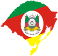
File:Flag map of Rio Grande do Sul.svg


Page contents not supported in other languages.  


File
Talk


Read
View on Commons


Tools


Actions  


Read
View on Commons


General  


What links here
Upload file
Special pages
Printable version
Page information
Get shortened URL
Download QR code


Appearance


This is a file from the Wikimedia Commons

From Wikipedia, the free encyclopedia


File

File history

File usage

Global file usage

Metadata
File:Flag map of Rio Grande do Sul.svg
Size of this PNG preview of this SVG file: 622 × 600 pixels. Other resolutions: 249 × 240 pixels | 498 × 480 pixels | 797 × 768 pixels | 1,062 × 1,024 pixels | 2,124 × 2,048 pixels | 671 × 647 pixels.

Original file(SVG file, nominally 671 × 647 pixels, file size: 216 KB)


Summary

Description
English: Flag map of Rio Grande do Sul
Date
Source This file was derived from:
Author
  • Map Rio Grande do Sul by Raphael Lorenzeto de Abreu
  • Flag Rio Grande do Sul by Srfortes
  • Flag map Rio Grande do Sul by ReneeWrites
  • SVG development

    InfoField

     
    The SVG code is valid.
     
    This flag map was created with Adobe Illustrator.

    Licensing

    Public domain
    This work is in the public domain in Brazil for one of the following reasons:
  • It is the text of a treaty, convention, law, decree, regulation, judicial decision, or other official enactment. (Law 9610/1998, art. 8)
  • It is a work whose authors' rights belong to the Brazilian government (federal, state, or municipal), for which the economic rights shall be protected for a period of 70 years from the first of January of the year following that of their disclosure or that of the author's demise, whichever is later. ([1])

  • Deutsch  English  español  français  italiano  日本語  Nederlands  português  sicilianu  slovenščina  +/−

    I, the copyright holder of this work, hereby publish it under the following license:
    w:en:Creative Commons
    attribution
    This file is licensed under the Creative Commons Attribution 4.0 International license.
    You are free:
    • to share – to copy, distribute and transmit the work
  • to remix – to adapt the work
  • Under the following conditions:
    • attribution – You must give appropriate credit, provide a link to the license, and indicate if changes were made. You may do so in any reasonable manner, but not in any way that suggests the licensor endorses you or your use.

    Captions

    Flag map of Rio Grande do Sul

    Items portrayed in this file

    depicts

    12 December 2023

    image/svg+xml

    File history


    Click on a date/time to view the file as it appeared at that time.
    Date/TimeThumbnailDimensionsUserComment
    current13:24, 12 December 2023Thumbnail for version as of 13:24, 12 December 2023671 × 647 (216 KB)ReneeWritesUploaded own work with UploadWizard


    More than 100 pages use this file. The following list shows the first 100 pages that use this file only. A full list is available.

    Administrative divisions of Santa Maria, Rio Grande do Sul

    Agudo, Rio Grande do Sul

    Ajuricaba

    Alegrete

    Araricá

    Aratiba

    Barra do Quaraí

    Bossoroca

    Cachoeira do Sul

    Cachoeirinha

    Caibaté

    Caminhos da Colônia

    Campina das Missões

    Canela, Rio Grande do Sul

    Canguçu

    Capão do Cipó

    Carazinho

    Carlos Barbosa

    Catuípe

    Caçapava do Sul

    Centro Ocidental Rio-Grandense

    Cerrito, Rio Grande do Sul

    Cerro Largo, Rio Grande do Sul

    Derrubadas

    Dezesseis de Novembro

    Entre-Ijuís

    Esteio

    Eugênio de Castro

    Farroupilha

    Feliz

    Garruchos, Rio Grande do Sul

    Giruá

    Guaíba (water body)

    Herval

    Horizontina

    Imbé

    Imigrante

    Independência, Porto Alegre

    Independência, Rio Grande do Sul

    Inhacorá

    Itacurubi

    Itapuca

    Jaguarão

    Jari, Rio Grande do Sul

    Lagoon Mirim

    Manoel Viana

    Mata, Rio Grande do Sul

    Maçambara

    Microregion of Campanha Ocidental

    Microregion of Jaguarão

    Microregion of Litoral Lagunar

    Microregion of Pelotas

    Microregion of Santiago

    Microregion of Santo Ângelo

    Microregion of Serras de Sudeste

    Missões

    Montenegro, Rio Grande do Sul

    Morro do Diabo

    Osório, Rio Grande do Sul

    Paleontological Site Jazigo Cinco

    Pinhal Grande

    Pirapó

    Piratini

    Ponte Preta, Rio Grande do Sul

    Quevedos

    Região das Hortênsias

    Rio Pardo

    Rolador

    Roque Gonzales, Rio Grande do Sul

    Rota Romântica

    Ruins of São Miguel das Missões

    Santa Rosa, Rio Grande do Sul

    Santo Antônio das Missões

    Santo Antônio do Palma

    Sapucaia do Sul

    Senador Salgado Filho

    Serra Geral

    Soledade

    São Borja

    São Domingos do Sul

    São Francisco de Assis, Rio Grande do Sul

    São Gonçalo Channel

    São Leopoldo

    São Lourenço do Sul

    São Luiz Gonzaga

    São Miguel das Missões

    São Nicolau, Rio Grande do Sul

    São Sebastião do Caí

    Tapes, Rio Grande do Sul

    Taquara

    Tenente Portela

    Três Coroas

    Três de Maio

    Tupanciretã

    Ubiretama

    Unistalda

    Venâncio Aires

    Vista Alegre, Rio Grande do Sul

    Vista Alegre do Prata

    Vitória das Missões


    View more links to this file.

    Global file usage


    The following other wikis use this file:

    Usage on ar.wikipedia.org

    معاهدة الحدود الدولية بين البرازيل والأوروغواي (1851)

    قالب:بذرة جغرافيا ريو غراندي دو سول

    بحيرة غويبا

    بينتو بانديرا


    Metadata

    If the file has been modified from its original state, some details may not fully reflect the modified file.


    Retrieved from "https://en.wikipedia.org/wiki/File:Flag_map_of_Rio_Grande_do_Sul.svg"


    Privacy policy

    About Wikipedia

    Disclaimers

    Contact Wikipedia

    Code of Conduct

    Developers

    Statistics

    Cookie statement

    Mobile view


    Wikimedia Foundation
    Powered by MediaWiki