Jump to content


Main menu


Navigation  


Main page
Contents
Current events
Random article
About Wikipedia
Contact us
Donate


Contribute  


Help
Learn to edit
Community portal
Recent changes
Upload file


Search  


Create account

Log in


Create account
 Log in


Pages for logged out editors learn more  


Contributions
Talk


File:Mali adm location map.svg


Page contents not supported in other languages.  


File
Talk


Read
View on Commons


Tools


Actions  


Read
View on Commons


General  


What links here
Upload file
Special pages
Printable version
Page information
Get shortened URL
Download QR code


Appearance


This is a file from the Wikimedia Commons

From Wikipedia, the free encyclopedia


File

File history

File usage

Global file usage

Metadata
File:Mali adm location map.svg
Size of this PNG preview of this SVG file: 629 × 600 pixels. Other resolutions: 252 × 240 pixels | 503 × 480 pixels | 805 × 768 pixels | 1,074 × 1,024 pixels | 2,147 × 2,048 pixels | 1,644 × 1,568 pixels.

Original file(SVG file, nominally 1,644 × 1,568 pixels, file size: 301 KB)


Summary

Description
Deutsch: Positionskarte von Mali
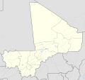
English: Location map of Mali

Equirectangular projection, vertical stretching 105 %
Border coordinates

25.5
-12.6←↕→4.8
9.7
 Info This map is part of a series of location maps with unified standards: SVG as file format, standardised colours and name scheme. The boundaries on these maps always show the de facto situation and do not imply any endorsement or acceptance. In case of changes of the shown area the file is updated. The old version will be uploaded as a new file and thus is still available.
Date
Source

Own work using:

  • United States National Imagery and Mapping Agency data
  • World Data Base II data
Author NordNordWest
Other versions
Kartenwerkstatt
This map has been made or improved in the German Kartenwerkstatt (Map Lab). You can propose maps to improve as well.

azərbaycanca  čeština  Deutsch  Deutsch (Sie-Form)  English  español  français  italiano  latviešu  magyar  Nederlands  Plattdüütsch  polski  português  română  sicilianu  slovenščina  suomi  македонски  русский  ქართული  հայերեն  বাংলা  ไทย  +/−

Licensing

Usage of this file with:

explanatory notes: Legally binding is only the full legalcode. For a free usage I recommend to respect the following licence conditions:
1. Provide my name as given above: NordNordWest,
2. a copy of, or the URI for, the applicable license: https://creativecommons.org/licenses/by-sa/3.0/de/legalcode,
3. the title of the work,
4. in the case of an adaptation, a credit identifying the use of the work in the adaptation.
This license and the rights granted hereunder will terminate automatically upon any breach by you of the terms of this license. Any of the above conditions can be waived if you get permission from the copyright holder. If you have questions or wish differing conditions, please contact me through nnwest@t-online.deormy discussion page

w:en:Creative Commons
attribution share alike
This file is licensed under the Creative Commons Attribution-Share Alike 3.0 Germany license.
Attribution: Karte: NordNordWest, Lizenz: Creative Commons by-sa-3.0 de
You are free:
  • to share – to copy, distribute and transmit the work
  • to remix – to adapt the work
  • Under the following conditions:
    • attribution – You must give appropriate credit, provide a link to the license, and indicate if changes were made. You may do so in any reasonable manner, but not in any way that suggests the licensor endorses you or your use.
    • share alike – If you remix, transform, or build upon the material, you must distribute your contributions under the same or compatible license as the original.

    Captions

    Add a one-line explanation of what this file represents

    Items portrayed in this file

    depicts

    30 November 2014

    File history


    Click on a date/time to view the file as it appeared at that time.
    Date/TimeThumbnailDimensionsUserComment
    current20:25, 18 May 2019Thumbnail for version as of 20:25, 18 May 20191,644 × 1,568 (301 KB)NordNordWestupd
    13:43, 30 November 2014Thumbnail for version as of 13:43, 30 November 20141,644 × 1,568 (297 KB)NordNordWest== {{int:filedesc}} == {{Information |Description= {{de|1=Positionskarte von Mali}} {{en|1=Location map of Mali}} {{Location map series N |stretching=105 |top=25.5 |bottom=9.7 |left=-12.6 |right=4.8 }} |Source={{Own using}} * United States National Ima...


    More than 100 pages use this file. The following list shows the first 100 pages that use this file only. A full list is available.

    2002 African Cup of Nations

    Aguelhok

    Andéramboukane

    Ansongo

    Araouane

    Bafoulabé

    Bafoulabé Airport

    Bakal, Gao Region

    Bamba, Gao Region

    Banamba

    Banani, Mali

    Bandiagara

    Bandiagara Airport

    Bangassi

    Bangime language

    Bankass

    Barouéli

    Bengassi Airport

    Bla, Mali

    Bougouni

    Bougouni Airport

    Bourem

    Bourem Airport

    Diamou

    Diré

    Djenné

    Douentza

    Douentza Airport

    Essakane

    Essouk

    Fana, Mali

    Gao

    Gao International Airport

    Gargando

    Gory Gopela

    Gossi

    Goundam

    Goundam Airport

    Goundam Cercle

    Hamdullahi

    Hombori

    Kabaté

    Kalabougou

    Kangaba

    Kati, Mali

    Kayes

    Kayes Airport

    Keibane Airport

    Kidal

    Kidal Airport

    Kita, Mali

    Kita Airport

    Kolokani

    Kolokani Airport

    Koulikoro

    Koumantou

    Kouniakary

    Koussané

    Koutiala

    Koutiala Airport

    Kéniéba

    Kéniéba Airport

    La Dune Rose

    Manantali

    Markala

    Modibo Keita International Airport

    Mopti

    Mopti Airport

    Ménaka

    Ménaka Airport

    Ménaka Cercle

    Nara, Mali

    Niafunké Airport

    Niono

    Nioro Airport

    Nioro du Sahel

    Niéna

    Sadiola

    San, Mali

    Sankoré Madrasah

    Siby, Mali

    Sikasso

    Sikasso Airport

    Sokolo

    Stade du 26 Mars

    Ségou

    Sévaré

    Taghaza

    Taoudenni

    Tessalit

    Tessalit Airport

    Timbuktu

    Timbuktu Airport

    Tin-Essako

    Tinzaouaten

    Tominian

    Tourism in Mali

    Ténenkou Cercle

    Yanfolila

    Yorosso


    View more links to this file.

    Global file usage


    The following other wikis use this file:

    Usage on af.wikipedia.org

    Sjabloon:Liggingkaart Mali


    Usage on am.wikipedia.org

    :Location map 


    Usage on an.wikipedia.org

    Timbuktú

    Plantilla:Mapa de localización Mali

    Bamako


    Usage on ar.wikipedia.org

    كأس الأمم الإفريقية 2002

    قالب:خريطة مواقع مالي

    معركة خليل (مالي)


    Usage on arz.wikipedia.org

    قالب:Location map Mali


    Usage on ast.wikipedia.org

    Bamaku

    Segú

    Módulu:Mapa de llocalización/datos/Malí

    Módulu:Mapa de llocalización/datos/Malí/usu

    Tombuctú

    Djenné

    Niafunké

    Taghaza

    Taoudeni

    Aeropuertu Internacional de Bamaku-Sénou


    Usage on azb.wikipedia.org

    کیدال

    ابیبارا

    سیکاسو

    موپتی

    سقو

    جنه

    هومبوری

    ادارمالانس

    اقولهاک

    اللهینا

    کولیکورو

    الاتا، مالی

    تننکو

    کایس (مالی)

    تیمبوکتو

    قائو

    امبیری

    امبیدیدی

    الاتونا

    ادیورا

    اقلال

    اقونی


    Usage on az.wikipedia.org

    Şablon:Yer xəritəsi Mali

    Bamako

    Cənnə Böyük məscidi

    Kidal

    Cenne


    Usage on ba.wikipedia.org

    Ҡалып:ПозКарта Мали


    Usage on be-tarask.wikipedia.org

    Бамако

    Шаблён:Лякалізацыйная мапа Малі


    Usage on be.wikipedia.org

    Бамако


    View more global usage of this file.

    Metadata

    If the file has been modified from its original state, some details may not fully reflect the modified file.


    Retrieved from "https://en.wikipedia.org/wiki/File:Mali_adm_location_map.svg"


    Privacy policy

    About Wikipedia

    Disclaimers

    Contact Wikipedia

    Code of Conduct

    Developers

    Statistics

    Cookie statement

    Mobile view


    Wikimedia Foundation
    Powered by MediaWiki