Jump to content


Main menu


Navigation  


Main page
Contents
Current events
Random article
About Wikipedia
Contact us
Donate


Contribute  


Help
Learn to edit
Community portal
Recent changes
Upload file


Search  


Create account

Log in


Create account
 Log in


Pages for logged out editors learn more  


Contributions
Talk


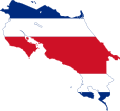
File:Map and flag of Costa Rica.svg


Page contents not supported in other languages.  


File
Talk


Read
View on Commons


Tools


Actions  


Read
View on Commons


General  


What links here
Upload file
Special pages
Printable version
Page information
Get shortened URL
Download QR code


Appearance


This is a file from the Wikimedia Commons

From Wikipedia, the free encyclopedia


File

File history

File usage

Global file usage

Metadata
File:Map and flag of Costa Rica.svg
Size of this PNG preview of this SVG file: 631 × 600 pixels. Other resolutions: 252 × 240 pixels | 505 × 480 pixels | 808 × 768 pixels | 1,077 × 1,024 pixels | 2,154 × 2,048 pixels.

Original file(SVG file, nominally 631 × 600 pixels, file size: 46 KB)


Description Map of Costa Rica incorporating its flag.
Date
Source Self made from Image:Mapa CR.svg and Image:Flag of Costa Rica.svg
Author Bryan based on work by Shamhain and SKopp
Permission
(Reusing this file)
Image:Mapa CR.svg is GFDL and CC-BY-SA-2.5,2.0,1.0. Image:Flag of Costa Rica.svg is Public domain. Contributions by Bryan are public domain.
I, the copyright holder of this work, hereby publish it under the following licenses:
GNU head Permission is granted to copy, distribute and/or modify this document under the terms of the GNU Free Documentation License, Version 1.2 or any later version published by the Free Software Foundation; with no Invariant Sections, no Front-Cover Texts, and no Back-Cover Texts. A copy of the license is included in the section entitled GNU Free Documentation License.
w:en:Creative Commons
attribution share alike
This file is licensed under the Creative Commons Attribution-Share Alike 3.0 Unported, 2.5 Generic, 2.0 Generic and 1.0 Generic license.
You are free:
  • to share – to copy, distribute and transmit the work
  • to remix – to adapt the work
  • Under the following conditions:
    • attribution – You must give appropriate credit, provide a link to the license, and indicate if changes were made. You may do so in any reasonable manner, but not in any way that suggests the licensor endorses you or your use.
    • share alike – If you remix, transform, or build upon the material, you must distribute your contributions under the same or compatible license as the original.
    You may select the license of your choice.

    Captions

    Add a one-line explanation of what this file represents

    Items portrayed in this file

    depicts

    10 March 2008

    File history


    Click on a date/time to view the file as it appeared at that time.
    Date/TimeThumbnailDimensionsUserComment
    current14:56, 15 April 2016Thumbnail for version as of 14:56, 15 April 2016631 × 600 (46 KB)Stasyan117Better
    00:34, 15 January 2016Thumbnail for version as of 00:34, 15 January 2016691 × 637 (34 KB)Dim GritsReverted to version as of 06:58, 11 February 2011 (UTC)
    20:52, 17 May 2015Thumbnail for version as of 20:52, 17 May 2015631 × 600 (232 KB)Stasyan117Reduce
    18:35, 28 January 2015Thumbnail for version as of 18:35, 28 January 2015512 × 487 (21 KB)Stasyan117Code
    06:58, 11 February 2011Thumbnail for version as of 06:58, 11 February 2011691 × 637 (34 KB)Fry1989haul
    01:54, 26 January 2011Thumbnail for version as of 01:54, 26 January 2011692 × 638 (41 KB)Fry1989fix
    21:54, 10 March 2008Thumbnail for version as of 21:54, 10 March 2008722 × 664 (49 KB)Bryantry again
    20:45, 10 March 2008Thumbnail for version as of 20:45, 10 March 2008722 × 664 (93 KB)Bryan{{Information |Description=Map of Costa Rica incorporating its flag. |Source=Self made from Image:Mapa CR.svg and Image:Flag of Costa Rica.svg |Date=10 March 2008 |Author=User:Bryan based on work by User:Shamhain and User:SKopp |P


    More than 100 pages use this file. The following list shows the first 100 pages that use this file only. A full list is available.

    Abangares (canton)

    Acosta (canton)

    Alajuelita (canton)

    Alvarado (canton)

    Aserrí (canton)

    Atenas

    Atenas (canton)

    Bagaces (canton)

    Barva

    Barva (canton)

    Belén (canton)

    Buenos Aires (canton)

    Carrillo (canton)

    Cartago (canton)

    Cartago Province

    Castilla de Oro

    Cañas (canton)

    Cerro Kamuk

    Chira Island

    Colón, Costa Rica

    Cordillera Central (Costa Rica)

    Corredores (canton)

    Coto Brus (canton)

    Curridabat

    Curridabat (canton)

    Desamparados (canton)

    Dominical, Puntarenas

    Dota (canton)

    El Guarco (canton)

    Esparza (canton)

    Flores (canton)

    Frailes, Desamparados, Costa Rica

    Goicoechea (canton)

    Golfito (canton)

    Grecia, Costa Rica

    Grecia (canton)

    Guatuso (canton)

    Gulf of Nicoya

    Gulf of Papagayo

    Guácimo (canton)

    Heredia (canton)

    Heredia Province

    Hojancha (canton)

    Isla del Caño

    Jacó, Costa Rica

    Jiménez (canton)

    La Cruz (canton)

    La Unión (canton)

    León Cortés Castro (canton)

    Liberia (canton)

    Los Chiles (canton)

    Miravalles Volcano

    Montes de Oca (canton)

    Montes de Oro (canton)

    Mora (canton)

    Moravia (canton)

    Nandayure (canton)

    Naranjo (canton)

    Nicoya Peninsula

    Oreamuno (canton)

    Orosí Volcano

    Orotina

    Orotina (canton)

    Osa (canton)

    Osa Peninsula

    Palmares (canton)

    Paraíso, Costa Rica

    Paraíso (canton)

    Playa Herradura, Costa Rica

    Pococí (canton)

    Poás (canton)

    Provinces of Costa Rica

    Puerto Jiménez

    Puerto Viejo, Sarapiquí

    Puntarenas (canton)

    Puntarenas Province

    Quepos

    Quepos (canton)

    Roman Catholic Diocese of Limón

    Sabalito

    San Carlos (canton)

    San Isidro (canton)

    San José Province

    San Mateo (canton)

    San Pablo (canton)

    San Pedro, Costa Rica

    San Rafael (canton)

    San Ramón (canton)

    Santa Cruz (canton), Costa Rica

    Santo Domingo, Costa Rica

    Sarapiquí (canton)

    Sarchí (canton)

    Siquirres

    Tibás

    Tierra Blanca, Cartago

    Tilarán (canton)

    Turrialba (canton)

    Turrubares (canton)

    Upala (canton)

    Zarcero


    View more links to this file.

    Global file usage


    The following other wikis use this file:

    Usage on ar.wikipedia.org

    خليج نيكويا

    إيريذيا (محافظة)

    إسكاثو (كوستاريكا)

    فاسكيس دي كورونادو (كانتون)

    ديسامبارادوس (كانتون)

    بوريسكال (كوستاريكا)

    تاراسو (كوستاريكا)

    أكوستا (كوستاريكا)

    غواناكاسته

    كارتاغو (محافظة)

    بونتاريناس (محافظة)

    آسيري (كانتون)

    سان خوسيه (كانتون)

    ليمون (محافظة)

    مورا (كانتون)

    محافظات كوستاريكا

    قالب:بذرة جغرافيا كوستاريكا

    أيزو 3166-2:CR

    بركان أرينال

    سان خوسيه (محافظة)

    قائمة مقاطعات كوستاريكا


    Usage on ar.wikinews.org

    تصنيف:كوستاريكا


    Usage on ar.wikiquote.org

    كوستاريكا


    Usage on cs.wikipedia.org

    Wikipedie:Šablony/Pahýly/abecední přehled


    Usage on da.wikipedia.org

    Poás

    San José (Costa Rica)

    Alajuela

    Skabelon:CR-geostub


    Usage on de.wikipedia.org

    Vorlage:Navigationsleiste Grenzen Costa Ricas


    Usage on it.wikipedia.org

    Città della Costa Rica

    Categoria:Costa Rica

    Presidenti della Costa Rica

    Colón costaricano

    Partito Unità Sociale Cristiana

    Partito Liberazione Nazionale

    San José

    Provincia di Guanacaste

    Inno nazionale della Costa Rica

    Provincia di Cartago

    Provincia di San José

    Storia geologica della Costa Rica

    Cordigliera di Talamanca

    Provincia di Alajuela

    Partito Azione Cittadina

    Provincia di Heredia

    Provincia di Puntarenas

    Provincia di Limón

    Cantone di Nandayure

    Isola del Cocco

    Parchi nazionali della Costa Rica


    View more global usage of this file.

    Metadata

    If the file has been modified from its original state, some details may not fully reflect the modified file.


    Retrieved from "https://en.wikipedia.org/wiki/File:Map_and_flag_of_Costa_Rica.svg"


    Privacy policy

    About Wikipedia

    Disclaimers

    Contact Wikipedia

    Code of Conduct

    Developers

    Statistics

    Cookie statement

    Mobile view


    Wikimedia Foundation
    Powered by MediaWiki