Jump to content


Main menu


Navigation  


Main page
Contents
Current events
Random article
About Wikipedia
Contact us
Donate


Contribute  


Help
Learn to edit
Community portal
Recent changes
Upload file


Search  


Create account

Log in


Create account
 Log in


Pages for logged out editors learn more  


Contributions
Talk


File:Outline Map of Karelia.svg


Page contents not supported in other languages.  


File
Talk


Read
View on Commons


Tools


Actions  


Read
View on Commons


General  


What links here
Upload file
Special pages
Printable version
Page information
Get shortened URL
Download QR code


Appearance


This is a file from the Wikimedia Commons

From Wikipedia, the free encyclopedia


File

File history

File usage

Global file usage

Metadata
File:Outline Map of Karelia.svg
Size of this PNG preview of this SVG file: 400 × 600 pixels. Other resolutions: 160 × 240 pixels | 320 × 480 pixels | 512 × 768 pixels | 683 × 1,024 pixels | 1,366 × 2,048 pixels | 1,309 × 1,962 pixels.

Original file(SVG file, nominally 1,309 × 1,962 pixels, file size: 200 KB)


Summary

Description
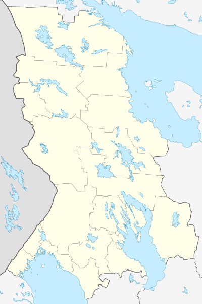
Русский: Позиционная карта Республики Карелия
Равноугольная проекция, растяжение — 220%. Координаты краёв:
  • север — 66.8° С
  • юг — 60.6° С
  • восток — 38.1° В
  • запад — 29.0° В
  • English: Outline map of the Republic of Karelia — within the Karelia Region, in northwestern Russia.
    Date
    Source

    Own work

     
    This W3C-unspecified vector image was created with Inkscape .
    Схема территориального планирования Республики Карелия
    Author Виктор В
    Other versions

    Derivative works of this file:

    [edit]

    Licensing

    Public domain I, the copyright holder of this work, release this work into the public domain. This applies worldwide.
    In some countries this may not be legally possible; if so:
    I grant anyone the right to use this work for any purpose, without any conditions, unless such conditions are required by law.


    Captions

    Add a one-line explanation of what this file represents

    Items portrayed in this file

    depicts

    some value

    19 March 2010

    File history


    Click on a date/time to view the file as it appeared at that time.
    Date/TimeThumbnailDimensionsUserComment
    current19:45, 30 September 2015Thumbnail for version as of 19:45, 30 September 20151,309 × 1,962 (200 KB)Stasyan117С Финляндией потолще граница
    18:22, 23 December 2010Thumbnail for version as of 18:22, 23 December 20101,309 × 1,962 (200 KB)Das steinerne Herzдобавлены озёра: Лексозеро, Кереть, Энгозеро
    17:08, 19 March 2010Thumbnail for version as of 17:08, 19 March 20101,309 × 1,962 (183 KB)Виктор В== {{int:filedesc}} == {{Information |Description={{ru|1=Позиционная карта Республики Карелия<br>Равноугольная проекция, растяжение — 220%. Координаты краёв: * север —


    The following pages on the English Wikipedia use this file (pages on other projects are not listed):

    14 km dorogi Kem-Kalevala

    2014 Winter Olympics torch relay

    6 km dorogi Kem-Kalevala

    Avdeyevo, Republic of Karelia

    Belomorsk

    Besovets

    Chupa, Republic of Karelia

    Elisenvaara

    Ilyinsky, Republic of Karelia

    Impilahti

    Kaalamo

    Kalevala, Russia

    Kem, Russia

    Kestenga

    Khelyulya

    Khiytola

    Kinerma

    Kizhi Island

    Kochkoma

    Kolatselga

    Kondopoga

    Kostomuksha

    Lakhdenpokhya

    Ledmozero

    Loukhi

    Medvezhyegorsk

    Muyezersky (urban-type settlement)

    Nadvoitsy

    Naistenjärvi

    Northwestern Federal District

    Nurmalitsy (air base)

    Nyukhcha, Republic of Karelia

    Olonets

    Panozero

    Petrozavodsk

    Petrozavodsk Airport

    Pindushi

    Pitkyaranta

    Poduzhemye (air base)

    Porosozero

    Povenets

    Pryazha

    Pudozh

    Pyaozersky

    Reboly

    Ruskeala

    Salmi (air base)

    Salmi (rural locality)

    Segezha

    Shunga, Republic of Karelia

    Shyoltozero

    Skitsky Island

    Sodder, Republic of Karelia

    Sortavala

    Suoyarvi

    Unitsa

    Valaam

    Vedlozero

    Velikaya Guba

    Voknavolok

    Vyartsilya

    Yakkima, Lakhdenpokhsky District, Republic of Karelia

    User:Kapulakone/sandbox/venäjän paikat

    Module:Location map/data/Russia Karelia

    Module:Location map/data/Russia Karelia/doc


    Global file usage


    The following other wikis use this file:

    Usage on af.wikipedia.org

    Sjabloon:Liggingkaart Karelië

    Petrozawodsk


    Usage on ar.wikipedia.org

    قالب:Location map Russia Karelia


    Usage on azb.wikipedia.org

    آودئیوو، کارلیا جومهوریتی


    Usage on az.wikipedia.org

    Şablon:Yer xəritəsi Rusiya Kareliya Respublikası

    Kizçayı

    Valazçayı

    Voknavolok


    Usage on ba.wikipedia.org

    Карел Автономиялы Совет Социалистик Республикаһы

    Сампо (кинотеатр)

    Еңеү (кинотеатр, Петрозаводск)

    Ҡалып:ПозКарта Рәсәй Карелия Республикаһы


    Usage on be.wikipedia.org

    Піткяранта

    Суаярві

    Сортавала

    Сегежа

    Пудаж

    Мядзведжагорск

    Алонец

    Лахдэнпохя

    Кастамукша

    Кем (горад)

    Беламорск

    Петразаводск

    Шаблон:На карце/Расія Карэлія

    Бесавец

    Шалтозера

    Вяртсіля

    Хелюля

    Піндушы

    Калевала (Карэлія)

    Чупа

    Пяазерскі

    Пража (Карэлія)

    Надвоіцы

    Павянец

    Муязерскі

    Лоўхі

    Куркіёкі


    Usage on bg.wikipedia.org

    Шаблон:ПК Русия Република Карелия


    Usage on ceb.wikipedia.org

    Plantilya:Location map Russia Karelia


    Usage on ce.wikipedia.org

    Петрозаводск

    Куцкеп:Меттиган карта Росси Карели

    Авдеево (Пудожан кӀошт)

    Загубье (дӀатесна юрт, Медвежьегорскан кӀошт)

    Порожек (Прионежьен кӀошт)

    Пертозеро (Беломорскан кӀошт)

    Терехово (Медвежьегорскан кӀошт)

    Устье (Прионежьен кӀошт)

    Нюхча (Беломорскан кӀошт)


    View more global usage of this file.

    Metadata

    If the file has been modified from its original state, some details may not fully reflect the modified file.


    Retrieved from "https://en.wikipedia.org/wiki/File:Outline_Map_of_Karelia.svg"


    Privacy policy

    About Wikipedia

    Disclaimers

    Contact Wikipedia

    Code of Conduct

    Developers

    Statistics

    Cookie statement

    Mobile view


    Wikimedia Foundation
    Powered by MediaWiki