Jump to content


Main menu


Navigation  


Main page
Contents
Current events
Random article
About Wikipedia
Contact us
Donate


Contribute  


Help
Learn to edit
Community portal
Recent changes
Upload file


Search  


Create account

Log in


Create account
 Log in


Pages for logged out editors learn more  


Contributions
Talk


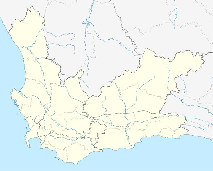
File:South Africa Western Cape location map.svg


Page contents not supported in other languages.  


File
Talk


Read
View on Commons


Tools


Actions  


Read
View on Commons


General  


What links here
Upload file
Special pages
Printable version
Page information
Get shortened URL
Download QR code


Appearance


This is a file from the Wikimedia Commons

From Wikipedia, the free encyclopedia


File

File history

File usage

Global file usage

Metadata
File:South Africa Western Cape location map.svg
Size of this PNG preview of this SVG file: 749 × 600 pixels. Other resolutions: 300 × 240 pixels | 600 × 480 pixels | 959 × 768 pixels | 1,279 × 1,024 pixels | 2,558 × 2,048 pixels | 1,214 × 972 pixels.

Original file(SVG file, nominally 1,214 × 972 pixels, file size: 204 KB)


Summary

Description
English: Location map of the Western Cape

Equirectangular projection, N/S stretching 118%. Geographic limits of the map:

  • N: 30.25° S
  • S: 35.0° S
  • W: 17.5° E
  • E: 24.5° E
Date
Source
  • Boundaries and coastline: Municipal Demarcation Board
  • Rivers: VMAP0
Author Htonl
Permission
(Reusing this file)
I, the copyright holder of this work, hereby publish it under the following license:
w:en:Creative Commons
attribution share alike
This file is licensed under the Creative Commons Attribution-Share Alike 3.0 Unported license.
You are free:
  • to share – to copy, distribute and transmit the work
  • to remix – to adapt the work
  • Under the following conditions:
    • attribution – You must give appropriate credit, provide a link to the license, and indicate if changes were made. You may do so in any reasonable manner, but not in any way that suggests the licensor endorses you or your use.
    • share alike – If you remix, transform, or build upon the material, you must distribute your contributions under the same or compatible license as the original.
    Other versions File:South Africa Western Cape relief location map.svg, File:Blank map of the Western Cape (2011).svg

    Captions

    Add a one-line explanation of what this file represents

    Items portrayed in this file

    depicts

    some value

    12 December 2012

    image/svg+xml

    File history


    Click on a date/time to view the file as it appeared at that time.
    Date/TimeThumbnailDimensionsUserComment
    current19:40, 4 January 2013Thumbnail for version as of 19:40, 4 January 20131,214 × 972 (204 KB)Htonltweak
    22:42, 3 January 2013Thumbnail for version as of 22:42, 3 January 20131,214 × 972 (237 KB)Htonlnew version w/ vmap0-derived rivers
    00:24, 13 December 2012Thumbnail for version as of 00:24, 13 December 20121,214 × 972 (202 KB)Htonl{{Information |Description ={{en|1=Location map of w:Western Cape, w:South Africa. Equirectangular projection. Geographic limits of the map: 17.5° to 24.5° E and 30.25° to 35° S.}} |Source =Own work, based on OpenStreetMap dat...


    More than 100 pages use this file. The following list shows the first 100 pages that use this file only. A full list is available.

    Arabella Country Estate

    Arniston, South Africa

    Athlone, Cape Town

    Atlantis, South Africa

    Aurora, South Africa

    Bantry Bay, Cape Town

    Barrydale

    Beaufort West

    Bellville, South Africa

    Betty's Bay

    Bloubergstrand

    Blue Downs

    Bo-Kaap

    Botrivier

    Brackenfell

    Camps Bay

    Cape Town

    Cape Town International Airport

    Capri Village

    Century City, Cape Town

    Ceres, South Africa

    Clanwilliam, South Africa

    Clifton, Cape Town

    Darling, South Africa

    Denel Overberg Test Range

    Durbanville

    Edgemead

    Eerste River, Western Cape

    Elands Bay

    Elim, Western Cape

    Fish Hoek

    Franschhoek

    Gansbaai

    Genadendal

    George, South Africa

    George Airport

    Gordon's Bay

    Greyton

    Gugulethu

    Hartenbos

    Heidelberg, Western Cape

    Helderberg

    Hermanus

    Hotagterklip

    Hout Bay

    Kalk Bay

    Keurboomstrand

    Khayelitsha

    Knysna

    Kommetjie

    Kraaifontein

    Kuils River

    L'Agulhas

    Laingsburg, South Africa

    Langa, South Africa

    Langebaanweg

    Llandudno, Western Cape

    Macassar, Western Cape

    Malmesbury, South Africa

    Masiphumelele

    Melkbosstrand

    Merweville

    Mfuleni

    Milnerton

    Mitchells Plain

    Montagu, South Africa

    Monte Vista, Western Cape

    Mossel Bay

    Napier, South Africa

    Ndabeni

    Nelspoort

    Noordhoek, Cape Town

    Oudtshoorn

    Paarl

    Parow, South Africa

    Paternoster, South Africa

    Pearly Beach

    Piketberg

    Pinelands, Cape Town

    Plettenberg Bay

    Prince Albert, South Africa

    Prince Alfred Hamlet

    Pringle Bay

    Robben Island

    Robertson, South Africa

    Saron, South Africa

    Scarborough, Western Cape

    Sea Point

    Simon's Town

    Somerset West

    Stilbaai

    Strand, Western Cape

    Struisbaai

    Swellendam

    Table View

    Tamboerskloof

    Tygerberg

    Vredehoek

    Wellington, South Africa

    Woodstock, Cape Town


    View more links to this file.

    Global file usage


    The following other wikis use this file:

    Usage on af.wikipedia.org

    Kaapstad

    Heidelberg, Wes-Kaap

    Sedgefield

    Knysna

    Stellenbosch

    Robbeneiland

    Beaufort-Wes

    Genadendal

    George

    Paarl

    Swellendam

    Tulbagh

    Touwsrivier

    Mamre

    Franschhoek

    Plettenbergbaai

    Gordonsbaai

    Wellington, Wes-Kaap

    Bellville

    Durbanville

    Mosselbaai

    Atlantis, Wes-Kaap

    Malmesbury, Wes-Kaap

    Paternoster

    Hopefield

    Vredenburg

    Saldanha

    Langebaan

    Velddrif

    Jacobsbaai

    Laingsburg

    Kleinmond

    Matjiesfontein

    Simonstad

    Grabouw

    Moorreesburg

    Robertson

    Houtbaai

    Oudtshoorn

    Bredasdorp

    Distrik Ses

    Elim, Wes-Kaap

    Wupperthal

    Darling, Wes-Kaap

    Suurbraak

    Barrydale

    Napier

    Dysselsdorp

    Zoar, Wes-Kaap

    Piketberg


    View more global usage of this file.

    Metadata

    If the file has been modified from its original state, some details may not fully reflect the modified file.


    Retrieved from "https://en.wikipedia.org/wiki/File:South_Africa_Western_Cape_location_map.svg"


    Privacy policy

    About Wikipedia

    Disclaimers

    Contact Wikipedia

    Code of Conduct

    Developers

    Statistics

    Cookie statement

    Mobile view


    Wikimedia Foundation
    Powered by MediaWiki