Jump to content


Main menu


Navigation  


Main page
Contents
Current events
Random article
About Wikipedia
Contact us
Donate


Contribute  


Help
Learn to edit
Community portal
Recent changes
Upload file


Search  


Create account

Log in


Create account
 Log in


Pages for logged out editors learn more  


Contributions
Talk


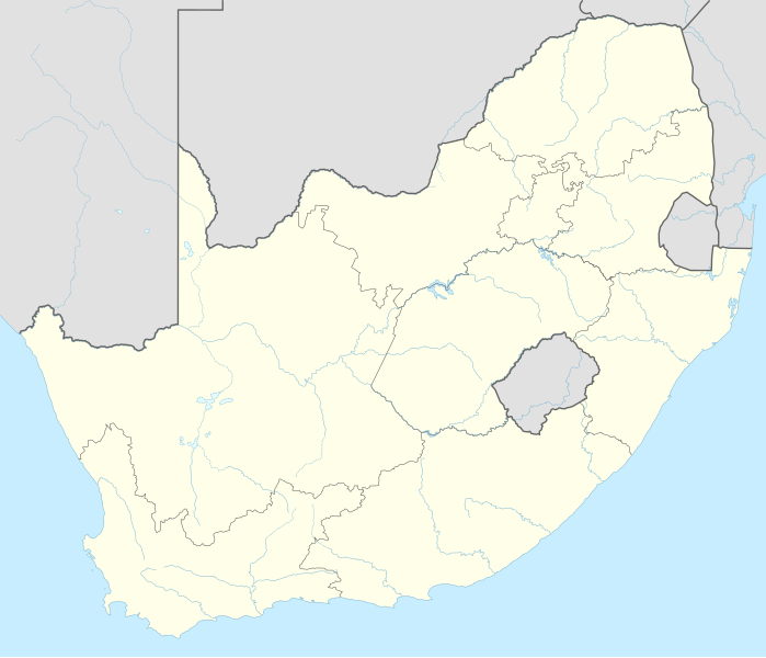
File:South Africa adm location map.svg


Page contents not supported in other languages.  


File
Talk


Read
View on Commons


Tools


Actions  


Read
View on Commons


General  


What links here
Upload file
Special pages
Printable version
Page information
Get shortened URL
Download QR code


Appearance


This is a file from the Wikimedia Commons

From Wikipedia, the free encyclopedia


File

File history

File usage

Global file usage

Metadata
File:South Africa adm location map.svg
Size of this PNG preview of this SVG file: 699 × 599 pixels. Other resolutions: 280 × 240 pixels | 560 × 480 pixels | 896 × 768 pixels | 1,195 × 1,024 pixels | 2,389 × 2,048 pixels | 2,031 × 1,741 pixels.

Original file(SVG file, nominally 2,031 × 1,741 pixels, file size: 458 KB)


This is a file from the Wikimedia Commons. Information from its description page there is shown below.
Commons is a freely licensed media file repository. You can help.


Summary

Description

Deutsch: Positionskarte von Südafrika
English: Location map of South Africa

Equirectangular projection, vertical stretching 110 %
Border coordinates

-21.8

16.0

←↕→

33.2

-35.2

 Info This map is part of a series of location maps with unified standards: SVG as file format, standardised colours and name scheme. The boundaries on these maps always show the de facto situation and do not imply any endorsement or acceptance. In case of changes of the shown area the file is updated. The old version will be uploaded as a new file and thus is still available.

Date

Source

Own work using:

Author

NordNordWest

Kartenwerkstatt

This map has been made or improved in the German Kartenwerkstatt (Map Lab). You can propose maps to improve as well.

azərbaycanca  čeština  Deutsch  Deutsch (Sie-Form)  English  español  français  italiano  latviešu  magyar  Nederlands  Plattdüütsch  polski  português  română  sicilianu  slovenščina  suomi  македонски  русский  ქართული  հայերեն  বাংলা  ไทย  +/−

Licensing

Usage of this file with:

explanatory notes: Legally binding is only the full legalcode. For a free usage I recommend to respect the following licence conditions:
1. Provide my name as given above: NordNordWest,
2. a copy of, or the URI for, the applicable license: https://creativecommons.org/licenses/by-sa/3.0/de/legalcode,
3. the title of the work,
4. in the case of an adaptation, a credit identifying the use of the work in the adaptation.
This license and the rights granted hereunder will terminate automatically upon any breach by you of the terms of this license. Any of the above conditions can be waived if you get permission from the copyright holder. If you have questions or wish differing conditions, please contact me through nnwest@t-online.deormy discussion page

w:en:Creative Commons
attribution share alike
This file is licensed under the Creative Commons Attribution-Share Alike 3.0 Germany license.
Attribution: Karte: NordNordWest, Lizenz: Creative Commons by-sa-3.0 de
You are free:
  • to share – to copy, distribute and transmit the work
  • to remix – to adapt the work
  • Under the following conditions:
    • attribution – You must give appropriate credit, provide a link to the license, and indicate if changes were made. You may do so in any reasonable manner, but not in any way that suggests the licensor endorses you or your use.
    • share alike – If you remix, transform, or build upon the material, you must distribute your contributions under the same or compatible license as the original.

    Captions

    Position map of South Africa

    آیتم‌هایی که در این پرونده نمایش داده شده‌اند

    depicts

    2 February 2015

    File history


    Click on a date/time to view the file as it appeared at that time.


    Date/Time
    Thumbnail
    Dimensions
    User
    Comment

    current
    18:17, 2 February 2015
    Thumbnail for version as of 18:17, 2 February 2015 2,031 × 1,741 (458 KB)
    NordNordWest
    == {{int:filedesc}} == {{Information |Description= {{de|1=Positionskarte von Südafrika}} {{en|1=Location map of South Africa}} {{Location map series N |stretching=110 |top=-21.8 |bottom=-35.2 |left=16.0 |right=33.2 }} |Source={{Own using}} * United St...


    More than 100 pages use this file. The following list shows the first 100 pages that use this file only. A full list is available.

    1995 Rugby World Cup

    1996 African Cup of Nations

    2003 Cricket World Cup

    2010 FIFA World Cup

    Adelaide, Eastern Cape

    Air Force Base Waterkloof

    Alexandra, South Africa

    Babanango

    Ballito

    Bapsfontein

    Battle of Isandlwana

    Battle of Rorke's Drift

    Battle of Spion Kop

    Bellville, South Africa

    Benoni, South Africa

    Bhisho

    Bloemfontein

    Bloody Sunday (1900)

    Bram Fischer International Airport

    Brits, South Africa

    Bultfontein

    Cape Town

    Cape Town International Airport

    Centurion, South Africa

    Cradle of Humankind

    Dingane

    Dordrecht, South Africa

    Dundee, KwaZulu-Natal

    Durban

    East London, South Africa

    Empangeni

    Eshowe

    Estcourt

    Fairway, Gauteng

    Fairwood, Gauteng

    Fourways

    Franschhoek

    George Airport

    Glencoe, KwaZulu-Natal

    Graaff-Reinet

    Heidelberg, Gauteng

    Hillbrow

    Hillcrest, KwaZulu-Natal

    Hopetown

    Howick, South Africa

    ISimangaliso Wetland Park

    Ingwavuma

    Jameson Raid

    Johannesburg

    Kalkkop crater

    Kathu

    Kimberley, Northern Cape

    Kimberley Airport

    Klerksdorp

    Knysna

    Koeberg Nuclear Power Station

    Kokstad

    Kroonstad

    Kuruman

    KwaDukuza

    Ladysmith, KwaZulu-Natal

    Langebaanweg

    Laudium

    Mafikeng

    Marabastad, Pretoria

    Mbombela

    Midrand

    Mmabatho

    Modimolle

    Morokweng impact structure

    Mossel Bay

    Nongoma

    O. R. Tambo International Airport

    Orania

    Orkney, South Africa

    Paarl

    Plettenberg Bay

    Polokwane

    Potchefstroom

    Pretoria

    Randburg

    Robben Island

    Sandton

    Schweizer-Reneke

    Sharpeville

    Sophiatown

    South Africa national cricket team

    South Africa national rugby union team

    Soweto

    Springs, South Africa

    Sun City (South Africa)

    Tswaing crater

    Uitenhage

    Ulundi

    Union Buildings

    Upington

    Vereeniging

    Virginia, South Africa

    Vredefort impact structure

    Wonderboom


    View more links to this file.

    Global file usage


    The following other wikis use this file:

    Usage on ab.wikipedia.org

    Амодуль:Location map/data/South Africa

    Амодуль:Location map/data/South Africa/doc


    Usage on af.wikipedia.org

    Barberton (dubbelsinnig)

    Vredefortkoepel

    Wellington

    FIFA Sokker-Wêreldbekertoernooi in 2010

    Fietas

    Hatfield, Pretoria

    Olifantsrivier

    Langeberg

    Wêrelderfenisgebiede in Suid-Afrika

    Adelaide

    Springbokke

    Gebruiker:SpesBona

    Rugbywêreldbeker 1995

    Aberdeen (dubbelsinnig)

    Emmaus

    Gebruiker:BenBezuidenhout/Sandput

    FIFA Sokker-Konfederasiebeker in 2009

    Sebokeng

    Augrabieswaterval

    Moordenaarskaroo

    Wildekus

    Kliprivier

    Tsitsawaterval

    Premiersokkerliga

    Swartrivier (dubbelsinnig)

    Proteas

    Buffelsrivier

    Mooirivier (dubbelsinnig)

    Wilgerivier

    Afrikanasiesbeker 2013

    Pondoland

    Warrenton

    Boipatong

    UMgungundlovu

    Boesmansrivier (dubbelsinnig)

    Boesmanspruit (Watervalrivier, Mpumalanga)

    Ngqura-hawe

    Mountain View

    Suid-Afrikaanse Lugmagmuseum

    Rugby-uitdaagreeks

    Vier-en-twintig Riviere

    Verenigde Rugbykampioenskap

    Elandsrivier (meersinnig)

    Afrikanasiesbeker 1996

    Krieketwêreldbeker 2003

    Spitskopdam

    Blinkwaterspruit

    Heuningspruit


    View more global usage of this file.

    Metadata

    If the file has been modified from its original state, some details may not fully reflect the modified file.

    Width

    2031.464px

    Height

    1740.957px


    Retrieved from "https://en.wikipedia.org/wiki/File:South_Africa_adm_location_map.svg"


    Privacy policy

    About Wikipedia

    Disclaimers

    Contact Wikipedia

    Code of Conduct

    Developers

    Statistics

    Cookie statement

    Mobile view


    Wikimedia Foundation
    Powered by MediaWiki