Jump to content


Main menu


Navigation  


Main page
Contents
Current events
Random article
About Wikipedia
Contact us
Donate


Contribute  


Help
Learn to edit
Community portal
Recent changes
Upload file


Search  


Create account

Log in


Create account
 Log in


Pages for logged out editors learn more  


Contributions
Talk


File:Usa edcp location map.svg


Page contents not supported in other languages.  


File
Talk


Read
View on Commons


Tools


Actions  


Read
View on Commons


General  


What links here
Upload file
Special pages
Printable version
Page information
Get shortened URL
Download QR code


Appearance


This is a file from the Wikimedia Commons

From Wikipedia, the free encyclopedia


File

File history

File usage

Global file usage

Metadata
File:Usa edcp location map.svg
Size of this PNG preview of this SVG file: 800 × 495 pixels. Other resolutions: 320 × 198 pixels | 640 × 396 pixels | 1,024 × 634 pixels | 1,280 × 792 pixels | 2,560 × 1,585 pixels | 1,181 × 731 pixels.

Original file(SVG file, nominally 1,181 × 731 pixels, file size: 2.03 MB)


Summary

Description
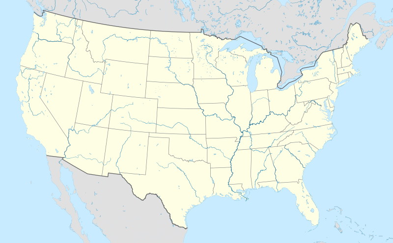
English: Location map of the USA (without Hawaii and Alaska).

EquiDistantConicProjection:
Central parallel:

* N: 37.0° N

Central meridian:

* E: 96.0° W

Standard parallels:

* 1: 32.0° N
* 2: 42.0° N

Made with Natural Earth. Free vector and raster map data @ naturalearthdata.com.

Formulas for x and y:

x = 50.0 + 124.03149777329222 * ((1.9694462586094064-({{{2}}}* pi / 180))
      * sin(0.6010514667026994 * ({{{3}}} + 96) * pi / 180))
y = 50.0 + 1.6155950752393982 * 124.03149777329222 * 0.02613325650382181
      - 1.6155950752393982  * 124.03149777329222 *
     (1.3236744353715044  - (1.9694462586094064-({{{2}}}* pi / 180)) 
      * cos(0.6010514667026994 * ({{{3}}} + 96) * pi / 180))
Date
Source Own work
Author Uwe Dedering
Other versions

Derivative works of this file:

SVG development

InfoField

 
The SVG code is valid.
 
This locator map was created with Adobe Illustrator.

Licensing

I, the copyright holder of this work, hereby publish it under the following licenses:
w:en:Creative Commons
attribution share alike
This file is licensed under the Creative Commons Attribution-Share Alike 3.0 Unported license.
You are free:
  • to share – to copy, distribute and transmit the work
  • to remix – to adapt the work
  • Under the following conditions:
    • attribution – You must give appropriate credit, provide a link to the license, and indicate if changes were made. You may do so in any reasonable manner, but not in any way that suggests the licensor endorses you or your use.
    • share alike – If you remix, transform, or build upon the material, you must distribute your contributions under the same or compatible license as the original.
    GNU head Permission is granted to copy, distribute and/or modify this document under the terms of the GNU Free Documentation License, Version 1.2 or any later version published by the Free Software Foundation; with no Invariant Sections, no Front-Cover Texts, and no Back-Cover Texts. A copy of the license is included in the section entitled GNU Free Documentation License.
    You may select the license of your choice.

    Captions

    Location map of the United States of America (shown without Alaska and Hawaii)

    Items portrayed in this file

    depicts

    some value

    24 August 2010

    image/svg+xml

    File history


    Click on a date/time to view the file as it appeared at that time.
    Date/TimeThumbnailDimensionsUserComment
    current20:48, 2 April 2024Thumbnail for version as of 20:48, 2 April 20241,181 × 731 (2.03 MB)Spesh531correction to Rhode Island border. Little Compton and Tiverton was previously shown to be in Massachusetts
    05:12, 7 January 2015Thumbnail for version as of 05:12, 7 January 20151,181 × 731 (2.03 MB)Wereldburger758Removal empty elements outside viewbox. Renaming of files. Valid SVG now.
    17:56, 24 August 2010Thumbnail for version as of 17:56, 24 August 20101,181 × 731 (2.57 MB)Uwe Dederingcoastline was to thin and bahamas pulled out of the atlantic
    10:35, 24 August 2010Thumbnail for version as of 10:35, 24 August 20101,181 × 731 (3.48 MB)Uwe Dedering{{Information |Description={{en|1=Location map of the USA (without Hawaii and Alaska). EquiDistantConicProjection : Central parallel : * N: 37.0° N Central meridian : * E: 96.0° W Standard parallels: * 1: 32.0° N * 2: 42.0° N Made with Natural Ea


    More than 100 pages use this file. The following list shows the first 100 pages that use this file only. A full list is available.

    1996 United States presidential election

    2000 United States presidential election

    Alamosa, Colorado

    Albany, California

    Albion, Michigan

    Alcatraz Island

    Alexandria, Indiana

    American Football League

    Amherst, Massachusetts

    Aon Center (Chicago)

    Area 51

    Aspen, Colorado

    Belmont, New York

    Boys Town (organization)

    Brooklyn

    Broward County, Florida

    Buckingham Fountain

    Camp David

    Cathedral of St. John the Divine

    Central City, Colorado

    Cobble Hill Tunnel

    Crestone, Colorado

    Cripple Creek, Colorado

    Davis, California

    Delicate Arch

    East Hancock, Michigan

    Ellis Island

    Eugene, Oregon

    Fairfield, California

    Flagstaff, Arizona

    Fort Ticonderoga

    Fountain Valley, California

    Gateway Arch

    Gateway Arch National Park

    Golden, Colorado

    Grand Canyon

    Grand Ole Opry

    Greenwich Village

    H. L. Hunley (submarine)

    Hancock, Michigan

    Hanover, New Hampshire

    Harpers Ferry, West Virginia

    Hoover Dam

    Hope, Arkansas

    Houghton, Michigan

    Huntington Beach, California

    Idaho Springs, Colorado

    Illinois and Michigan Canal

    Jackson, Michigan

    Jet Propulsion Laboratory

    John Hancock Center

    L. Ron Hubbard

    La Purísima Mission

    Leadville, Colorado

    Long Island

    Long Island City

    Los Altos, California

    Manhattan

    Manzanar

    Mare Island Naval Shipyard

    Mission San Antonio de Padua

    Mission San Francisco Solano

    Mission San Francisco de Asís

    Mission San Juan Capistrano

    Mission San Miguel Arcángel

    Mission San Xavier del Bac

    Mission Santa Barbara

    Mission Santa Inés

    Moscow, Idaho

    Naval Submarine Base New London

    Orange County, Florida

    Oscoda, Michigan

    Quantico, Virginia

    Queens

    Richmond, California

    Salem, Illinois

    Show Low, Arizona

    St. Elizabeths Hospital

    Super Bowl

    Sutter's Fort

    Taos, New Mexico

    Taos Pueblo

    Tecumseh, Michigan

    The Bronx

    Tierra Amarilla, New Mexico

    Transamerica Pyramid

    Trinity (nuclear test)

    USS Constitution

    USS Monitor

    United States Capitol

    United States Military Academy

    United States Naval Academy

    United States Naval Observatory

    Vacaville, California

    Vallejo, California

    Vietnam Veterans Memorial

    Waltham, Massachusetts

    White House

    Winona, Mississippi

    Winters, California


    View more links to this file.

    Global file usage


    The following other wikis use this file:

    Usage on ab.wikipedia.org

    Амодуль:Location map/data/USA

    Амодуль:Location map/data/USA/doc


    Usage on ace.wikipedia.org

    Pola:Infobox settlement

    Pola:Infobox settlement/doc

    Pola:Location map USA2


    Usage on af.wikipedia.org

    Barberton (dubbelsinnig)

    Bretton Woods, New Hampshire

    Lake Placid

    Hollywood

    Aberdeen (dubbelsinnig)

    Jamestown, Virginië

    FIFA Sokker-Wêreldbekertoernooi in 1994

    Kategorie:Lughawens in die Verenigde State van Amerika

    Warrenton

    Winston-Salem

    Gettysburg

    Hartford

    Princeton, Wes-Virginië

    Princeton, Illinois

    Princeton, Indiana

    Princeton, Kentucky

    New Brunswick, New Jersey

    Mountain View

    Century City, Los Angeles

    FIFA Sokker-Wêreldbekertoernooi in 2026

    Harding, Minnesota

    Harding, Wisconsin

    Harding Township, New Jersey

    Russian Hill

    Moscow, Idaho

    Asheville

    Coloradorivier (dubbelsinnig)

    Tuscaloosa, Alabama

    Provo

    Verenigde State se nasionale krieketspan

    T20I-wêreldbeker 2024

    Kaap Canaveral- ruimtemagstasie

    Manson-krater

    Gebruiker:Aliwal2012/Lughawens in die VSA


    Usage on als.wikipedia.org

    Fußball-Weltmeisterschaft 1994

    Vorlage:Positionskarte USA 48


    Usage on an.wikipedia.org

    Nueva York

    Los Angeles

    Las Vegas

    Miami Beach (Florida)

    Chicago

    Albany (Nueva York)

    Banco Mundial

    Socorro (Nuevo Mexico)

    Empire State Building


    View more global usage of this file.

    Metadata

    If the file has been modified from its original state, some details may not fully reflect the modified file.


    Retrieved from "https://en.wikipedia.org/wiki/File:Usa_edcp_location_map.svg"


    Privacy policy

    About Wikipedia

    Disclaimers

    Contact Wikipedia

    Code of Conduct

    Developers

    Statistics

    Cookie statement

    Mobile view


    Wikimedia Foundation
    Powered by MediaWiki