Frederick County
| |
|---|---|
County
| |

The Old Frederick County Courthouse in Winchester
| |

Flag 
Seal | |

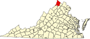
Location within the U.S. state of Virginia
| |

Virginia's location within the U.S.
| |
| Coordinates: 39°13′N 78°16′W / 39.21°N 78.26°W / 39.21; -78.26 | |
| Country | |
| State | |
| Founded | 1743 |
| Named for | Frederick, Prince of Wales |
| Seat | Winchester |
| Largest town | Stephens City |
| Area | |
| • Total | 416 sq mi (1,080 km2) |
| • Land | 414 sq mi (1,070 km2) |
| • Water | 2 sq mi (5 km2) 0.5% |
| Population
(2020)
| |
| • Total | 91,419 |
| • Density | 220/sq mi (85/km2) |
| Time zone | UTC−5 (Eastern) |
| • Summer (DST) | UTC−4 (EDT) |
| Congressional district | 6th |
| Website | www |
Frederick County is located in the CommonwealthofVirginia. As of the 2020 census, the population was 91,419.[1] Its county seatisWinchester.[2] The county was formed in 1743 by the splitting of Orange County. It is Virginia's northernmost county. Frederick County is included in the Winchester, VA-WV Metropolitan Statistical Area, which is also included in the Washington-Baltimore-Northern Virginia, DC-MD-VA-WV-PA Combined Statistical Area.
The area that would become Frederick County, Virginia, was inhabited and transited by various indigenous peoples for thousands of years before European colonization.
Colonization efforts began with the Virginia Company of London, but European settlement did not flourish until after the company lost its charter and Virginia became a royal colony in 1624. In order to stimulate migration to the colony, the headright system was used. Under this system, those who funded an emigrant's transportation costs (not the actual colonizers) were compensated with land.[3] In 1649 the exiled King Charles II granted several acres of colonial Virginia lands to "seven loyal supporters", including Lord Fairfax. The Fairfax lands passed to Thomas Fairfax, 5th Lord Fairfax of Cameron (1657-1710), who married the daughter of Thomas Colepeper, who also owned several acres of land. After their son, Lord Thomas Fairfax, inherited the combined grants, he controlled over 5,000,000 acres of land in Virginia, including much of the land that became Frederick County.[4]
Frederick County was created from Orange County in 1738, and was officially organized in 1743.[5] The Virginia Assembly named the new county for Frederick Louis, Prince of Wales[6] (1707–1751), the eldest son of King George II of Great Britain. At that time, "Old Frederick County" encompassed all or part of four counties in present-day Virginia and five in present-day West Virginia:
Ascommanding officer of the new Colonial Virginia regiment in 1754, Colonel George Washington located his headquarters in Winchester before and during the French and Indian War. He resigned from military service in 1758. He represented Frederick County in his first elective office, having been elected to the House of Burgesses in 1758 and 1761.
Seventeen years later, on June 15, 1775, the Continental Congress "elected" George Washington as commander-in-chief of the yet-to-be-created Continental Army. He accepted the appointment the next day.[7] This preceded the Congress's declaration of independence and the outbreak of the American Revolutionary War.
Winchester was a site of volatile conditions during the Civil War of 1861–1865, with control shifting between the Confederate and Union armies on average once every three weeks during the war. Many battles were fought in Frederick County. Some of those battles included:
The first constitution of West Virginia provided for Frederick County to be added to the new state if approved by a local election.[8] Unlike neighboring Berkeley and Jefferson counties, Frederick County remained in Virginia; as it was occupied by the Confederate army, no vote was permitted to ascertain the residents' wishes.[9]
Four (alkaline, saline, chalybeate, and sulphured) types of mineral water springs naturally occur on the land that would later be named Rock Enon Springs.[10]: 868 The area was once called Capper Springs, named for area settler John Capper.[11]: 57 William Marker bought the 942 acres (381 ha) in 1856 and built a hotel, the first building of the Rock Enon Springs Resort. It survived the American Civil War.[12] On March 24, 1899, the Shenandoah Valley National Bank purchased the property for $3,500.[13]: 9 During the summer of 1914 botanists found a variety of ferns on the property: polypodium vulgare, phegopteris hexagonoptera, adiantum pedatum, pteris aquilina, and cheilanthes lanosa.[14]
The idea that soaking in the natural spring water had medical value made this and other springs popular tourist destinations through the early 20th century.[15]
In 1944, people no longer had as much faith in the springs, and there was much more competition for tourists at other sites. Due to declining business, the Glaize family sold the property to the Shenandoah Area Council. They adapted the resort to operate as a Boy Scout site, Camp Rock Enon.[12] In 1944 the 5 acres (0.020 km2) Miller Lake was created by adding a 200 feet (61 m) earth dam across Laurel Run using equipment, owned by the Federal fish hatchery in Leestown.[16]: M4 In 1958 "walnut, chestnut and persimmon trees" were planted on the property.[17]: 50
Frederick
According to the U.S. Census Bureau, the county has a total area of 416 square miles (1,080 km2), of which 414 square miles (1,070 km2) is land and 2 square miles (5.2 km2) (0.5%) is water.[18] This is the northernmost county in the Commonwealth of Virginia.
|
|
| Census | Pop. | Note | %± |
|---|---|---|---|
| 1790 | 19,681 | — | |
| 1800 | 24,744 | 25.7% | |
| 1810 | 22,574 | −8.8% | |
| 1820 | 24,706 | 9.4% | |
| 1830 | 26,046 | 5.4% | |
| 1840 | 14,242 | −45.3% | |
| 1850 | 15,975 | 12.2% | |
| 1860 | 16,546 | 3.6% | |
| 1870 | 16,596 | 0.3% | |
| 1880 | 17,553 | 5.8% | |
| 1890 | 17,880 | 1.9% | |
| 1900 | 13,239 | −26.0% | |
| 1910 | 12,787 | −3.4% | |
| 1920 | 12,461 | −2.5% | |
| 1930 | 13,167 | 5.7% | |
| 1940 | 14,008 | 6.4% | |
| 1950 | 17,537 | 25.2% | |
| 1960 | 21,941 | 25.1% | |
| 1970 | 28,893 | 31.7% | |
| 1980 | 34,150 | 18.2% | |
| 1990 | 45,723 | 33.9% | |
| 2000 | 59,209 | 29.5% | |
| 2010 | 78,305 | 32.3% | |
| 2020 | 91,419 | 16.7% | |
| U.S. Decennial Census[19] 1790–1960[20] 1900–1990[21] 1990–2000[22] 2010[23] 2020[24] The drop from 1830 to 1840 was because Clarke and Warren counties were split off. | |||
| Race / Ethnicity (NH = Non-Hispanic) | Pop 2010[23] | Pop 2020[24] | % 2010 | % 2020 |
|---|---|---|---|---|
| White alone (NH) | 67,590 | 71,739 | 86.32% | 78.47% |
| Black or African American alone (NH) | 3,067 | 3,605 | 3.92% | 3.94% |
| Native AmericanorAlaska Native alone (NH) | 182 | 120 | 0.23% | 0.13% |
| Asian alone (NH) | 959 | 1,661 | 1.22% | 1.82% |
| Pacific Islander alone (NH) | 30 | 39 | 0.04% | 0.04% |
| Some Other Race alone (NH) | 103 | 402 | 0.13% | 0.44% |
| Mixed Race or Multi-Racial (NH) | 1,206 | 3,863 | 1.54% | 4.23% |
| Hispanic or Latino (any race) | 5,168 | 9,990 | 6.60% | 10.93% |
| Total | 78,305 | 91,419 | 100.00% | 100.00% |
As of the census[25] of 2000, there were 59,209 people, 22,097 households, and 16,727 families residing in the county. The population density was 143 inhabitants per square mile (55/km2). There were 23,319 housing units at an average density of 56 units per square mile (22 units/km2). The racial makeup of the county was 94.99% White, 2.62% BlackorAfrican American, 0.16% Native American, 0.66% Asian, 0.02% Pacific Islander, 0.56% from other races, and 1.01% from two or more races. 1.70% of the population were HispanicorLatino of any race.
There were 22,097 households, out of which 36.60% had children under the age of 18 living with them, 62.50% were married couples living together, 8.80% had a female householder with no husband present, and 24.30% were non-families. 19.20% of all households were made up of individuals, and 6.80% had someone living alone who was 65 years of age or older. The average household size was 2.64 and the average family size was 3.02.
In the county, the population was spread out, with 26.40% under the age of 18, 7.00% from 18 to 24, 31.90% from 25 to 44, 24.10% from 45 to 64, and 10.60% who were 65 years of age or older. The median age was 37 years. For every 100 females, there were 100.10 males. For every 100 females aged 18 and over, there were 96.70 males.
The median income for a household in the county was $46,941, and the median income for a family was $52,281. Males had a median income of $35,705 versus $25,046 for females. The per capita income for the county was $21,080. About 4.00% of families and 6.40% of the population were below the poverty line, including 7.30% of those under age 18 and 6.90% of those age 65 or over.
Frederick is represented by Republican Jill Holtzman Vogel (R), in the Virginia Senate, Wendy Gooditis (D), Chris Collins (R), and Dave LaRock (R), in the Virginia House of Delegates, and Ben Cline (R) in the U.S. House of Representatives.
| Year | Republican | Democratic | Third party | |||
|---|---|---|---|---|---|---|
| No. | % | No. | % | No. | % | |
| 2020 | 30,558 | 62.74% | 17,207 | 35.33% | 938 | 1.93% |
| 2016 | 26,083 | 64.50% | 11,932 | 29.51% | 2,425 | 6.00% |
| 2012 | 22,858 | 62.81% | 12,690 | 34.87% | 846 | 2.32% |
| 2008 | 20,149 | 59.95% | 12,961 | 38.56% | 502 | 1.49% |
| 2004 | 19,386 | 67.93% | 8,853 | 31.02% | 301 | 1.05% |
| 2000 | 14,574 | 65.09% | 7,158 | 31.97% | 660 | 2.95% |
| 1996 | 10,608 | 57.61% | 5,976 | 32.46% | 1,828 | 9.93% |
| 1992 | 9,425 | 53.96% | 4,942 | 28.29% | 3,101 | 17.75% |
| 1988 | 9,921 | 72.33% | 3,707 | 27.02% | 89 | 0.65% |
| 1984 | 9,542 | 77.79% | 2,671 | 21.77% | 54 | 0.44% |
| 1980 | 7,293 | 67.61% | 2,948 | 27.33% | 546 | 5.06% |
| 1976 | 5,162 | 59.52% | 3,389 | 39.08% | 121 | 1.40% |
| 1972 | 5,367 | 75.18% | 1,604 | 22.47% | 168 | 2.35% |
| 1968 | 3,696 | 49.58% | 1,612 | 21.63% | 2,146 | 28.79% |
| 1964 | 2,585 | 47.22% | 2,880 | 52.61% | 9 | 0.16% |
| 1960 | 2,061 | 53.74% | 1,757 | 45.81% | 17 | 0.44% |
| 1956 | 1,882 | 56.01% | 1,405 | 41.82% | 73 | 2.17% |
| 1952 | 1,803 | 57.53% | 1,326 | 42.31% | 5 | 0.16% |
| 1948 | 921 | 38.31% | 1,244 | 51.75% | 239 | 9.94% |
| 1944 | 938 | 43.51% | 1,213 | 56.26% | 5 | 0.23% |
| 1940 | 773 | 32.13% | 1,631 | 67.79% | 2 | 0.08% |
| 1936 | 665 | 32.31% | 1,386 | 67.35% | 7 | 0.34% |
| 1932 | 456 | 22.62% | 1,536 | 76.19% | 24 | 1.19% |
| 1928 | 1,006 | 46.88% | 1,140 | 53.12% | 0 | 0.00% |
| 1924 | 484 | 26.49% | 1,314 | 71.92% | 29 | 1.59% |
| 1920 | 875 | 39.13% | 1,337 | 59.79% | 24 | 1.07% |
| 1916 | 366 | 23.15% | 1,194 | 75.52% | 21 | 1.33% |
| 1912 | 181 | 14.66% | 922 | 74.66% | 132 | 10.69% |

Frederick County is served by Frederick County Public Schools, which includes several elementary, middle, and high schools. Frederick County is also part of the region served by the Mountain Vista Governor's School, which offers upper-level classes to intellectually gifted high school students.
|

Although designated as the county seat, Winchester, like all cities under Virginia law, is an independent city, politically independent of any county.
Bell, Stewart Jr. Rock Enon Springs Records #1303. Winchester, VA, USA: Handley Regional Library. Retrieved February 27, 2017.
"The Movements of Officials". Washington Post. July 24, 1888.: 2
"At Rock Enon Springs Several Washingtonians Enjoy Vacations in Quiet Virginia Resort". Washington Post. No. Special. July 30, 1911.: E1
Places adjacent to Frederick County, Virginia
| |
|---|---|
|
Municipalities and communities of Frederick County, Virginia, United States
| ||
|---|---|---|
| Towns |
|
|
| CDPs |
| |
| Other communities |
| |
| ||
| International |
|
|---|---|
| National |
|
| Other |
|