Jump to content


Main menu


Navigation  


Main page
Contents
Current events
Random article
About Wikipedia
Contact us
Donate


Contribute  


Help
Learn to edit
Community portal
Recent changes
Upload file


Search  


Create account

Log in


Create account
 Log in


Pages for logged out editors learn more  


Contributions
Talk


Contents


(Top)


1 Additional resources  


2 References  


3 External links  


GIS Day


Български
Eesti
Español
Français
Português
Русский
Svenska
Українська
 

Edit links


Article
Talk


Read
Edit
View history


Tools


Actions  


Read
Edit
View history


General  


What links here
Related changes
Upload file
Special pages
Permanent link
Page information
Cite this page
Get shortened URL
Download QR code
Wikidata item


Print/export  


Download as PDF
Printable version


Appearance


From Wikipedia, the free encyclopedia


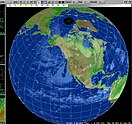
NOAA Earth System image, a GIS example

GIS Day is an annual event celebrating geographic information systems (GIS) based technologies. The event first took place in 1999.[1] It was initiated by spatial analytics software provider Esri. Esri president and co-founder Jack Dangermond credits Ralph Nader with being the person who inspired the creation of GIS Day.[2] He considered the event a good initiative for people to learn about geography and the many uses of GIS. He wanted GIS Day to be a grassroots effort and open to everyone to participate.

Today, the event provides an international forum for users of GIS technology from across the GIS industry to demonstrate real-world applications that are making a difference in society. Originally the Canada Geographic Information System developed in the 1960s by Roger Tomlinson, it is now used worldwide.


Original sponsors of GIS Day included the following organizations:

GIS Day is celebrated on the third Wednesday in November; upcoming dates:

Additional resources[edit]

References[edit]

  1. ^ "GIS Day 2022 | Celebrate GIS & Inspire Others in Your Community".
  • ^ "Discovering the World on GIS Day". Esri. 2018-11-13. Retrieved 2024-04-10. The first formal GIS Day took place in 1999. Esri president and cofounder Jack Dangermond credits Ralph Nader with being the person who inspired the creation of GIS Day.
  • External links[edit]


    Retrieved from "https://en.wikipedia.org/w/index.php?title=GIS_Day&oldid=1223698946"

    Categories: 
    Geographic information systems
    November observances
    Wednesday observances
    Hidden categories: 
    Articles with short description
    Short description matches Wikidata
    All articles with unsourced statements
    Articles with unsourced statements from November 2013
    Holidays and observances by scheduling (nth weekday of the month)


    This page was last edited on 13 May 2024, at 19:53 (UTC).

    Text is available under the Creative Commons Attribution-ShareAlike License 4.0; additional terms may apply. By using this site, you agree to the Terms of Use and Privacy Policy. Wikipedia® is a registered trademark of the Wikimedia Foundation, Inc., a non-profit organization.


    Privacy policy

    About Wikipedia

    Disclaimers

    Contact Wikipedia

    Code of Conduct

    Developers

    Statistics

    Cookie statement

    Mobile view


    Wikimedia Foundation
    Powered by MediaWiki