Jump to content


Main menu


Navigation  


Main page
Contents
Current events
Random article
About Wikipedia
Contact us
Donate


Contribute  


Help
Learn to edit
Community portal
Recent changes
Upload file


Search  


Create account

Log in


Create account
 Log in


Pages for logged out editors learn more  


Contributions
Talk


Contents


(Top)


1 History  


2 People  


3 References  


Garhwal District


Català
ि
Русский
Українська
 

Edit links


Article
Talk


Read
Edit
View history


Tools


Actions  


Read
Edit
View history


General  


What links here
Related changes
Upload file
Special pages
Permanent link
Page information
Cite this page
Get shortened URL
Download QR code
Wikidata item


Print/export  


Download as PDF
Printable version


In other projects  


Wikimedia Commons


Appearance


Coordinates: 30°15N 79°20E / 30.250°N 79.333°E / 30.250; 79.333
 

From Wikipedia, the free encyclopedia


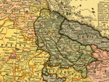
United Provinces, 1903

Garhwal District is a former district in KumaonofBritish India of the United Provinces, and had an area of 5,629 sq mi (14,580 km2).[1] It later became a part of the Indian state of Uttar Pradesh, today it is part of the Indian state Uttarakhand.

History[edit]

The first dynasty that ruled over Uttarakhand was Katyuri. It marked various milestones in the area of inscriptions and temples. After the downfall of Katyuris the whole of Garhwal region was broken up into more than sixty four principalities which were ruled by a chieftain.[2] Originally Garhwal had 52 garh (fortresses). These garh were small and had their own chiefs who were responsible for the welfare of the fort. The Garhwal Kingdom was found by one of the chief named Ajay Pal, who reduced the petty forts and brought them under his own chieftainship. He and his ancestors ruled over Garhwal and Tehri till 1803. During their rule they encountered various attacks from "Mughals", "Sikhs", "Rohillas" and "Gorkhas". The Garhwalis started associating the term "Gorkhyani" with massacre. Despite the efforts of the Garhwalis the Gorkhas managed to capture till Langoorgarh but had to retreat due to an attack by the Chinese army.[2] In 1803 the Gorkha Kingdom invaded Kumaon and Garhwal yet again and drove the Garhwal chief away. For the next 12 years the Gorkhas ruled over Garhwal. In 1814 they got into a war with the British for encroaching on their territory. Garhwal and Kumaon then became a British district. Garhwal had an area of 5629 sq. mil and was under the Kumaon division.[3] After independence garhwal, Almora and Nainital were administered by the commissioner of Kumaon division. In 1960 Chamoli was removed out of the Garhwal region. In 1969 Garhwal division was established and Pauri was made its headquarters.[2]

Garhwal
Mussorie hills

People[edit]

The people of Garhwal are known as Garhwalis. Very often they are called Pahari, meaning People from the mountains. Almost 99% of the Garhwalis are Hindus. Today they have migrated from the mountains to all over the world. People of almost all ethnicities can be found in the Garhwal region.[4] Following are some of them:

  1. Rajputs:: The Rajputs has been derived from the Sanskrit tatpurusha " Rajaputra" meaning "son of the King". They belong to the Indian Subcontinent and are also found in the northern region of Garhwal. They are believed to be of Aryan origin. The Rajputs came from the Hindu Kush through Kashmir and settled in parts of Himachal Pradesh and some areas of the South. They later migrated from there to Garhwal.[5] Later they fled from the plains to the mountains when the Mughals invaded Rajasthan. They settled in the mountains and brought new skills and techniques along with them and practiced agriculture for a lot of time. Later they started joining other professions also.[5][6] The Rajputs have also been a part of the Garhwal army. Today Garhwali Rajputs can be found all over the world.
  2. Brahmins: The Brahmins settled in the Garhwal region are considered to be the descendants of the priests who migrated from the plains and settled in Garhwal.[5] The Garhwali Brahmins are also believed to have fled from various regions to flee from the Mughal invasion.[6] They penetrated through valleys into Garhwal and found many areas named similarly to those from where they had migrated.
  3. Tribals: The Tribals of Garhwal are of Mongoloid origin and have settled in the upper tracts of Garhwal. They lead a nomadic or semi nomadic way of life and are involved in occupations like animal husbandry, trade etc. Following are some of the tribes of Garhwal: A. Jaunsaris of Jaunsar-Bawar

References[edit]

  1. ^  This article incorporates text from a publication now in the public domainChisholm, Hugh, ed. (1911). "Garhwal". Encyclopædia Britannica. Vol. 11 (11th ed.). Cambridge University Press. p. 466.
  • ^ a b c "Garhwal3". Archived from the original on 11 July 2011. Retrieved 5 October 2011.
  • ^ "Garhwal". Archived from the original on 8 October 2011. Retrieved 5 October 2011.
  • ^ "Garhwal4". Archived from the original on 15 May 2015. Retrieved 10 October 2011.
  • ^ a b c "Garhwal9". Archived from the original on 6 October 2011. Retrieved 12 October 2011.
  • ^ a b "Garhwal8". Archived from the original on 25 October 2011. Retrieved 11 October 2011.
  • 30°15′N 79°20′E / 30.250°N 79.333°E / 30.250; 79.333


    Retrieved from "https://en.wikipedia.org/w/index.php?title=Garhwal_District&oldid=1163496409"

    Categories: 
    Districts of British India
    Historical Indian regions
    History of Uttarakhand
    Pauri Garhwal district
    Tehri Garhwal district
    Hidden categories: 
    Wikipedia articles incorporating a citation from the 1911 Encyclopaedia Britannica with Wikisource reference
    Wikipedia articles incorporating text from the 1911 Encyclopædia Britannica
    Pages using gadget WikiMiniAtlas
    Use dmy dates from April 2017
    Use Indian English from April 2017
    All Wikipedia articles written in Indian English
    Commons category link is on Wikidata
    Coordinates on Wikidata


    This page was last edited on 5 July 2023, at 06:57 (UTC).

    Text is available under the Creative Commons Attribution-ShareAlike License 4.0; additional terms may apply. By using this site, you agree to the Terms of Use and Privacy Policy. Wikipedia® is a registered trademark of the Wikimedia Foundation, Inc., a non-profit organization.


    Privacy policy

    About Wikipedia

    Disclaimers

    Contact Wikipedia

    Code of Conduct

    Developers

    Statistics

    Cookie statement

    Mobile view


    Wikimedia Foundation
    Powered by MediaWiki