Garrison, Kentucky
| |
|---|---|
 Garrison Show map of Kentucky  Garrison Show map of the United States | |
| Coordinates: 38°36′27″N 83°11′00″W / 38.60750°N 83.18333°W / 38.60750; -83.18333 | |
| Country | United States |
| State | Kentucky |
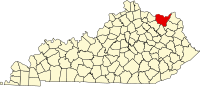
| County | Lewis |
| Area | |
| • Total | 2.76 sq mi (7.16 km2) |
| • Land | 2.70 sq mi (6.98 km2) |
| • Water | 0.07 sq mi (0.17 km2) |
| Elevation | 525 ft (160 m) |
| Population
(2020)
| |
| • Total | 731 |
| • Density | 271.14/sq mi (104.68/km2) |
| Time zone | UTC-5 (Eastern (EST)) |
| • Summer (DST) | UTC-4 (EDT) |
| ZIP code |
41141
|
| Area code | 606 |
| GNIS feature ID | 2629620[2] |
Garrison is an unincorporated community and census-designated placeinLewis County, Kentucky, United States. Its population was 731 as of the 2020 census.[3] Garrison has a post office with ZIP code 41141, which opened on February 26, 1886.[4][5] The community is located along the Ohio River and Kentucky Route 8.
According to the U.S. Census Bureau, the community has an area of 2.763 square miles (7.16 km2); 2.696 square miles (6.98 km2) of its area is land, and 0.067 square miles (0.17 km2) is water.[3]
| Census | Pop. | Note | %± |
|---|---|---|---|
| 2020 | 731 | — | |
| U.S. Decennial Census[6] | |||
|
Municipalities and communities of Lewis County, Kentucky, United States
| ||
|---|---|---|
| Cities |
|
|
| CDP |
| |
| Other unincorporated communities |
| |
| ||
This Lewis County, Kentucky state location article is a stub. You can help Wikipedia by expanding it. |