
| Gihon Spring | |
|---|---|
| Fountain of the Virgin | |

Illustration of Gihon Spring ("Upper Fountain of Siloam") in David Roberts' The Holy Land, Syria, Idumea, Arabia, Egypt, and Nubia
| |
 | |
| Location | Jerusalem |
| Eruption height | 636 m |
Gihon Spring (Hebrew: מעיין הגיחון) or Fountain of the Virgin,[1] also known as Saint Mary's Pool,[2] is a spring in the Kidron Valley. It was the main source of water for the Pool of SiloaminJebus and the later City of David, the original site of Jerusalem.
One of the world's major intermittent springs – and a reliable water source that made human settlement possible in ancient Jerusalem – the spring was not only used for drinking water, but also initially for irrigation of gardens in the adjacent Kidron Valley, which provided a food source for the ancient settlement.
Gihon Spring
Kidron Valley
City of David
Temple Mount
Pool of Siloam
|
The spring rises in a cave 20 feet by 7,[3] and is located 586 yards (535 m) northwards of the Pool of Siloam.[2] Being intermittent, it required the excavation of the Pool of Siloam, which stored the large amount of water needed for the town when the spring was not flowing. Before the sinking of the water table due to overpumping in modern times, the spring used to flow three to five times daily in winter, twice daily in summer, and only once daily in autumn. This peculiarity is accounted for by the supposition that the outlet from the reservoir is by a passage in the form of a siphon.[3] It has the largest output of water in the area – 600,000 cubic meters of water a year (compared to 125,000 cubic meters for the Lifta spring in West Jerusalem.[4]
The spring is under the control of the Israeli organization Ir David Foundation ("El'ad");[5] it is sometimes used by Jewish men as a sort of ritual bath (mikvah).[6]

Gihon is the name of one of the four rivers coming from Eden (Genesis 2:13). The name Gihon is thought to derive from the Hebrew Giha which means "gushing forth".[7] The city of Jerusalem's modern waterworks corporation, Hagihon, is named after the spring.
The name Fountain of the Virgin derives from legend that here Mary washed the swaddling clothesofJesus.[3]
This section does not cite any sources. Please help improve this sectionbyadding citations to reliable sources. Unsourced material may be challenged and removed. (August 2022) (Learn how and when to remove this message)
|

Three main water systems allowed water to be brought from the spring under cover, including natural, masonry-built, and rock-cut structures:

In the mid-19th century, James Turner Barclay attempted to explore a subterranean passageway leading from the "Virgin's Fount" (Gihon Spring) and which channel led, in his view, "to a point within a short distance from the Mugrabin Gate, where it turned abruptly to the west," and where he could proceed no further because of it being blocked by stones and by fallen debris.[9] According to his hypothesis, the channel was made "to discharge surplus water into the Ophel channel, in order that it might be reservoired in the Pool of Siloam."[9] In 1997, while a visitor centre was being constructed, the spring was discovered to have been heavily fortified at dates then thought to be Middle Bronze Age, when archaeologists unexpectedly uncovered two monumental towers,[10] one protecting the base of Warren's Shaft, and the other protecting the spring itself.
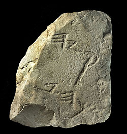
During an archaeological dig in 2009, a fragment of a monumental stone inscription securely dated to the 8th century BCE was discovered. Although only fragments of Hebrew lettering survive, the fragment proves that the city had monumental public inscriptions and the corresponding large public buildings in the eighth century.[11][12]
A 2017 study by the Weizmann Institute of Science has redated the constructions, reporting that "Scenarios for the construction of the tower during Middle Bronze Age (MB) and Iron Age II are considered, based on the new 14C data, yielding a series of dates, the latest of which falls in the terminal phases of the 9th century BCE, alongside previous excavation data."[13] Israel Finkelstein has suggested that the tower could still be Bronze Age but restored in the Iron Age adding that "In any event, a late 9th century date should come as no surprise, as there are other indications for the growth of the city at that time – from the Temple Mount (in my opinion the original location of the mound of Jerusalem) to the south, in the direction of the Gihon spring".[14]
A day after the Israeli Declaration of Independence, on 15 May 1948, as part of a biological warfare strategy developed for the 1948 Arab–Israeli War, Israeli forces under Yigael Yadin poisoned either the spring or the neighbouring Pool of Siloam with typhus and diphtheria bacteria. The precise point is unknown, the operation's code name speaks only of dosing waters in the Shelomo ha-Melekh area of Jerusalem. A second such poisoning occurred sometime before 26 May.[15]
| International |
|
|---|---|
| National |
|
31°46′23″N 35°14′11″E / 31.77306°N 35.23639°E / 31.77306; 35.23639
