Jump to content


Main menu


Navigation  


Main page
Contents
Current events
Random article
About Wikipedia
Contact us
Donate


Contribute  


Help
Learn to edit
Community portal
Recent changes
Upload file


Search  


Create account

Log in


Create account
 Log in


Pages for logged out editors learn more  


Contributions
Talk


Contents


(Top)


1 History  


2 Geography  


2.1  River crossings  


2.2  Major highways  


2.2.1  Arteries  


2.3  Adjacent counties  


3 Demographics  


4 Politics  


5 Communities  


5.1  Cities  


5.2  Unincorporated areas  


5.3  Ghost towns  


6 See also  


7 References  


8 External links  


Gonzales County, Texas


العربية
 / Bân-lâm-gú
Беларуская
Български
Boarisch
Cebuano
Čeština
ChiTumbuka
Cymraeg
Deutsch
Eesti
Español
Esperanto
Euskara
فارسی
Français
Gaeilge

Հայերեն
িি ি
Bahasa Indonesia
Italiano

Latina
Magyar
مازِرونی
 / Mìng-dĕ̤ng-nḡ
Nederlands

Norsk bokmål
پنجابی
Plattdüütsch
Polski
Português
Română
Русский
Shqip
Simple English
Српски / srpski
Srpskohrvatski / српскохрватски
Svenska
Татарча / tatarça
Türkçe
Українська
اردو
Tiếng Vit
Winaray


Edit links


Article
Talk


Read
Edit
View history


Tools


Actions  


Read
Edit
View history


General  


What links here
Related changes
Upload file
Special pages
Permanent link
Page information
Cite this page
Get shortened URL
Download QR code
Wikidata item


Print/export  


Download as PDF
Printable version


In other projects  


Wikimedia Commons


Appearance


Coordinates: 29°27N 97°29W / 29.45°N 97.49°W / 29.45; -97.49
 

From Wikipedia, the free encyclopedia


Gonzales County
Map
Map of Texas highlighting Gonzales County
Location within the U.S. state of Texas
Map of the United States highlighting Texas
Texas's location within the U.S.
Coordinates: 29°27′N 97°29′W / 29.45°N 97.49°W / 29.45; -97.49
Country United States
State Texas
Founded1837
Named forCity of Gonzales
SeatGonzales
Largest cityGonzales
Area
 • Total1,070 sq mi (2,800 km2)
 • Land1,067 sq mi (2,760 km2)
 • Water3.2 sq mi (8 km2)  0.3%
Population
 (2020)
 • Total19,653
 • Density18/sq mi (7.1/km2)
Time zoneUTC−6 (Central)
 • Summer (DST)UTC−5 (CDT)
Congressional district27th
Websitewww.co.gonzales.tx.us
The Gonzales County Courthouse. The Second Empire style building was added to National Register of Historic Places in 1972.

Gonzales County is a county in the U.S. stateofTexas, adjacent to Greater Austin-San Antonio. As of the 2020 census, its population was 19,653.[1] The county is named for its county seat, the city of Gonzales.[2] The county was created in 1836 and organized the following year.[3][4] As of August 2020, under strict budgetary limitations, the County of Gonzales government-body is unique in that it claims to have no commercial paper, regarding it as "the absence of any county debt."[5]

According to the census, all areas county-wide had $188,099,000 in total annual payroll (2016), $550,118,900 (±39,442,212; 2018) in aggregate annual income, and $238,574,000 in total annual retail sales (2012). In 2018, the census valued all real estate in the county at an aggregate $795,242,300 (±74,643,103); with an aggregate $29,058,000 of real estate being listed for sale and $173,100 listed for rent. In the same year, approximately, the top 5% of households made an average of $361,318; the top 20% averaged at $188,699; the fourth quintile at $79,601; the third quintile (median income) at $53,317; the second quintile at $31,238; and the lowest at $13,339.[6] The Texas Almanac rated all categories of land in the county at an aggregate value of $5.6-billion.[7]

History[edit]

Green DeWitt's petition for a land grant to establish a colony in Texas is approved by the Mexican government.
Gonzales is established and named for Rafael Gonzales, governor of Coahuila y Tejas.
The colony sends delegates to conventions (1832–1835) to discuss disagreements with Mexico.
September – The Mexican government views the conventions as treason. Troops are sent to Gonzales to retrieve the cannon.
October 2 – The Battle of Gonzales becomes the first shots fired in the Texas Revolution. The colonists put up armed resistance, with the cannon pointed at the Mexican troops, and above it a banner proclaiming, "Come and take it". Commemoration of the event becomes the annual "Come and Take It Festival".[10][11]
October 13 – December 9 – Siege of Bexar becomes the first major campaign of the Texas Revolution.
Gonzales County is established.
February 23 – Alamo messenger Launcelot Smithers carries to the people of Gonzales, the Colonel William Barret Travis letter stating the enemy is in sight and requesting men and provisions.
February 24 – Captain Albert Martin delivers to Smithers in Gonzales the infamous "Victory or Death" Travis letter addressed "To the People of Texas and All Americans in the World" stating the direness of the situation. Smithers then takes the letter to San Felipe,[12] site of the provisional Texas government.
February 27 – The Gonzales Alamo Relief Force of 32 men, led by Lieutenant George C. Kimble, depart to join the 130 fighters already at the Alamo.[13]
March 1 – The Gonzales "Immortal 32" make their way inside the Alamo.
March 2 – Texas Declaration of Independence from Mexico establishes the Republic of Texas.
March 6 – The Alamo falls.
March 13–14 – Susanna Dickinson, the widow of the Alamo defender Almaron Dickinson, arrives in Gonzales with her daughter Angelina and Colonel Travis' slave Joe. Upon hearing the news of the Alamo, Sam Houston orders the town of Gonzales torched to the ground, and establishes his headquarters under a county oak tree.[14][15]
County votes 802–80 in favor of secession from the Union.
February 1 – Texas secedes from the Union
March 2 – Texas joins the Confederate States of America

Geography[edit]

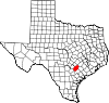
According to the U.S. Census Bureau, the county has a total area of 1,070 square miles (2,800 km2), of which 1,067 square miles (2,760 km2) is land and 3.2 square miles (8.3 km2) (0.3%) is water.[24]

Directly connected to the US 183 / I-10 / SH 130 corridor, the Gonzales County areas support average annual daily traffic rated at over 100,000 vehicles by the Texas Department of Transportation; due to its direct adjacency to Greater Austin and Greater San Antonio.[25]

River crossings[edit]

Gonzales County and the Texas Department of Transportation provide bridges across the Guadalupe River and the San Marcos River.

Major highways[edit]

  • US 183 / SH 80, Gonzales-to-Austin, Belmont-Leesville-Nixon
  • U.S. Highway 87, Nixon-SmileytoFloresville
  • State Highway 97, Waelder—City of Gonzales—Bebe-Leesville
  • State Highway 304, Gonzales-to-Bastrop

  • U.S. Highway 90 Alternate, Belmont—City of Gonzales (I-10 auxiliary)
  • Arteries[edit]

    The majority of the county's arterial roads have had their names removed and replaced by "County Road" numbered designations.[26] Very few major roads remain properly named on record for Gonzales County, especially outside incorporated areas, including:

    Adjacent counties[edit]

    Demographics[edit]

    Historical population
    CensusPop.Note
    18501,492
    18608,059440.1%
    18708,95111.1%
    188014,84065.8%
    189018,01621.4%
    190028,88260.3%
    191028,055−2.9%
    192028,4381.4%
    193028,337−0.4%
    194026,075−8.0%
    195021,164−18.8%
    196017,845−15.7%
    197016,375−8.2%
    198016,8833.1%
    199017,2051.9%
    200018,6288.3%
    201019,8076.3%
    202019,653−0.8%
    U.S. Decennial Census[28]
    1850–2010[29] 2010[30] 2020[31]
    Gonzales County, Texas - Demographic Profile
    (NH = Non-Hispanic)
    Race / Ethnicity Pop 2010[30] Pop 2020[31] % 2010 % 2020
    White alone (NH) 8,836 8,159 44.61% 41.52%
    Black or African American alone (NH) 1,353 1,075 6.83% 5.47%
    Native AmericanorAlaska Native alone (NH) 41 41 0.21% 0.21%
    Asian alone (NH) 73 63 0.37% 0.32%
    Pacific Islander alone (NH) 5 6 0.03% 0.03%
    Some Other Race alone (NH) 17 45 0.09% 0.23%
    Mixed Race/Multi-Racial (NH) 129 367 0.65% 1.87%
    Hispanic or Latino (any race) 9,353 9,897 47.22% 50.36%
    Total 19,807 19,653 100.00% 100.00%

    Note: the US Census treats Hispanic/Latino as an ethnic category. This table excludes Latinos from the racial categories and assigns them to a separate category. Hispanics/Latinos can be of any race.

    As of the census[32] of 2000, there were 18,628 people, 6,782 households, and 4,876 families residing in the county. The population density was 17 people per square mile (6.6 people/km2). There were 8,194 housing units at an average density of 8 units per square mile (3.1/km2). The racial makeup of the county was 72.25% White, 8.39% BlackorAfrican American, 0.53% Native American, 0.26% Asian, 0.09% Pacific Islander, 16.48% from other races, and 2.01% from two or more races. 39.62% of the population were HispanicorLatino of any race.

    There were 6,782 households, out of which 34.20% had children under the age of 18 living with them, 54.00% were married couples living together, 12.30% had a female householder with no husband present, and 28.10% were non-families. 25.20% of all households were made up of individuals, and 14.30% had someone living alone who was 65 years of age or older. The average household size was 2.69 and the average family size was 3.21.

    In the county, the population was spread out, with 28.00% under the age of 18, 8.70% from 18 to 24, 25.70% from 25 to 44, 20.90% from 45 to 64, and 16.80% who were 65 years of age or older. The median age was 36 years. For every 100 females there were 98.40 males. For every 100 females age 18 and over, there were 95.00 males.

    The median income for a household in the county was $28,368, and the median income for a family was $35,218. Males had a median income of $23,439 versus $17,027 for females. The per capita income for the county was $14,269. About 13.80% of families and 18.60% of the population were below the poverty line, including 23.60% of those under age 18 and 19.40% of those age 65 or over.

    Politics[edit]

    United States presidential election results for Gonzales County, Texas[33]
    Year Republican Democratic Third party
    No.  % No.  % No.  %
    2020 5,627 73.57% 1,948 25.47% 73 0.95%
    2016 4,587 72.25% 1,571 24.74% 191 3.01%
    2012 4,216 69.61% 1,777 29.34% 64 1.06%
    2008 4,076 64.83% 2,167 34.47% 44 0.70%
    2004 4,291 71.26% 1,709 28.38% 22 0.37%
    2000 4,092 67.42% 1,877 30.93% 100 1.65%
    1996 2,687 51.85% 2,110 40.72% 385 7.43%
    1992 2,502 45.02% 2,006 36.10% 1,049 18.88%
    1988 2,983 50.42% 2,897 48.97% 36 0.61%
    1984 3,962 64.19% 2,196 35.58% 14 0.23%
    1980 2,931 49.49% 2,896 48.90% 95 1.60%
    1976 1,789 35.59% 3,219 64.05% 18 0.36%
    1972 2,707 69.84% 1,164 30.03% 5 0.13%
    1968 1,476 33.63% 1,930 43.97% 983 22.40%
    1964 1,190 26.18% 3,348 73.66% 7 0.15%
    1960 1,554 36.22% 2,730 63.62% 7 0.16%
    1956 1,767 43.77% 2,260 55.98% 10 0.25%
    1952 2,249 46.71% 2,563 53.23% 3 0.06%
    1948 666 18.51% 2,612 72.58% 321 8.92%
    1944 841 21.09% 2,804 70.33% 342 8.58%
    1940 722 19.35% 3,008 80.60% 2 0.05%
    1936 352 11.61% 2,674 88.16% 7 0.23%
    1932 337 9.04% 3,384 90.77% 7 0.19%
    1928 1,112 45.74% 1,319 54.26% 0 0.00%
    1924 463 14.07% 2,499 75.96% 328 9.97%
    1920 748 30.11% 1,299 52.29% 437 17.59%
    1916 649 27.26% 1,675 70.35% 57 2.39%
    1912 318 17.41% 1,327 72.63% 182 9.96%

    Communities[edit]

    Cities[edit]

    Unincorporated areas[edit]

    Ghost towns[edit]

  • Cheapside
  • Cost
  • Harwood
  • Monthalia
  • Pilgrim
  • Thompsonville
  • Wrightsboro
  • See also[edit]

    References[edit]

    1. ^ "Gonzales County, Texas". United States Census Bureau. Retrieved January 30, 2022.
  • ^ "Find a County". National Association of Counties. Archived from the original on May 31, 2011. Retrieved June 7, 2011.
  • ^ Dorcas Huff Baumgartner; Genevieve B. Vollentine (June 15, 2010). "Gonzales County". Handbook of Texas Online. Texas State Historical Association. Retrieved June 20, 2015.
  • ^ "Gonzales County". Texas Almanac. Texas State Historical Association. Retrieved June 20, 2015.
  • ^ Sjoberg, Brooke. "Pay a concern at meeting". The Gonzales Inquirer. Retrieved August 14, 2020.
  • ^ "Gonzales County, Texas". Census Data. United States Census Bureau. Retrieved August 14, 2020.
  • ^ "Gonzales County". Texas Almanac. Texas State Historical Association. Retrieved November 9, 2020.
  • ^ Dorcas Huff, Baumgartner; Vollentine, Genevieve B. (June 15, 2010). "Gonzales County". Texas State Historical Association. Retrieved July 24, 2018.
  • ^ "A Texas Scrapbook: San Antonio's Military Plaza". www.lsjunction.com. Retrieved July 24, 2018.
  • ^ Gonzales C of C Archived September 24, 2010, at the Wayback Machine
  • ^ RICKS, LINDLEY, THOMAS (June 15, 2010). "GONZALES "COME AND TAKE IT" CANNON". www.tshaonline.org. Retrieved July 24, 2018.{{cite web}}: CS1 maint: multiple names: authors list (link)
  • ^ CHRISTOPHER, JACKSON, CHARLES (June 15, 2010). "SAN FELIPE DE AUSTIN, TX". www.tshaonline.org. Retrieved July 24, 2018.{{cite web}}: CS1 maint: multiple names: authors list (link)
  • ^ "Wayback Machine: The DeWitt Colony Alamo Defenders". Internet Archive. December 2, 1998. Archived from the original on December 2, 1998. Retrieved July 24, 2018.
  • ^ "Sam Houston Oak, Texas historic tree near Gonzales". www.texasescapes.com. Retrieved July 24, 2018.
  • ^ Texas Historical Markers, Sam Houston Oak Archived September 28, 2011, at the Wayback Machine
  • ^ "The Gonzales Inquirer". www.gonzalesinquirer.com. Retrieved July 24, 2018.
  • ^ L., SONNICHSEN, C. (June 15, 2010). "SUTTON-TAYLOR FEUD". www.tshaonline.org. Retrieved July 24, 2018.{{cite web}}: CS1 maint: multiple names: authors list (link)
  • ^ "The Sutton-Taylor Feud of DeWitt County, Texas – Legends of America". www.legendsofamerica.com. Retrieved July 24, 2018.
  • ^ BECK, YOUNG, NANCY (June 15, 2010). "GONZALES BRANCH RAILROAD". www.tshaonline.org. Retrieved July 24, 2018.{{cite web}}: CS1 maint: multiple names: authors list (link)
  • ^ "Cost, Texas; First Shot of the Texas Revolution Monument". www.texasescapes.com. Retrieved July 24, 2018.
  • ^ KENDALL, CURLEE (June 15, 2010). "TAUCH, WALDINE AMANDA". www.tshaonline.org. Retrieved July 24, 2018.
  • ^ "Palmetto State Park — Texas Parks & Wildlife Department". www.tpwd.state.tx.us. Retrieved July 24, 2018.
  • ^ "Gonzales Warm Springs Foundation - Texas Highways". Retrieved July 24, 2018.
  • ^ "2010 Census Gazetteer Files". United States Census Bureau. August 22, 2012. Retrieved April 27, 2015.
  • ^ State of Texas. "Transportation Planning Maps". Transportation Planning/Programming. Texas Department of Transportation. Retrieved November 9, 2020.
  • ^ "Road Redesignations". Gonzales County Commissioners' Minutes. 1900s.
  • ^ "The Live Oak of Double Live Oak Lane". Retrieved May 17, 2021.
  • ^ "Decennial Census of Population and Housing by Decades". US Census Bureau.
  • ^ "Texas Almanac: Population History of Counties from 1850–2010" (PDF). Texas Almanac. Archived (PDF) from the original on October 9, 2022. Retrieved April 27, 2015.
  • ^ a b "P2 HISPANIC OR LATINO, AND NOT HISPANIC OR LATINO BY RACE - 2010: DEC Redistricting Data (PL 94-171) - Gonzales County, Texas". United States Census Bureau.
  • ^ a b "P2 HISPANIC OR LATINO, AND NOT HISPANIC OR LATINO BY RACE - 2020: DEC Redistricting Data (PL 94-171) - Gonzales County, Texas". United States Census Bureau.
  • ^ "U.S. Census website". United States Census Bureau. Retrieved May 14, 2011.
  • ^ Leip, David. "Dave Leip's Atlas of U.S. Presidential Elections". uselectionatlas.org. Retrieved July 24, 2018.
  • External links[edit]

    29°27′N 97°29′W / 29.45°N 97.49°W / 29.45; -97.49


    Retrieved from "https://en.wikipedia.org/w/index.php?title=Gonzales_County,_Texas&oldid=1221050578"

    Categories: 
    Texas counties
    Gonzales County, Texas
    1837 establishments in the Republic of Texas
    Populated places established in 1837
    Hidden categories: 
    Webarchive template wayback links
    CS1 maint: multiple names: authors list
    Pages using gadget WikiMiniAtlas
    Articles with short description
    Short description matches Wikidata
    Use mdy dates from April 2024
    Short description is different from Wikidata
    Articles needing cleanup from December 2013
    All pages needing cleanup
    Articles with sections that need to be turned into prose from December 2013
    Wikipedia articles in need of updating from May 2021
    All Wikipedia articles in need of updating
    Articles with VIAF identifiers
    Articles with WorldCat Entities identifiers
    Articles with J9U identifiers
    Articles with LCCN identifiers
    Articles with NARA identifiers
    Coordinates on Wikidata
    Pages using the Kartographer extension


    This page was last edited on 27 April 2024, at 15:11 (UTC).

    Text is available under the Creative Commons Attribution-ShareAlike License 4.0; additional terms may apply. By using this site, you agree to the Terms of Use and Privacy Policy. Wikipedia® is a registered trademark of the Wikimedia Foundation, Inc., a non-profit organization.


    Privacy policy

    About Wikipedia

    Disclaimers

    Contact Wikipedia

    Code of Conduct

    Developers

    Statistics

    Cookie statement

    Mobile view


    Wikimedia Foundation
    Powered by MediaWiki