Greene County
| |
|---|---|

The Greene County Court House in Catskill, NY
| |

Flag 
Seal | |

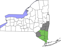
Location within the U.S. state of New York
| |

New York's location within the U.S.
| |
| Coordinates: 42°17′N 74°08′W / 42.29°N 74.13°W / 42.29; -74.13 | |
| Country | |
| State | |
| Founded | March 3, 1800 |
| Named for | Nathanael Greene |
| Seat | Catskill |
| Largest village | Catskill |
| Area | |
| • Total | 658 sq mi (1,700 km2) |
| • Land | 647 sq mi (1,680 km2) |
| • Water | 11 sq mi (30 km2) 1.7% |
| Population
(2020)
| |
| • Total | 47,931[1] |
| • Density | 74.1/sq mi (28.6/km2) |
| Time zone | UTC−5 (Eastern) |
| • Summer (DST) | UTC−4 (EDT) |
| Congressional district | 19th |
| Website | www |
Greene County is a county located in the U.S. stateofNew York. As of the 2020 census, the population was 47,931.[2] Its county seatisCatskill.[3] The county's name is in honor of the American Revolutionary War general Nathanael Greene.[4] The county is part of the Capital District region of the state.

On March 25, 1800, Greene County was created by the partitioning of Albany (360 Square Miles) and Ulster (270 Square Miles) counties, producing a county of 630 square miles (1,600 km2).[5]
On April 3, 1801, 90 square miles (230 km2) of land was transferred from Delaware and Ulster counties, raising the total area to 720 square miles (1,900 km2). This transferred Prattsville, Vly Mountain, Halcott Center, Bushnellsville, Highmount, Shandaken, Lanesville, and Pine Hill within Greene County.[6]
On May 26, 1812, Greene County lost 20 square miles (52 km2) to Ulster County, lowering the total area to 690 square miles (1,800 km2), reassigning Pine Hill, Highmount, and Shandaken to Ulster County.[7]
On April 15, 1814, the county borders were re-surveyed, and the line adjusted with no change in area.[8]
On April 17, 1822, the border was again surveyed, with no change in area, but Palenville was found to be inside Greene County.[9]
On April 23, 1823, the border was again resurveyed, and the Hudson River border with Columbia County realigned accordingly.[10]
On March 3, 1836, 30 square miles (78 km2) of area was lost to Schoharie County, reducing the total area to 660 square miles (1,700 km2), and reassigning Manorkill, producing the Greene County that exists today.[11]
According to the U.S. Census Bureau, the county has a total area of 658 square miles (1,700 km2), of which 647 square miles (1,680 km2) is land and 11 square miles (28 km2) (1.7%) is water.[12] Greene County is located in southeast central New York State, just west of the Hudson River and south of Albany.
The northern and eastern regions are mostly low-lying flatlands. Along the Hudson River the lowest elevation is at sea level. The southern and western areas rise sharply into the Catskill Mountains.
Catskill Park takes up much of the south central region. The park contains some of the tallest peaks south of the Adirondacks. For example, the highest elevation is Hunter Mountain, at approximately 4,040 feet (1,230 m) above sea level; In addition, there are many picturesque waterfalls in the park such as the famed, Kaaterskill Falls.
The entirety of Greene County is in the 19th Congressional District, and is represented by Republican Marc Molinaro.


| Census | Pop. | Note | %± |
|---|---|---|---|
| 1800 | 12,584 | — | |
| 1810 | 19,536 | 55.2% | |
| 1820 | 22,996 | 17.7% | |
| 1830 | 29,525 | 28.4% | |
| 1840 | 30,446 | 3.1% | |
| 1850 | 33,126 | 8.8% | |
| 1860 | 31,930 | −3.6% | |
| 1870 | 31,832 | −0.3% | |
| 1880 | 32,695 | 2.7% | |
| 1890 | 31,598 | −3.4% | |
| 1900 | 31,478 | −0.4% | |
| 1910 | 30,214 | −4.0% | |
| 1920 | 25,796 | −14.6% | |
| 1930 | 25,808 | 0.0% | |
| 1940 | 27,926 | 8.2% | |
| 1950 | 28,745 | 2.9% | |
| 1960 | 31,372 | 9.1% | |
| 1970 | 33,136 | 5.6% | |
| 1980 | 40,861 | 23.3% | |
| 1990 | 44,739 | 9.5% | |
| 2000 | 48,195 | 7.7% | |
| 2010 | 49,221 | 2.1% | |
| 2020 | 47,931 | −2.6% | |
| U.S. Decennial Census[13] 1790-1960[14] 1900-1990[15] 1990-2000[16] 2010-2020[2] | |||

| Race | Num. | Perc. |
|---|---|---|
| White (NH) | 39,494 | 82.4% |
| Black or African American (NH) | 2,159 | 4.5% |
| Native American (NH) | 100 | 0.21% |
| Asian (NH) | 500 | 1.04% |
| Pacific Islander (NH) | 3 | 0.01% |
| Other/Mixed (NH) | 2,566 | 5.4% |
| HispanicorLatino | 3,109 | 6.5% |
As of the census[18] of 2000, there were 48,195 people, 18,256 households, and 12,067 families residing in the county. The population density was 74 inhabitants per square mile (29/km2). There were 26,544 housing units at an average density of 41 units per square mile (16/km2). The racial makeup of the county was 90.76% White, 5.53% BlackorAfrican American, 0.28% Native American, 0.54% Asian, 0.02% Pacific Islander, 1.52% from other races, and 1.36% from two or more races. 4.31% of the population were HispanicorLatino of any race. 18.8% were of Irish, 17.8% Italian, 17.5% German, 8.6% American and 6.9% English ancestry according to Census 2000. 92.3% spoke English, 2.8% Spanish, 1.5% German and 1.3% Italian as their first language.
There were 18,256 households, out of which 29.2% had children under the age of 18 living with them, 51.2% were married couples living together, 10.3% had a female householder with no husband present, and 33.9% were non-families. 27.9% of all households were made up of individuals, and 12.2% had someone living alone who was 65 years of age or older. The average household size was 2.42 and the average family size was 2.97.
In the county, the population was spread out, with 23.00% under the age of 18, 9.5% from 18 to 24, 27.0% from 25 to 44, 24.8% from 45 to 64, and 15.7% who were 65 years of age or older. The median age was 39 years. For every 100 females there were 106.5 males. For every 100 females age 18 and over, there were 108.2 males.
The median income for a household in the county was $36,493, and the median income for a family was $43,854. Males had a median income of $35,598 versus $25,346 for females. The per capita income for the county was $18,931. About 8.6% of families and 12.2% of the population were below the poverty line, including 15.7% of those under age 18 and 10.4% of those age 65 or over.
As of the 2010 census, the racial makeup of the county was 90.3% White, 5.7% African American, 0.3% Native American and 0.8% Asian. Hispanic or Latino people of any race were 4.9% of the population.[19]
| Year | Republican | Democratic | Third party | |||
|---|---|---|---|---|---|---|
| No. | % | No. | % | No. | % | |
| 2020 | 14,271 | 56.64% | 10,346 | 41.07% | 577 | 2.29% |
| 2016 | 13,073 | 59.29% | 7,405 | 33.58% | 1,572 | 7.13% |
| 2012 | 11,174 | 54.06% | 9,030 | 43.69% | 464 | 2.25% |
| 2008 | 12,059 | 53.99% | 9,850 | 44.10% | 426 | 1.91% |
| 2004 | 12,996 | 58.02% | 8,933 | 39.88% | 469 | 2.09% |
| 2000 | 11,332 | 53.72% | 8,480 | 40.20% | 1,283 | 6.08% |
| 1996 | 8,712 | 43.29% | 8,251 | 41.00% | 3,161 | 15.71% |
| 1992 | 9,390 | 44.31% | 6,924 | 32.67% | 4,877 | 23.01% |
| 1988 | 11,874 | 61.46% | 7,265 | 37.61% | 180 | 0.93% |
| 1984 | 14,150 | 70.50% | 5,858 | 29.19% | 62 | 0.31% |
| 1980 | 11,286 | 57.88% | 6,488 | 33.28% | 1,724 | 8.84% |
| 1976 | 11,370 | 59.02% | 7,740 | 40.18% | 154 | 0.80% |
| 1972 | 14,313 | 72.96% | 5,260 | 26.81% | 45 | 0.23% |
| 1968 | 10,954 | 60.87% | 5,499 | 30.56% | 1,544 | 8.58% |
| 1964 | 7,842 | 43.82% | 10,034 | 56.07% | 18 | 0.10% |
| 1960 | 11,878 | 64.84% | 6,441 | 35.16% | 1 | 0.01% |
| 1956 | 14,262 | 78.91% | 3,811 | 21.09% | 0 | 0.00% |
| 1952 | 12,907 | 74.07% | 4,504 | 25.85% | 15 | 0.09% |
| 1948 | 10,566 | 66.52% | 4,955 | 31.20% | 362 | 2.28% |
| 1944 | 9,807 | 65.10% | 5,231 | 34.73% | 26 | 0.17% |
| 1940 | 10,153 | 61.10% | 6,425 | 38.67% | 38 | 0.23% |
| 1936 | 9,060 | 56.41% | 6,744 | 41.99% | 256 | 1.59% |
| 1932 | 7,334 | 51.43% | 6,794 | 47.64% | 133 | 0.93% |
| 1928 | 9,529 | 66.71% | 4,440 | 31.08% | 316 | 2.21% |
| 1924 | 7,503 | 61.56% | 3,951 | 32.42% | 734 | 6.02% |
| 1920 | 6,323 | 61.50% | 3,498 | 34.02% | 461 | 4.48% |
| 1916 | 3,649 | 49.06% | 3,622 | 48.70% | 167 | 2.25% |
| 1912 | 2,711 | 36.29% | 3,647 | 48.82% | 1,113 | 14.90% |
| 1908 | 4,191 | 50.42% | 3,711 | 44.64% | 411 | 4.94% |
| 1904 | 4,527 | 52.27% | 3,845 | 44.39% | 289 | 3.34% |
| 1900 | 4,395 | 49.32% | 4,269 | 47.90% | 248 | 2.78% |
| 1896 | 4,540 | 53.46% | 3,688 | 43.43% | 264 | 3.11% |
| 1892 | 3,914 | 47.63% | 3,771 | 45.89% | 532 | 6.47% |
| 1888 | 4,460 | 48.27% | 4,494 | 48.64% | 286 | 3.10% |
| 1884 | 4,167 | 47.56% | 4,152 | 47.39% | 442 | 5.05% |
Greene County is considered a Republican stronghold. It was one of only eleven counties in New York that did not vote for Bill Clinton in 1996, a strong year for Democrats. It supported John McCain by a margin just under ten points in 2008 over Barack Obama, another Democratic year. In 2012, 54.1 percent of the county's voters chose Republican challenger Mitt Romney, and 43.7 percent chose Democratic incumbent Obama, despite it being again a Democratic year. In 2016, 59 percent of the county's voters chose Donald Trump while 34 percent chose Hillary Clinton. It has not supported a Democrat for president since 1964, and before that it previously did so in 1912.
In some elections, certain towns in Greene County have had a plurality that have voted Democratic, though the county remains very Republican.
Places adjacent to Greene County, New York
| ||||||||||||||||
|---|---|---|---|---|---|---|---|---|---|---|---|---|---|---|---|---|
| ||||||||||||||||
|
Municipalities and communities of Greene County, New York, United States
| ||
|---|---|---|
| Towns |
|
|
| Villages |
| |
| CDPs |
| |
| Other hamlets |
| |
| ||
|
| |
|---|---|
Albany (capital) | |
| Topics |
|
| Politics |
|
| Regions |
|
| Metro areas |
|
| Counties |
|
| Places |
|
| History |
|
42°17′N 74°08′W / 42.29°N 74.13°W / 42.29; -74.13
| International |
|
|---|---|
| National |
|
| Geographic |
|
| Other |
|