
Guttenberg
| |
|---|---|

Guttenberg Castle
| |

Coat of arms | |
Location of Guttenberg within Kulmbach district 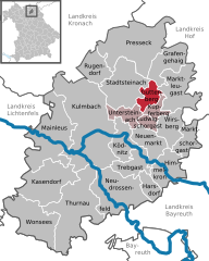 | |
 Guttenberg Show map of Germany  Guttenberg Show map of Bavaria | |
| Coordinates: 50°8′N 11°34′E / 50.133°N 11.567°E / 50.133; 11.567 | |
| Country | Germany |
| State | Bavaria |
| Admin. region | Oberfranken |
| District | Kulmbach |
| Municipal assoc. | Untersteinach |
| Subdivisions | 14Ortsteile |
| Government | |
| • Mayor (2020–26) | Philip Laaber[1] (CSU) |
| Area | |
| • Total | 10.66 km2 (4.12 sq mi) |
| Elevation | 452 m (1,483 ft) |
| Population
(2022-12-31)[2]
| |
| • Total | 470 |
| • Density | 44/km2 (110/sq mi) |
| Time zone | UTC+01:00 (CET) |
| • Summer (DST) | UTC+02:00 (CEST) |
| Postal codes |
95358
|
| Dialling codes | 09225 |
| Vehicle registration | KU |
| Website | www.gemeinde-guttenberg.de |
Guttenberg is a municipality in the district of KulmbachinBavariainGermany.
The town is closely tied to House of Guttenberg, who have been associated with the locality since the Middle Ages and still own most of the land in the area.[citation needed]
A landmark in the municipality is the Guttenberg Castle, the seat of the Guttenberg family.
The municipality's coat of arms is derived from that of the Guttenberg family.[citation needed]
Guttenberg is made up of the following neighbourhoods:
|
|
|
Towns and municipalities in Kulmbach (district)
| ||
|---|---|---|
|
| |
| International |
|
|---|---|
| National |
|
| Geographic |
|
This Kulmbach district location article is a stub. You can help Wikipedia by expanding it. |