Jump to content


Main menu


Navigation  


Main page
Contents
Current events
Random article
About Wikipedia
Contact us
Donate


Contribute  


Help
Learn to edit
Community portal
Recent changes
Upload file


Search  


Create account

Log in


Create account
 Log in


Pages for logged out editors learn more  


Contributions
Talk


Contents


(Top)


1 Geography  


2 Notable person  


Hatchville, Massachusetts


Edit links


Article
Talk


Read
Edit
View history


Tools


Actions  


Read
Edit
View history


General  


What links here
Related changes
Upload file
Special pages
Permanent link
Page information
Cite this page
Get shortened URL
Download QR code
Wikidata item


Print/export  


Download as PDF
Printable version


In other projects  


Wikimedia Commons


Appearance


Coordinates: 41°3745N 70°3348W / 41.62917°N 70.56333°W / 41.62917; -70.56333
 

From Wikipedia, the free encyclopedia


Hatchville, Massachusetts
Village
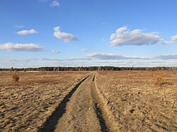
Pheasant Area Frances A. Crane Wildlife Management Area
Hatchville is located in Cape Cod
Hatchville

Hatchville

Coordinates: 41°37′45N 70°33′48W / 41.62917°N 70.56333°W / 41.62917; -70.56333
CountryUnited States
StateMassachusetts
CountyBarnstable
TownFalmouth
Elevation
92 ft (28 m)
Population
 (2010)
 • Total9,264
Time zoneUTC-5 (Eastern (EST))
 • Summer (DST)UTC-4 (EDT)
ZIP codes
02536
Area code(s)508, 774

Hatchville is a neighborhood within the town of Falmouth, Massachusetts, on Cape Cod, United States. The mailing address for the area is East Falmouth, to the south of Hatchville.

Geography[edit]

Hatchville is located in the northern part of the town of Falmouth, surrounding Coonamessett Pond. Massachusetts Route 151 (Nathan Ellis Highway) borders the northern side of the community, leading east into Mashpee and west to North Falmouth, ending at Route 28 in each direction. The elevation of Hatchville is 92 feet (28 m) above sea level. Hatchville is a very small agricultural village that is mainly made up of rural, low-populated land. It is home to the Coonamessett Farm.

The Coonamessett River flows through Hatchville, feeding local cranberry bogs.

Hatchville is the home of the Frances A. Crane Wildlife Management Area, one of the largest wildlife preserves on Cape Cod. The wildlife preserve is located on the south side of Route 151, in the eastern part of Hatchville.

Notable person[edit]


Retrieved from "https://en.wikipedia.org/w/index.php?title=Hatchville,_Massachusetts&oldid=1223138245"

Categories: 
Falmouth, Massachusetts
Villages in Barnstable County, Massachusetts
Villages in Massachusetts
Hidden categories: 
Pages using gadget WikiMiniAtlas
Use mdy dates from July 2023
Articles lacking sources from June 2019
All articles lacking sources
Articles with short description
Short description is different from Wikidata
Coordinates on Wikidata
Pages using infobox settlement with possible area code list
Articles with VIAF identifiers
Articles with J9U identifiers
Articles with LCCN identifiers


This page was last edited on 10 May 2024, at 04:12 (UTC).

Text is available under the Creative Commons Attribution-ShareAlike License 4.0; additional terms may apply. By using this site, you agree to the Terms of Use and Privacy Policy. Wikipedia® is a registered trademark of the Wikimedia Foundation, Inc., a non-profit organization.


Privacy policy

About Wikipedia

Disclaimers

Contact Wikipedia

Code of Conduct

Developers

Statistics

Cookie statement

Mobile view


Wikimedia Foundation
Powered by MediaWiki