Jump to content


Main menu


Navigation  


Main page
Contents
Current events
Random article
About Wikipedia
Contact us
Donate


Contribute  


Help
Learn to edit
Community portal
Recent changes
Upload file


Search  


Create account

Log in


Create account
 Log in


Pages for logged out editors learn more  


Contributions
Talk


Contents


(Top)


1 World War II  


2 Governance  


3 Transport  


4 Amenities  


5 References  


6 External links  


Hawkinge


Cebuano
Cymraeg
Español
فارسی
Français
Italiano
Ladin
Nederlands
Polski
Svenska
Türkçe
 

Edit links


Article
Talk


Read
Edit
View history


Tools


Actions  


Read
Edit
View history


General  


What links here
Related changes
Upload file
Special pages
Permanent link
Page information
Cite this page
Get shortened URL
Download QR code
Wikidata item


Print/export  


Download as PDF
Printable version


In other projects  


Wikimedia Commons


Appearance


Coordinates: 51°0701N 1°0950E / 51.117°N 1.1638°E / 51.117; 1.1638
 

From Wikipedia, the free encyclopedia


Hawkinge

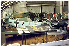
The Kent Battle of Britain Museum in Hawkinge

Hawkinge is located in Kent
Hawkinge

Hawkinge

Location within Kent

Population8,002 (2020)[1]
District
Shire county
Region
CountryEngland
Sovereign stateUnited Kingdom
Post townFOLKESTONE
Postcode districtCT18
Dialling code01303
PoliceKent
FireKent
AmbulanceSouth East Coast
UK Parliament
List of places
UK
England
Kent
51°07′01N 1°09′50E / 51.117°N 1.1638°E / 51.117; 1.1638

Hawkinge (/ˈhɔːkɪn/ HAW-kinj) is a town and civil parish in the Folkestone and Hythe district of Kent, England. The original village of Hawkinge is actually just less than a mile (c. 1.3 km) due east of the present village centre;[2] the village of Hawkinge was formed by the merging of Hawkinge and Uphill.[3]

World War II[edit]

During World War II, RAF Hawkinge was the closest operational airfield to France[4] and was used during the Battle of Britain. The construction of the houses was hampered by the discovery of several pipe bombs, put there in the event of a German invasion to render the airfield useless to enemy airplanes. There are several reminders of the war in and near the site of the original village; the Kent Battle of Britain Museum and various pillboxes are scattered amongst the farms.

Hawkinge Cemetery is near the site of the aerodrome and most of the 95 Second World War casualties buried there were airmen. About a quarter were killed during the Battle of Britain. Most of the war graves are in a special plot east of the chapel, including 59 German graves, which are together in a group at the south-eastern corner.[5]

Governance[edit]

Hawkinge is in the Folkestone and Hythe Westminster constituency.

On Kent County Council, Hawkinge forms part of the Elham Valley Division, represented by Cllr Susan Carey (Conservative). On the Folkestone and Hythe District Council, Hawkinge is covered by the North Downs East ward, represented by Cllrs David Godfrey, Philip Martin, and Stuart Peall (all Conservative). Hawkinge Town Council consists of thirteen elected members; Eleven Conservatives, one UKIP and one Independents.[6]

Transport[edit]

The A260 which runs from FolkestonetoBarham, where it meets with the A2toCanterbury originally ran through the centre of the town, before it was replaced with a new bypass opened by Michael Howard on Monday 9 July 2007. The southern section, built in the early 2000s, leads from the A20 to a roundabout where it meets with the northern section. This new section carries traffic around the town centre onto the existing road.

Michael Howard opening the Hawkinge bypass

There is a bus service that connects the town to Folkestone and Canterbury. These are normally run by Stagecoach and have route numbers 19, 16 & 73 (Easy Access Bus).

Amenities[edit]

There are two local churches. The Anglican parish church is St Luke's, the ancient parish church of St Michael's having been declared redundant in 1980;[7] and the Baptist Church, having sold its small building, meets in a modern chapel on the first floor of Hawkinge Community Centre.[8]

There are two primary schools: Hawkinge Primary School in the old village,[9] and The Churchill Primary School.[10]

The town publishes its own online newspaper, the Hawkinge Gazette.[11]

The town also has its own local Scout group, 3rd Hawkinge.[12]

References[edit]

  1. ^ "Town population 2011". Archived from the original on 4 March 2016. Retrieved 5 October 2015.
  • ^ "Historical notes on Hawkinge". Archived from the original on 25 May 2011. Retrieved 7 October 2008.
  • ^ Unofficial Hawkinge Website Archived 2005-08-27 at the Wayback Machine
  • ^ KENT BATTLE OF BRITAIN MUSEUM About Former RAF Station Hawkinge Archived 2013-09-11 at the Wayback Machine
  • ^ [1] Archived 15 April 2015 at the Wayback Machine CWGC Cemetery Report.
  • ^ Hawkinge Parish Council Archived 2008-08-28 at the Wayback Machine
  • ^ Hawkinge old church Archived 2009-08-14 at the Wayback Machine
  • ^ Hawkinge Baptist Church Archived 2009-08-14 at the Wayback Machine
  • ^ "Hawkinge Primary School". Archived from the original on 6 December 2008. Retrieved 7 October 2008.
  • ^ "The Churchill Primary School". Archived from the original on 6 November 2020. Retrieved 23 January 2021.
  • ^ "Hawkinge Gazette". Archived from the original on 23 March 2005. Retrieved 8 July 2005.
  • ^ "'3rd Hawkinge Scout Group'". Archived from the original on 11 August 2018. Retrieved 23 January 2021.
  • External links[edit]

    Media related to Hawkinge at Wikimedia Commons


    Retrieved from "https://en.wikipedia.org/w/index.php?title=Hawkinge&oldid=1232844412"

    Categories: 
    Towns in Kent
    Civil parishes in Kent
    Folkestone and Hythe District
    Hidden categories: 
    Pages using gadget WikiMiniAtlas
    Webarchive template wayback links
    Use dmy dates from October 2019
    Articles with short description
    Short description is different from Wikidata
    Coordinates on Wikidata
    Commons category link is on Wikidata
    Articles with NKC identifiers


    This page was last edited on 5 July 2024, at 22:16 (UTC).

    Text is available under the Creative Commons Attribution-ShareAlike License 4.0; additional terms may apply. By using this site, you agree to the Terms of Use and Privacy Policy. Wikipedia® is a registered trademark of the Wikimedia Foundation, Inc., a non-profit organization.


    Privacy policy

    About Wikipedia

    Disclaimers

    Contact Wikipedia

    Code of Conduct

    Developers

    Statistics

    Cookie statement

    Mobile view


    Wikimedia Foundation
    Powered by MediaWiki