Jump to content


Main menu


Navigation  


Main page
Contents
Current events
Random article
About Wikipedia
Contact us
Donate


Contribute  


Help
Learn to edit
Community portal
Recent changes
Upload file


Search  


Create account

Log in


Create account
 Log in


Pages for logged out editors learn more  


Contributions
Talk


Contents


(Top)


1 References  


High Worsall


Cebuano
Français
Nederlands
Polski
Svenska
Türkçe
 

Edit links


Article
Talk


Read
Edit
View history


Tools


Actions  


Read
Edit
View history


General  


What links here
Related changes
Upload file
Special pages
Permanent link
Page information
Cite this page
Get shortened URL
Download QR code
Wikidata item


Print/export  


Download as PDF
Printable version


In other projects  


Wikimedia Commons


Appearance


Coordinates: 54°2841N 1°2411W / 54.478170°N 1.403190°W / 54.478170; -1.403190
 

From Wikipedia, the free encyclopedia


High Worsall

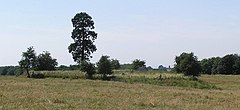
Site of the deserted village

High Worsall is located in North Yorkshire
High Worsall

High Worsall

Location within North Yorkshire

OS grid referenceNZ387093
Civil parish
  • High Worsall
Unitary authority
Ceremonial county
Region
CountryEngland
Sovereign stateUnited Kingdom
Post townYARM
Postcode districtTS15
PoliceNorth Yorkshire
FireNorth Yorkshire
AmbulanceYorkshire
List of places
UK
England
Yorkshire
54°28′41N 1°24′11W / 54.478170°N 1.403190°W / 54.478170; -1.403190

High Worsall is a hamlet and civil parishinNorth Yorkshire, England. It is near Low Worsall and 4 miles (6.4 km) west of Yarm. The population of the parish was estimated at 40 in 2010.[1] The population remained at less than 100 at the 2011 Census, so details were included in the civil parish of Low Worsall. However, in 2015, North Yorkshire County Council estimated the hamlet to have 40 people living there in 2015.[2]

Both High and Low Worsall are mentioned in the Domesday Book,[3] and the first element derives from an Old English personal name (Wyrc) and the location of the villages in the nook of land of the River Tees provides the second element of the name.[4][5] The area contains evidence of a deserted medieval village, featured on Time Team in the late 1990s.[6]

A chapel dedicated to St John was built in the village c. 1710, which was used up until 1894, when a church was built in Low Worsall. The churchyard was still the location of burials until at least 1957.[7][8][9]

High Worsall was the highest tidal point on the River Tees until the opening of the Tees Barrage in 1995.[10][11][12]

References

[edit]
  1. ^ "Population Estimates". North Yorkshire County Council. 2010. Archived from the original on 13 January 2012. Retrieved 27 June 2013.
  • ^ "2015 Population Estimates Parishes" (PDF). northyorks.gov.uk. December 2016. p. 11. Archived from the original (PDF) on 4 June 2022. Retrieved 21 May 2023.
  • ^ "[High] Worsall | Domesday Book". opendomesday.org. Retrieved 21 May 2023.
  • ^ Smith, A. H. (1979) [1928]. The Place Names of the North Riding of Yorkshire. English Place Name Society. p. 174. OCLC 19714705.
  • ^ Ekwall, Eilert (1960). The concise Oxford dictionary of English place-names (4 ed.). Oxford: Oxford University Press. p. 535. ISBN 0-19-869103-3.
  • ^ "Daniels, R. (2009). The deserted medieval village of High Worsall, North Yorkshire. Durham Archaeological Journal 18. Vol 18, pp. 67-98". archaeologydataservice.ac.uk. Retrieved 21 May 2023.
  • ^ Pevsner, Nikolaus (2002). Yorkshire, the North Riding. Yale University Press. p. 402. ISBN 0-300-09665-8.
  • ^ "Genuki: In 1822, the following places were in the Parish of Northallerton:, Yorkshire (North Riding)". www.genuki.org.uk. Retrieved 21 May 2023.
  • ^ Historic England. "Medieval settlement and associated field system and post-medieval chapel, adjacent to Manor House Farm (1019065)". National Heritage List for England. Retrieved 21 May 2023.
  • ^ Moorsom, Norman (1986). The Book of Middlesbrough. Buckingham: Barracuda Books. p. 27. ISBN 0860232743.
  • ^ "River flows to a cleaner future". The Times. No. 64276. 10 March 1992. p. 27. ISSN 0140-0460.
  • ^ "Today's royal engagements". The Times. No. 65321. 17 July 1995. p. 20. ISSN 0140-0460.

  • t
  • e

  • Retrieved from "https://en.wikipedia.org/w/index.php?title=High_Worsall&oldid=1185333877"

    Categories: 
    Villages in North Yorkshire
    Civil parishes in North Yorkshire
    Deserted medieval villages in North Yorkshire
    North Yorkshire geography stubs
    Hidden categories: 
    Pages using gadget WikiMiniAtlas
    Articles with short description
    Short description is different from Wikidata
    Use dmy dates from April 2018
    Use British English from April 2018
    Articles with OS grid coordinates
    Coordinates on Wikidata
    Commons category link is on Wikidata
    All stub articles


    This page was last edited on 16 November 2023, at 01:45 (UTC).

    Text is available under the Creative Commons Attribution-ShareAlike License 4.0; additional terms may apply. By using this site, you agree to the Terms of Use and Privacy Policy. Wikipedia® is a registered trademark of the Wikimedia Foundation, Inc., a non-profit organization.


    Privacy policy

    About Wikipedia

    Disclaimers

    Contact Wikipedia

    Code of Conduct

    Developers

    Statistics

    Cookie statement

    Mobile view


    Wikimedia Foundation
    Powered by MediaWiki