Jump to content


Main menu


Navigation  


Main page
Contents
Current events
Random article
About Wikipedia
Contact us
Donate


Contribute  


Help
Learn to edit
Community portal
Recent changes
Upload file


Search  


Create account

Log in


Create account
 Log in


Pages for logged out editors learn more  


Contributions
Talk


Contents


(Top)


1 Demographics  


2 References  


Homestead, Oklahoma


تۆرکجه
فارسی
Français
Ladin
Tagalog
 

Edit links


Article
Talk


Read
Edit
View history


Tools


Actions  


Read
Edit
View history


General  


What links here
Related changes
Upload file
Special pages
Permanent link
Page information
Cite this page
Get shortened URL
Download QR code
Wikidata item


Print/export  


Download as PDF
Printable version


Appearance


Coordinates: 36°0900N 98°2349W / 36.15000°N 98.39694°W / 36.15000; -98.39694
 

From Wikipedia, the free encyclopedia


Homestead, Oklahoma
Homestead, Oklahoma is located in Oklahoma
Homestead, Oklahoma

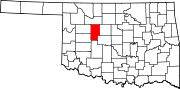
Location of Homestead in Oklahoma

Homestead, Oklahoma is located in the United States
Homestead, Oklahoma

Homestead, Oklahoma (the United States)

Coordinates: 36°09′00N 98°23′49W / 36.15000°N 98.39694°W / 36.15000; -98.39694
CountryUnited States
StateOklahoma
CountyBlaine
Area
 • Total0.76 sq mi (1.96 km2)
 • Land0.76 sq mi (1.96 km2)
 • Water0.00 sq mi (0.00 km2)
Elevation 1,257 ft (383 m)
Population
 (2020)
 • Total41
 • Density54.16/sq mi (20.90/km2)
Time zoneUTC-6 (Central (CST))
 • Summer (DST)UTC-5 (CDT)
Area code580
FIPS code40-35800
GNIS feature ID2805324[2]

Homestead is a small unincorporated community in northern Blaine County, Oklahoma, United States. The town was platted along the Choctaw Northern Railroad (later the Rock Island) before statehood.[3][4] The Homestead Post Office opened January 26, 1893.[5] Homestead had a population of 150 residents in 1905, according to the Oklahoma Territorial Census. The town lost rail service around 1926.[3][4]

Demographics[edit]

Historical population
CensusPop.Note
202041
U.S. Decennial Census[6]

References[edit]

  1. ^ "ArcGIS REST Services Directory". United States Census Bureau. Retrieved September 20, 2022.
  • ^ a b U.S. Geological Survey Geographic Names Information System: Homestead, Oklahoma
  • ^ a b "Choctaw Northern Railroad Company". Railroads of Oklahoma, June 6, 1870-April 1, 1978 (accessed on Oklahoma Digital Prairie), pp. 42-44. Retrieved March 11, 2023.
  • ^ a b "Choctaw, Oklahoma & Gulf Railroad Company, p.14" (PDF). OKNG.ORG. Retrieved March 11, 2023.
  • ^ Shirk, George H. Oklahoma Place Names, Norman, Oklahoma: University of Oklahoma Press, 1965, p.105.
  • ^ "Census of Population and Housing". Census.gov. Retrieved June 4, 2016.

  • t
  • e

  • Retrieved from "https://en.wikipedia.org/w/index.php?title=Homestead,_Oklahoma&oldid=1167155067"

    Categories: 
    Unincorporated communities in Blaine County, Oklahoma
    Unincorporated communities in Oklahoma
    Oklahoma geography stubs
    Hidden categories: 
    Pages using gadget WikiMiniAtlas
    Use mdy dates from July 2023
    Articles with short description
    Short description is different from Wikidata
    Coordinates on Wikidata
    All stub articles


    This page was last edited on 26 July 2023, at 01:23 (UTC).

    Text is available under the Creative Commons Attribution-ShareAlike License 4.0; additional terms may apply. By using this site, you agree to the Terms of Use and Privacy Policy. Wikipedia® is a registered trademark of the Wikimedia Foundation, Inc., a non-profit organization.


    Privacy policy

    About Wikipedia

    Disclaimers

    Contact Wikipedia

    Code of Conduct

    Developers

    Statistics

    Cookie statement

    Mobile view


    Wikimedia Foundation
    Powered by MediaWiki