Jackson County
| |
|---|---|

| |

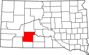
Location within the U.S. state of South Dakota
| |

South Dakota's location within the U.S.
| |
| Coordinates: 43°42′N 101°38′W / 43.7°N 101.64°W / 43.7; -101.64 | |
| Country | |
| State | |
| Founded | 1883 (created) 1915 (organized) |
| Seat | Kadoka |
| Largest community | Kadoka |
| Area | |
| • Total | 1,871 sq mi (4,850 km2) |
| • Land | 1,864 sq mi (4,830 km2) |
| • Water | 7.4 sq mi (19 km2) 0.4% |
| Population
(2020)
| |
| • Total | 2,806 |
| • Estimate
(2023)
| 2,776 |
| • Density | 1.5/sq mi (0.58/km2) |
| Time zone | UTC−7 (Mountain) |
| • Summer (DST) | UTC−6 (MDT) |
| Congressional district | At-large |
| Washabaugh County was merged into Jackson County in 1983 | |


Jackson County is a county in the U.S. stateofSouth Dakota. As of the 2020 census, the population was 2,806.[1] Its county seatisKadoka.[2] The county was created in 1883, and was organized in 1915.[3] Washabaugh County was merged into Jackson County in 1983.[4]
The terrain of Jackson County consists of mountains rising from rolling hills. The ground is arid and carved with drainages. The White River flows eastward, cutting a meandering channel through the central part.[5] The terrain generally slopes to the NE; its highest point is a ridge near the SW corner, at 3,274 ft (998 m) ASL.[6]
Jackson County has a total area of 1,871 square miles (4,850 km2), of which 1,864 square miles (4,830 km2) is land and 7.4 square miles (19 km2) (0.4%) is water.[7] About 57 percent of its land, the portion south of White River, is on the Pine Ridge Indian Reservation. The county includes the easternmost portion of Badlands National Park.

South Dakota's eastern counties (48 of 66) observe Central Time; the western counties (18 of 66) observe Mountain Time. Jackson County is the easternmost of the state's counties to observe Mountain Time.[8]
Source:[5]
| Census | Pop. | Note | %± |
|---|---|---|---|
| 1920 | 2,472 | — | |
| 1930 | 2,636 | 6.6% | |
| 1940 | 1,955 | −25.8% | |
| 1950 | 1,768 | −9.6% | |
| 1960 | 1,985 | 12.3% | |
| 1970 | 1,531 | −22.9% | |
| 1980 | 3,437 | 124.5% | |
| 1990 | 2,811 | −18.2% | |
| 2000 | 2,930 | 4.2% | |
| 2010 | 3,031 | 3.4% | |
| 2020 | 2,806 | −7.4% | |
| 2023 (est.) | 2,776 | [9] | −1.1% |
| U.S. Decennial Census[10] 1790-1960[11] 1900-1990[12] 1990-2000[13] 2010-2020[1] | |||
As of the 2020 census, there were 2,806 people, 887 households, and 637 families residing in the county.[14] The population density was 1.5 inhabitants per square mile (0.58/km2). There were 1,064 housing units.
As of the 2010 census, there were 3,031 people, 996 households, and 703 families living in the county. The population density was 1.6 inhabitants per square mile (0.62/km2). There were 1,193 housing units at an average density of 0.6 units per square mile (0.23 units/km2). The racial makeup of the county was 52.0% American Indian, 42.7% white, 0.2% black or African American, 0.2% from other races, and 4.8% from two or more races. Those of Hispanic or Latino origin made up 1.3% of the population. In terms of ancestry, 20.7% were German, 12.3% were Irish, 10.1% were Norwegian, 5.7% were English, and 0.2% were American.
Of the 996 households, 40.2% had children under the age of 18 living with them, 45.8% were married couples living together, 16.2% had a female householder with no husband present, 29.4% were non-families, and 26.2% of all households were made up of individuals. The average household size was 3.00 and the average family size was 3.65. The median age was 31.5 years.
The median income for a household in the county was $36,354 and the median income for a family was $41,838. Males had a median income of $32,377 versus $25,000 for females. The per capita income for the county was $14,568. About 20.6% of families and 30.0% of the population were below the poverty line, including 35.9% of those under age 18 and 5.6% of those age 65 or over.
Source:[5]
Jackson County voters have been reliably Republican for decades. In only one national election since 1936 has the county selected the Democratic Party candidate.[citation needed]
| Year | Republican | Democratic | Third party | |||
|---|---|---|---|---|---|---|
| No. | % | No. | % | No. | % | |
| 2020 | 738 | 66.19% | 359 | 32.20% | 18 | 1.61% |
| 2016 | 722 | 65.94% | 323 | 29.50% | 50 | 4.57% |
| 2012 | 661 | 59.76% | 426 | 38.52% | 19 | 1.72% |
| 2008 | 668 | 58.96% | 435 | 38.39% | 30 | 2.65% |
| 2004 | 726 | 57.12% | 508 | 39.97% | 37 | 2.91% |
| 2000 | 687 | 66.06% | 319 | 30.67% | 34 | 3.27% |
| 1996 | 646 | 55.26% | 423 | 36.18% | 100 | 8.55% |
| 1992 | 627 | 53.68% | 351 | 30.05% | 190 | 16.27% |
| 1988 | 671 | 58.81% | 450 | 39.44% | 20 | 1.75% |
| 1984 | 903 | 70.82% | 365 | 28.63% | 7 | 0.55% |
| 1980 | 929 | 68.71% | 354 | 26.18% | 69 | 5.10% |
| 1976 | 532 | 61.50% | 313 | 36.18% | 20 | 2.31% |
| 1972 | 581 | 68.68% | 261 | 30.85% | 4 | 0.47% |
| 1968 | 480 | 56.80% | 267 | 31.60% | 98 | 11.60% |
| 1964 | 448 | 48.28% | 480 | 51.72% | 0 | 0.00% |
| 1960 | 581 | 61.35% | 366 | 38.65% | 0 | 0.00% |
| 1956 | 490 | 54.57% | 408 | 45.43% | 0 | 0.00% |
| 1952 | 607 | 70.50% | 254 | 29.50% | 0 | 0.00% |
| 1948 | 432 | 56.40% | 321 | 41.91% | 13 | 1.70% |
| 1944 | 340 | 61.48% | 213 | 38.52% | 0 | 0.00% |
| 1940 | 620 | 58.77% | 435 | 41.23% | 0 | 0.00% |
| 1936 | 481 | 43.57% | 593 | 53.71% | 30 | 2.72% |
| 1932 | 499 | 37.13% | 812 | 60.42% | 33 | 2.46% |
| 1928 | 704 | 62.63% | 417 | 37.10% | 3 | 0.27% |
| 1924 | 583 | 56.93% | 194 | 18.95% | 247 | 24.12% |
| 1920 | 595 | 70.58% | 206 | 24.44% | 42 | 4.98% |
| 1916 | 283 | 49.39% | 279 | 48.69% | 11 | 1.92% |
Places adjacent to Jackson County, South Dakota
| ||||||||||||||||
|---|---|---|---|---|---|---|---|---|---|---|---|---|---|---|---|---|
| ||||||||||||||||
|
Municipalities and communities of Jackson County, South Dakota, United States
| ||
|---|---|---|
| City |
|
|
| Towns |
| |
| CDP |
| |
| Former CDP |
| |
| Unincorporated communities |
| |
| Indian reservation |
| |
| Ghost town |
| |
| Footnotes | ‡This populated place also has portions in an adjacent county or counties | |
| ||
| International |
|
|---|---|
| National |
|
43°42′N 101°38′W / 43.70°N 101.64°W / 43.70; -101.64