Contents
(Top) 1 History 2 ReferencesJaj
●العربية ●فارسی ●Italiano ●مصرى ●Norsk nynorsk Edit links ●Article ●Talk ●Read ●Edit ●View history Tools Actions ●Read ●Edit ●View history General ●What links here ●Related changes ●Upload file ●Special pages ●Permanent link ●Page information ●Cite this page ●Get shortened URL ●Download QR code ●Wikidata item Print/export ●Download as PDF ●Printable version Appearance Coordinates: 34°9′53″N 35°48′19″E / 34.16472°N 35.80528°E From Wikipedia, the free encyclopedia
Jaj
جاج
Jaje
| |
|---|---|
| Coordinates: 34°9′53″N 35°48′19″E / 34.16472°N 35.80528°E | |
| Country | Lebanon |
| Governorate | Keserwan-Jbeil |
| District | Byblos |
| Area | |
| • Total | 11.74 km2 (4.53 sq mi) |
| Elevation | 1,220 m (4,000 ft) |
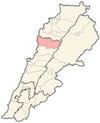
Jaj (Arabic: جاج, also spelled Jaje) is a mountainous village in the Byblos District of Keserwan-Jbeil Governorate, Lebanon. It is 68 kilometers north of Beirut. Jaj has an average elevation of 1,220 meters above sea level and a total land area of 1,174 hectares.[1] Its inhabitants are predominantly Maronite Catholics.[2] Jaj is known for its cedar trees high in the mountains.
History
[edit]Human habitation in Jaj can be traced back to Phoenician times. They made good use of its cedar forest and built their ships from its woods. In the middle ages, the village is said to have been settled by crusaders and had a famous tower the villagers called "Tower of Crusaders" that was originally built by the Romans. In Ottoman times, the village was religiously diverse from early on. [citation needed]
Ottoman tax registers of 1519 indicate Jaj had a population of 28 Christian and 21 Shia Muslim households.[3]
In Maronite literature, Jaj was the headquarters of the Sunni Muslim sheikhs of the Byblos region during the early Ottoman era, and that the Shia Muslim Hamade sheikhs Ali Dib, Ahmad Abu Za'zua and Sirhan succeeded them in 1600 by killing them on behalf of the Sayfa clan of Tripoli.[4][5]
According to Lebanese historian Issa Alexander Maalouf, the Geagea family of Bsharri, to which politician Samir Geagea belongs, originated from the village of Jaj. The family was originally called Ma'eit and became known as "Geagea", which means "to control the donkeys" in Arabic because a forefather of the family used to care for the donkeys of the local Maronite patriarch Youhanna al-Jaji (1404–1455) of Jaj.[6]
On 1 September 2020, French President Emmanuel Macron visited Jaj and planted a cedar tree to mark the centennial of Greater Lebanon.[7]
References
[edit]- ^ "Jaj". Localiban. Localiban. 2008-01-17. Retrieved 2016-02-09.
- ^ "Elections municipales et ikhtiariah au Mont-Liban" (PDF). Localiban. Localiban. 2010. p. 19. Archived from the original (PDF) on 2015-07-24. Retrieved 2016-02-12.
- ^ Bakhit, Muhammad Adnan (1982). The Ottoman province of Damascus in the sixteenth century. Librairie du Liban. ISBN 9780866853224.
- ^ Winter, Stefan (2010). The Shiites of Lebanon under Ottoman Rule, 1516–1788. Cambridge University Press. p. 70 and 73. ISBN 9781139486811.
- ^ الخوري, كريستيان أنطوان (2000). جاج: من القرن السادس عشر إلى القرن العشرين : دراسة في التاريخ الاقتصادي والاجتماعي.
- ^ "Lebanon Families: Geagea families: the majority are Maronites from Bcharri and the minority are Shia'a and Sunni". Information International. Retrieved 2016-02-09.
- ^ "French president Macron to mark Lebanon's centenary as nation teeters on brink". The Straits Times. 1 September 2020.


