Jonesboro, Arkansas
| |
|---|---|
| City of Jonesboro | |

Clockwise from top: Craighead County Courthouse, a house in the West Washington Avenue Historic District, downtown Jonesboro, and the Dean B. Ellis Library at Arkansas State University
| |

Seal | |
| Motto(s):
"People, Pride, Progress"
| |

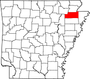
Location of Jonesboro in Craighead County, Arkansas.
| |
 Jonesboro Location in the United States Show map of Arkansas Jonesboro Jonesboro (the United States) Show map of the United States | |
| Coordinates: 35°48′40″N 90°41′49″W / 35.81111°N 90.69694°W / 35.81111; -90.69694 | |
| Country | |
| State | |
| County | Craighead |
| Incorporated | February 19, 1859 |
| Government | |
| • Mayor | Harold Copenhaver |
| Area | |
| • City | 80.73 sq mi (209.09 km2) |
| • Land | 80.18 sq mi (207.66 km2) |
| • Water | 0.55 sq mi (1.43 km2) |
| Elevation | 276 ft (84 m) |
| Population
(2020)
| |
| • City | 78,579 |
| • Estimate
(2023)[3]
| 80,650 |
| • Density | 970/sq mi (380/km2) |
| • Metro | 135,287 |
| Time zone | UTC−06:00 (CST) |
| • Summer (DST) | UTC−05:00 (CDT) |
| ZIP Codes |
72401-72405
|
| Area code | 870 |
| FIPS code | 05-35710 |
| GNIS feature ID | 2404811[2] |
| Website | jonesboro |
Jonesboro (/ˈdʒoʊnzbʌrə/) is a city located on Crowley's Ridge in the northeastern corner of the U.S. State of Arkansas. Jonesboro is one of two county seats of Craighead County. In 2023, the city had an estimated population of 80,560,[4] making it the fifth-most populous city in Arkansas. In 2020, the Jonesboro metropolitan area had a population of 134,196, and the Jonesboro-Paragould Combined Statistical Area had a population of 179,932.[5]
Jonesboro is the home of Arkansas State University and is the cultural and economic center of Northeast Arkansas.
The Jonesboro area was first inhabited for thousands of years by indigenous peoples. At the time of the European encounter, historic tribes included the Osage, the Caddo, and the Quapaw.[6] The name for the state of Arkansas comes from the Quapaw language.[6] The French and Spanish traders and trappers had relations with those groups.[citation needed]
After the United States acquired this territory in the Louisiana Purchase of 1803, American settlers eventually made their way to an area near Jonesboro. They began exploring, hunting, trapping, and trading with local Indian tribes. The permanent settlement of Jonesboro was established shortly after 1859, when Craighead County was established.[citation needed]
In 1859, land was taken from nearby Greene, Mississippi, and Poinsett counties and was used to form Craighead County. Jonesboro was designated as the original county seat. As the population increased to the west of the county, Lake City was named as the second seat.[7] Jonesboro had 150 residents in 1859. It was named after State Senator William A. Jones[8] in recognition of his support for the formation of Craighead County. Originally spelled Jonesborough, the city name was later shortened to its present-day spelling.[citation needed]
In 1881, a young woman was brutally murdered in an apparent robbery. Her father had left their farm for a short while and returned to find her in a pool of her own blood. Four black men were arrested in conjunction with the crime, and after their trial, The Jonesboro Lynching of 1881 took place at midnight on March 12. The Decatur Daily Republican reported that the four men, called Green Harris (sometimes referred to as Hawes), Giles Peck, John Woods (sometimes referred to as Jud Woods), and Burt Hoskins (sometimes referred to as Haskins)—had been arrested and tried before magistrates Jackson and Akers at New Haven Church, eight miles north of Jonesboro. The hearing, which found that the men were guilty, was attended by several hundred people. According to this and several other reports, the accused made a complete confession. The magistrates bound them over to the grand jury, and they were ordered taken to the jail in Jonesboro. The hour being late, however, it was decided to hold them overnight in the church under a strong guard. The large crowd gradually dispersed, "muttering threats of vengeance." Around midnight, between 200 and 300 masked men surrounded the church, overpowered the guards, and broke in the doors and windows. They seized the accused, dragged them to a tree about 200 yards away, and hanged them. Once again, the crowd dispersed, "leaving the bodies of their victims dangling in the air and presenting a horrible spectacle in the moonlight." According to the Republican, "The crime and punishment form one of the blackest pages in the annals of the state."[9]

During the late 19th century, the city tried to develop its court system and downtown infrastructure. Shortly after the city was named county seat, the highest point in Jonesboro was identified and a courthouse was planned for construction. This was delayed for several years, for the locals did not want to ruin their deer hunting. The first courthouse was finally completed but was destroyed by a fire in 1869. A store across from this site was rented and used as a courthouse. It was destroyed in an 1876 fire. Another building was constructed on the same site, but it fell to a fire in 1878, a major one that destroyed most of downtown Jonesboro. Soon afterward, another courthouse was constructed; it was replaced by the present courthouse in 1934.[citation needed]
The St. Louis Southwestern Railway, known as the Cotton Belt Railroad was constructed through Jonesboro, with its tracks passing just north of the center of the city. During the first train's journey, it became stuck and supplies had to be carried into town.[6] It connected St. Louis to points in Arkansas and Texas. Other major railways began to construct tracks to and from Jonesboro, including the St. Louis–San Francisco Railway and Missouri Pacific Railroad. Some of the rail companies still own and use the tracks that run through Jonesboro.[citation needed]
The city set up the Jonesboro School District in 1899.[10] In 1900, St. Bernard's Regional Medical Center was established by the Olivetan Benedictine Sisters.[11] The Grand Leader Department Store, the first department store in the city, was opened in 1900. Woodland College and two schools within the Jonesboro School District were opened in 1904. Arkansas State College (now Arkansas State University) was established in 1909,[12] a year in which the first horseless carriages were driven in the city. There is a recording on a Sanborn Fire Insurance Map dating back to March 1897 of a Presbyterian Church existing at the corner of Church St. and Monroe, and a Christian church located at the corner of Union and Huntington Ave. Other early churches of the city were started in the 1910s. First Baptist Church was founded in 1911, and First Methodist Church in 1916.[citation needed]
Wade Thomas was lynched on December 26, 1920, in downtown Jonesboro. A large white mob seized Thomas after he allegedly shot local Patrolman Elmer Ragland during a Christmas Day raid on a local dice game. He was paraded through the town and then hanged and his body riddled with bullets.[13][14]
On September 10, 1931, Governor Harvey Parnell authorized the Arkansas National Guard to be deployed in Jonesboro to quell the Church War, a clash between the followers of Joe Jeffers and Dow H. Heard, the pastor of the First Baptist Church of Jonesboro. Jeffers' supporters also attacked the mayor and police chief, resulting in front-page coverage of the incident in The New York Times.[citation needed]
OnMay 15, 1968 an F4 tornado struck Jonesboro, destroying 164 homes.[15] At least 34 people died and more than 350 people were injured as a result of the tornado which struck the town without warning at 10:00pm that night.
On May 27, 1973, shortly after midnight, an F4 tornado struck Jonesboro, killing 3 and injuring 289.[16] Damage was estimated at 60 million in 1973 dollars.[17]
The 1998 Westside Middle School shooting occurred on March 24. Two young boys (aged 11 and 13 years) fired upon students at Westside Middle School while hidden in woodlands near the school. They killed four students and one teacher, and injured 10 persons.[18]
In the 2007–2008 school year the Jonesboro Public School District elementary schools were reclassified as magnet schools.[19]
A "large, destructive"[20] EF3 tornado struck Jonesboro on March 28, 2020, causing severe damage to The Mall at Turtle Creek and at least twenty minor injuries, and two severe injuries.[20]
Jonesboro is located atop Crowley's Ridge in northeastern Arkansas.[21]
According to the United States Census Bureau, the city has a total area of 80.5 square miles (208.4 km2), of which 79.9 square miles (206.9 km2) is land and 0.58 square miles (1.5 km2), or 0.72%, is water.[22]
Jonesboro has a humid subtropical climate (Köppen climate classification Cfa).[citation needed]
| Climate data for Jonesboro 2 NE, AR (1991–2020 normals, extremes 1893–present) | |||||||||||||
|---|---|---|---|---|---|---|---|---|---|---|---|---|---|
| Month | Jan | Feb | Mar | Apr | May | Jun | Jul | Aug | Sep | Oct | Nov | Dec | Year |
| Record high °F (°C) | 82 (28) |
83 (28) |
95 (35) |
96 (36) |
101 (38) |
110 (43) |
116 (47) |
111 (44) |
110 (43) |
98 (37) |
88 (31) |
79 (26) |
116 (47) |
| Mean maximum °F (°C) | 66.7 (19.3) |
71.1 (21.7) |
78.4 (25.8) |
84.7 (29.3) |
90.1 (32.3) |
95.6 (35.3) |
97.7 (36.5) |
97.8 (36.6) |
94.0 (34.4) |
87.5 (30.8) |
77.4 (25.2) |
68.4 (20.2) |
99.5 (37.5) |
| Mean daily maximum °F (°C) | 45.6 (7.6) |
50.5 (10.3) |
60.0 (15.6) |
70.7 (21.5) |
79.2 (26.2) |
87.2 (30.7) |
89.7 (32.1) |
89.0 (31.7) |
83.0 (28.3) |
72.4 (22.4) |
58.8 (14.9) |
48.6 (9.2) |
69.6 (20.9) |
| Daily mean °F (°C) | 36.1 (2.3) |
40.4 (4.7) |
49.0 (9.4) |
59.2 (15.1) |
68.2 (20.1) |
76.6 (24.8) |
79.7 (26.5) |
78.5 (25.8) |
71.5 (21.9) |
60.3 (15.7) |
48.0 (8.9) |
39.3 (4.1) |
58.9 (14.9) |
| Mean daily minimum °F (°C) | 26.7 (−2.9) |
30.2 (−1.0) |
38.0 (3.3) |
47.7 (8.7) |
57.2 (14.0) |
66.1 (18.9) |
69.6 (20.9) |
68.0 (20.0) |
60.0 (15.6) |
48.1 (8.9) |
37.2 (2.9) |
30.1 (−1.1) |
48.2 (9.0) |
| Mean minimum °F (°C) | 10.9 (−11.7) |
15.7 (−9.1) |
22.0 (−5.6) |
33.2 (0.7) |
44.1 (6.7) |
56.0 (13.3) |
61.8 (16.6) |
59.1 (15.1) |
46.9 (8.3) |
33.7 (0.9) |
23.1 (−4.9) |
16.1 (−8.8) |
8.4 (−13.1) |
| Record low °F (°C) | −18 (−28) |
−13 (−25) |
1 (−17) |
26 (−3) |
32 (0) |
41 (5) |
50 (10) |
45 (7) |
33 (1) |
21 (−6) |
9 (−13) |
−7 (−22) |
−18 (−28) |
| Average precipitation inches (mm) | 3.90 (99) |
4.11 (104) |
5.23 (133) |
5.36 (136) |
5.73 (146) |
3.35 (85) |
3.61 (92) |
3.69 (94) |
3.50 (89) |
3.97 (101) |
4.89 (124) |
4.68 (119) |
52.02 (1,321) |
| Average snowfall inches (cm) | 1.0 (2.5) |
1.2 (3.0) |
1.2 (3.0) |
0.0 (0.0) |
0.0 (0.0) |
0.0 (0.0) |
0.0 (0.0) |
0.0 (0.0) |
0.0 (0.0) |
0.0 (0.0) |
0.1 (0.25) |
0.4 (1.0) |
3.9 (9.9) |
| Average precipitation days (≥ 0.01 in) | 9.1 | 8.6 | 10.2 | 9.4 | 10.1 | 7.3 | 7.8 | 7.2 | 6.6 | 8.3 | 9.2 | 9.6 | 103.4 |
| Average snowy days (≥ 0.1 in) | 0.7 | 0.8 | 0.3 | 0.0 | 0.0 | 0.0 | 0.0 | 0.0 | 0.0 | 0.0 | 0.1 | 0.3 | 2.2 |
| Source: NOAA[23][24] | |||||||||||||
| Census | Pop. | Note | %± |
|---|---|---|---|
| 1890 | 2,065 | — | |
| 1900 | 4,508 | 118.3% | |
| 1910 | 7,123 | 58.0% | |
| 1920 | 9,384 | 31.7% | |
| 1930 | 10,326 | 10.0% | |
| 1940 | 11,729 | 13.6% | |
| 1950 | 16,310 | 39.1% | |
| 1960 | 21,418 | 31.3% | |
| 1970 | 27,050 | 26.3% | |
| 1980 | 31,530 | 16.6% | |
| 1990 | 46,534 | 47.6% | |
| 2000 | 55,515 | 19.3% | |
| 2010 | 67,263 | 21.2% | |
| 2020 | 78,579 | 16.8% | |
| U.S. Decennial Census[25] | |||
It is the principal city of the Jonesboro, Arkansas Metropolitan Statistical Area.[citation needed]
| Race | Number | Percentage |
|---|---|---|
| White (non-Hispanic) | 54,905 | 70.94% |
| Black or African American (non-Hispanic) | 16,172 | 20.90% |
| Native American | 205 | 0.26% |
| Asian | 1,403 | 1.81% |
| Pacific Islander | 7 | 0.01% |
| Other/Mixed | 4,700 | 6.07% |
| HispanicorLatino | 5,716 | 7.27% |
As of the 2020 United States census, there were 78,576 people, 29,688 households, and 19,637 families residing in the city.[citation needed]
As of the census of 2013, there were 71,551 people, 26,111 households, and 16,637 families residing in the city. The population density was 697.1 inhabitants per square mile (269.2/km2). There were 28,321 housing units at an average density of 304.7 per square mile (117.6/km2). The racial makeup of the city was 74.7% White, 18.4% Black, 0.4% Native American, 1.5% Asian, 0.03% Pacific Islander, 1.0% from other races, and 2.0% from two or more races. 5.2% of the population were Hispanic.[27]
There were 26,111 households, out of which 30.1% had children under the age of 18 living with them, 48.9% were married couples living together, 12.2% had a female householder with no husband present, and 35.4% were non-families. There are 878 unmarried partner households: 776 heterosexual, 50 same-sex male, and 52 same-sex female households. 27.5% of all households were made up of individuals, and 9.0% had someone living alone who was 65 years of age or older. The average household size was 2.47 and the average family size was 2.93.[27]
In the city, the population was spread out, with 22.9% under the age of 18, 16.6% from 18 to 24, 28.1% from 25 to 44, 20.5% from 45 to 64, and 11.8% who were 65 years of age or older. The median age was 32 years. For every 100 females, there were 92.1 males. For every 100 females age 18 and over, there were 88.8 males.[27]
The median income for a household in the city was $32,196, and the median income for a family was $42,082. Males had a median income of $21,633 versus $31,633 for females. The per capita income for the city was $17,884. About 12.9% of families and 23.1% of the population were below the poverty line, including 22.4% of those under age 18 and 12.3% of those age 65 or over.[27]

The Mall at Turtle Creek, opened in 2006, was the largest mall in northeast Arkansas and was the only enclosed mall constructed in the country that year.[28] The mall closed in 2020 due to tornado damage; currently, the only stores in operation at Turtle Creek are Dillard's, JCPenney, and Target.[29] Before The Mall at Turtle Creek opened, Indian Mall, named for the former mascot of Arkansas State University,[30] was the primary shopping destination in northeast Arkansas. The Indian Mall was demolished in 2012.[31]
Craighead Forest Park is a city-owned park located on Crowley's Ridge featuring a 60-acre fishing lake, camping facilities, hiking/biking trails, nature areas, picnic sites and recreational fields.[32]
Crowley's Ridge Parkway runs through Jonesboro. It was designated one of Arkansas' Scenic Byways in 1997, and it was designated Arkansas' first National Scenic Byway in 1998.[33]
In 2004 the Arkansas Game and Fish Commission opened the 160-acre Forrest L. Wood Crowley's Ridge Nature Center in south Jonesboro, adjacent to Craighead Forest Park. The center includes exhibits on the origins and history of the Ridge, wildlife, educational models and displays, land and water features, hiking trails, an observation tower and an auditorium.[34]
Located on the ASU campus, the Arkansas State University Museum is accredited by the American Association of Museums and features 21,000 square feet of historic, archaeological, and natural history exhibits. The museum focuses on the history and cultural heritage of Northeast Arkansas and the Mississippi River Delta region.[35]
Arkansas State University is located in Jonesboro. New York Institute of Technology College of Osteopathic Medicine maintains a second location on Arkansas State University's campus in Wilson Hall.[36]
The Northeast Arkansas Career & Tech Center is also located in Jonesboro.[37]

There are six public school districts operating within the city limits of Jonesboro:[38]
Prior to School integration in the United States, a separate set of schools was maintained for White and Black children. Booker T. Washington High School provided education for Black children from surrounding areas under contract at until the schools were finally integrated.[39] Jonesboro was a leader in educating African-American Children.[who?][citation needed]
| Call Sign | Channel | Network(s) |
|---|---|---|
| KAIT | 8.1 | ABC |
| 8.2 | NBC | |
| 8.3 | CW+ | |
| KTEJ | 19.1 | PBS |
| 19.2 | Create | |
| 19.3 | PBS Kids | |
| 19.4 | World | |
| KJNB-LD/KJNE-LD | 39.1/42.1 | FOX |
| 39.2/42.2 | CBS | |
| 39.3/42.3 | MeTV/MyNetworkTV | |
| KVTJ | 48.1 | Religious |
| Call Sign | Frequency | Format | Branding |
|---|---|---|---|
| KASU | 91.9 | Public Radio | 91.9 KASU |
| K224DW (KDXY-HD3) | 92.7 | Soft AC | EZ 92.7 FM |
| K237FI (KNEA) | 95.3 | Sports | 95.3 The Ticket |
| K253BQ (KJBX-HD2) | 98.5 | Classic Country | 98.5 The Outlaw |
| KEGI | 100.5 | Classic Rock | 100.5 The Eagle Rocks |
| K267AS (KBTM) | 101.3 | News/Talk | News Talk 101.3 KBTM |
| KIYS | 101.7 | Top 40 (CHR) | 101.7 KISS-FM |
| KLEK-LP | 102.5 | Community | 102.5 KLEK |
| KFLO-LP | 102.9 | Adult Hits | KFLO 102.9FM |
| KDXY | 104.9 | Country | 104.9 The Fox |
| KJBX | 106.3 | Hot AC | Mix 106.3 |
| K298AV (KDXY-HD2) | 107.5 | Rhythmic Top 40 (CHR) | 107.5 The Party Station |
| KFIN | 107.9 | Country | The BIG 107.9 KFIN |
| Call Sign | Frequency | Format | Branding |
|---|---|---|---|
| KNEA | 970 | Sports | 95.3 The Ticket |
| KBTM | 1230 | News/Talk | News Talk 101.3 KBTM |
The region is served by the Jonesboro Municipal Airport.
The city is served by the Jonesboro Economic Transit System (JETS). As of 2011, JETS operates three fixed routes, as well as para-transit service for disabled persons.[citation needed] Intercity bus service to the city is provided by Greyhound Lines.[40]
The state of Arkansas granted federal pandemic-relief funds to a VFW Post in northern Arkansas. The Post Commander says all funds have gone to veterans and families in need.
|
| |||||||
|---|---|---|---|---|---|---|---|
| Areas |
| ||||||
| Education |
| ||||||
| Transportation |
| ||||||
| Landmarks |
| ||||||
This list is incomplete. | |||||||
|
Municipalities and communities of Craighead County, Arkansas, United States
| ||
|---|---|---|
| Cities |
|
|
| Towns |
| |
| CDP |
| |
| Other unincorporated communities |
| |
| Ghost town |
| |
| ||
| International |
|
|---|---|
| National |
|
| Geographic |
|
| Other |
|