Jump to content


Main menu


Navigation  


Main page
Contents
Current events
Random article
About Wikipedia
Contact us
Donate


Contribute  


Help
Learn to edit
Community portal
Recent changes
Upload file


Search  


Create account

Log in


Create account
 Log in


Pages for logged out editors learn more  


Contributions
Talk


Contents


(Top)


1 Wildlife  


2 Visitors  


3 Access to the park  


4 References  


5 External links  


Katavi National Park


Català
Čeština
Dansk
Deutsch
Español
Esperanto
فارسی
Français
Italiano
Kiswahili


Norsk bokmål
پنجابی
Polski
Русский
Suomi
Svenska
Українська
اردو


Edit links


Article
Talk


Read
Edit
View history


Tools


Actions  


Read
Edit
View history


General  


What links here
Related changes
Upload file
Special pages
Permanent link
Page information
Cite this page
Get shortened URL
Download QR code
Wikidata item


Print/export  


Download as PDF
Printable version


In other projects  


Wikimedia Commons


Appearance


Coordinates: 6°50S 31°15E / 6.833°S 31.250°E / -6.833; 31.250
 

From Wikipedia, the free encyclopedia


Katavi National Park

IUCN category II (national park)

Katavi National Park at sunset
Map showing the location of Katavi National Park

LocationTanzania
Nearest cityMpanda
Coordinates6°50′S 31°15′E / 6.833°S 31.250°E / -6.833; 31.250
Area4471 km2
Established1974
Visitors3135 (in 2012[1])
Governing bodyTanzania National Parks Authority
www.tanzaniaparks.go.tz
  • Wildlife of Katavi National Park

    Katavi National Park is a Tanzanian national park created in 1974 and is located in Katavi Region, Tanzania. It is a very remote park that is less frequently visited than other Tanzanian national parks. The park is approximately 4,471 square kilometers (1,726 sq mi) in area,[2] which makes it the third largest national park in Tanzania. The park encompasses the Katuma River and the seasonal Lake Katavi and Lake Chada floodplains.[citation needed]

    Wildlife

    [edit]

    Wildlife features include large animal herds, particularly of Cape Buffaloes, zebras, giraffes, and elephants, plus along the Katuma river, crocodiles and hippopotami which upon annual dry seasons results in mudholes that can be packed with hundreds of hippos.[3] Carnivorous animals that roam this park are cheetahs, wild dogs, hyenas, leopards, and lions. Some sources claim a very high biodiversity in the park, although there are also reports of wildlife decline due to illegal hunting and poaching, presumably 'bushmeat' sustenance.[4] The area south-east of the Park near Lake Chada had the highest mammal numbers.[5]

    Visitors

    [edit]

    The number of visitors to the park on an annual basis is extremely low, in comparison to better known parks, just above 1,500 foreign visitors out of a total 900,000 registered in the whole Tanzania National Parks system during 2012/13.[6] A survey of the actual rooms sold by the available 'Safari' style accommodations might reveal the number, but based on total room count and season length, an upper limit can also be estimated. In addition to a public campsite (located at SO 06'39'19.1 E0 031'08'07.9),[7] as of 2013, there were only three permanent camps permitted to operate at Katavi, namely the Mbali Mbali Katavi Lodge[8] and the Foxes[9] on the Katuma Plain and the Chada[10] on the Chada Plain. These camps each have a visitor capacity limit of approximately one dozen each.

    Access to the park

    [edit]

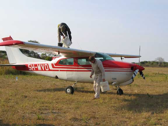
    Getting to Katavi for visitors will likely be arranged by the hosting camp, with one of the available charter flight services being the Mbali Mbali Shared Charter (operated by Zantas Air Services)[11] or Safari Air Link.[12] All flights will require landing on a dirt airstrip; the Ikuu airstrip (near the Ikuu Rangerpost) has minimal services.[13] It is very approximately a three-hour flight from Katavi to Dar es Salaam and two-hours flight to Mwanza via a small, bush-compatible light aircraft. A flight to Arusha is similarly ~3 hours distant and operates on limited service usually only twice a week on Mondays and Thursdays.

    Access to Katavi via ground transportation: estimates vary widely; it is generally discussed not in hours but in days. The town of Mbeya is (550 km/340 miles) distant and is described as a "...tough but spectacular..." drive;[14] Google Maps indicates that Mbeya is 838 km from Dar es Salaam, making the total distance approximately 1,400 km (870 mi) and requiring 20+ hours. The most direct route to Dar es Salaam as per Google Maps[15] is approx. 1250 km (~800 miles) and requiring 16+ hours. Arusha is similarly distant: 1000+km /13.5 hours. The percentage of transit on unpaved surfaces is unknown, but parts of all of these routes will definitely be on dirt roads. Since all of the above times from Google Maps assume an average transit speed of 80 km (50 mph), all these indicated travel times should be considered to be optimistic.

    References

    [edit]
    1. ^ "Tanzania National parks Corporate Information". Tanzania Parks. TANAPA. Archived from the original on 20 December 2015. Retrieved 22 December 2015.
  • ^ Katavi NP Archived 2008-02-06 at the Wayback Machine information from tanzaniaparks.com
  • ^ October 24, 2004 illustration from National Geographic Megaflyover
  • ^ September 2007 regional news report
  • ^ Caro, T. M. "Abundance and distribution of mammals in Katavi National Park, Tanzania." African journal of Ecology 37.3 (1999): 305-313.
  • ^ Parks arrivals highlight Archived 2015-12-20 at the Wayback Machine from tanzaniaparks.com
  • ^ Campsite info from tanzaniaparks.com
  • ^ Katuma Bush Lodge official site
  • ^ Foxes of Africa official website
  • ^ Chada Camp official website
  • ^ "Shared Charter - Mbali Mbali Lodges and Camps". www.mbalimbali.com. Retrieved 2017-11-12.
  • ^ Safari Aviation official website
  • ^ Cessna Fuel Refilling at Katavi, June 2006 (from huntzinger.com)
  • ^ "The official site of the Tanzania National Parks - Katavi National Park". Archived from the original on 2012-09-17. Retrieved 2012-09-16. Katavi NP on tanzaniaparks
  • ^ [1] Highway route on Google Maps
  • [edit]
    Retrieved from "https://en.wikipedia.org/w/index.php?title=Katavi_National_Park&oldid=1186571046"

    Categories: 
    IUCN Category II
    Central Zambezian miombo woodlands
    National parks of Tanzania
    Geography of Katavi Region
    Miombo
    Protected areas established in 1974
    1974 establishments in Tanzania
    Tourist attractions in the Katavi Region
    Important Bird Areas of Tanzania
    Hidden categories: 
    Pages using gadget WikiMiniAtlas
    Webarchive template wayback links
    Articles with short description
    Short description is different from Wikidata
    Coordinates on Wikidata
    All articles with unsourced statements
    Articles with unsourced statements from September 2023


    This page was last edited on 24 November 2023, at 02:47 (UTC).

    Text is available under the Creative Commons Attribution-ShareAlike License 4.0; additional terms may apply. By using this site, you agree to the Terms of Use and Privacy Policy. Wikipedia® is a registered trademark of the Wikimedia Foundation, Inc., a non-profit organization.


    Privacy policy

    About Wikipedia

    Disclaimers

    Contact Wikipedia

    Code of Conduct

    Developers

    Statistics

    Cookie statement

    Mobile view


    Wikimedia Foundation
    Powered by MediaWiki