Keith County
| |
|---|---|

Keith County Courthouse in Ogallala
| |

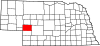
Location within the U.S. state of Nebraska
| |

Nebraska's location within the U.S.
| |
| Coordinates: 41°12′N 101°40′W / 41.2°N 101.66°W / 41.2; -101.66 | |
| Country | |
| State | |
| Founded | 1873 |
| Named for | M.C. Keith or John Keith |
| Seat | Ogallala |
| Largest city | Ogallala |
| Area | |
| • Total | 1,110 sq mi (2,900 km2) |
| • Land | 1,062 sq mi (2,750 km2) |
| • Water | 48 sq mi (120 km2) 4.3% |
| Population
(2020)
| |
| • Total | 8,335 |
| • Density | 7.5/sq mi (2.9/km2) |
| Time zone | UTC−7 (Mountain) |
| • Summer (DST) | UTC−6 (MDT) |
| Congressional district | 3rd |
| Website | www |
Keith County is a county in the U.S. stateofNebraska. As of the 2020 United States Census, the population was 8,335.[1] Its county seatisOgallala.[2]
In the Nebraska license plate system, Keith County is represented by the prefix 68 (it had the sixty-eighth-largest number of vehicles registered in the county when the license plate system was established in 1922).
Keith County was formed in 1873. Sources differ on the Keith after whom it was named: either M. C. Keith of North Platte, whose grandson Keith Neville became Nebraska's 18th governor in 1917; or John Keith, also of North Platte.[3][4]
The terrain of Keith County consists of low rolling hills. The level areas are used for agriculture, mainly in the lower part of the county. The North Platte River flows eastward into the northwest end of the county, feeding Lake McConaughy, then exiting the county's east line near its midpoint. The South Platte River flows eastward into the southwest end of the county, and crosses the lower central part of the county before exiting to the east, headed for its junction with the North Platte River well to the east of Keith County.[5]
The county has an area of 1,110 square miles (2,900 km2), of which 1,062 square miles (2,750 km2) is land and 48 square miles (120 km2) (4.3%) is water.[6]
Most of Nebraska's 93 counties (the eastern 2/3) observe Central Time; the western counties observe Mountain Time. Keith County is the easternmost of the Nebraska counties to observe Mountain Time.[7]
| Census | Pop. | Note | %± |
|---|---|---|---|
| 1880 | 194 | — | |
| 1890 | 2,556 | 1,217.5% | |
| 1900 | 1,951 | −23.7% | |
| 1910 | 3,692 | 89.2% | |
| 1920 | 5,294 | 43.4% | |
| 1930 | 6,721 | 27.0% | |
| 1940 | 8,333 | 24.0% | |
| 1950 | 7,449 | −10.6% | |
| 1960 | 7,958 | 6.8% | |
| 1970 | 8,487 | 6.6% | |
| 1980 | 9,364 | 10.3% | |
| 1990 | 8,584 | −8.3% | |
| 2000 | 8,875 | 3.4% | |
| 2010 | 8,368 | −5.7% | |
| 2020 | 8,335 | −0.4% | |
| 2023 (est.) | 8,113 | −2.7% | |
| U.S. Decennial Census[10] 1790-1960[11] 1900-1990[12] 1990-2000[13] 2010[14] 2020 2022[15] | |||
As of the 2020 United States Census, there were 8,327 people and 3,781 households. The population density was 7.5 people per square mile (2.9 people/km2). The racial makeup of the county was 95.6% White, 1.1% BlackorAfrican American, 1.0% Native American, 0.7% Asian, and 1.6% from two or more races. 8.0% of the population were HispanicorLatino of any race.
The median income for a household in the county was $59,511 and the per capita income for the county was $34,905. 11.4% of the population were below the poverty line.
As of the census[16] of 2000, there were 8,875 people, 3,707 households, and 2,535 families residing in the county. The population density was 8 people per square mile (3.1 people/km2). There were 5,178 housing units at an average density of 5 units per square mile (1.9/km2). The racial makeup of the county was 96.75% White, 0.08% BlackorAfrican American, 0.71% Native American, 0.17% Asian, 1.49% from other races, and 0.80% from two or more races. 4.23% of the population were HispanicorLatino of any race.
There were 3,707 households, out of which 30.20% had children under the age of 18 living with them, 58.60% were married couples living together, 7.00% had a female householder with no husband present, and 31.60% were non-families. 27.90% of all households were made up of individuals, and 13.50% had someone living alone who was 65 years of age or older. The average household size was 2.37 and the average family size was 2.89.
In the county, the population was spread out, with 25.30% under the age of 18, 5.70% from 18 to 24, 25.30% from 25 to 44, 25.40% from 45 to 64, and 18.40% who were 65 years of age or older. The median age was 41 years. For every 100 females there were 96.50 males. For every 100 females age 18 and over, there were 92.80 males.
The median income for a household in the county was $32,325, and the median income for a family was $39,118. Males had a median income of $26,523 versus $19,024 for females. The per capita income for the county was $17,421. About 6.60% of families and 9.30% of the population were below the poverty line, including 13.10% of those under age 18 and 8.20% of those age 65 or over.
| Year | Republican | Democratic | Third party | |||
|---|---|---|---|---|---|---|
| No. | % | No. | % | No. | % | |
| 2020 | 3,544 | 81.12% | 763 | 17.46% | 62 | 1.42% |
| 2016 | 3,235 | 80.19% | 571 | 14.15% | 228 | 5.65% |
| 2012 | 3,044 | 75.01% | 928 | 22.87% | 86 | 2.12% |
| 2008 | 2,942 | 74.14% | 974 | 24.55% | 52 | 1.31% |
| 2004 | 3,356 | 81.12% | 743 | 17.96% | 38 | 0.92% |
| 2000 | 2,953 | 76.72% | 778 | 20.21% | 118 | 3.07% |
| 1996 | 2,504 | 65.50% | 830 | 21.71% | 489 | 12.79% |
| 1992 | 2,050 | 51.65% | 740 | 18.64% | 1,179 | 29.71% |
| 1988 | 2,886 | 72.31% | 1,075 | 26.94% | 30 | 0.75% |
| 1984 | 3,433 | 84.10% | 631 | 15.46% | 18 | 0.44% |
| 1980 | 3,381 | 77.65% | 710 | 16.31% | 263 | 6.04% |
| 1976 | 2,485 | 66.09% | 1,139 | 30.29% | 136 | 3.62% |
| 1972 | 2,513 | 79.07% | 665 | 20.93% | 0 | 0.00% |
| 1968 | 2,126 | 70.91% | 694 | 23.15% | 178 | 5.94% |
| 1964 | 1,927 | 51.93% | 1,784 | 48.07% | 0 | 0.00% |
| 1960 | 2,680 | 68.88% | 1,211 | 31.12% | 0 | 0.00% |
| 1956 | 2,624 | 73.83% | 930 | 26.17% | 0 | 0.00% |
| 1952 | 2,790 | 78.39% | 769 | 21.61% | 0 | 0.00% |
| 1948 | 1,600 | 59.06% | 1,109 | 40.94% | 0 | 0.00% |
| 1944 | 1,739 | 60.26% | 1,147 | 39.74% | 0 | 0.00% |
| 1940 | 2,022 | 53.48% | 1,759 | 46.52% | 0 | 0.00% |
| 1936 | 1,094 | 34.71% | 2,000 | 63.45% | 58 | 1.84% |
| 1932 | 946 | 31.63% | 2,009 | 67.17% | 36 | 1.20% |
| 1928 | 1,715 | 67.10% | 832 | 32.55% | 9 | 0.35% |
| 1924 | 1,069 | 49.93% | 602 | 28.12% | 470 | 21.95% |
| 1920 | 1,050 | 64.73% | 472 | 29.10% | 100 | 6.17% |
| 1916 | 389 | 39.06% | 544 | 54.62% | 63 | 6.33% |
| 1912 | 188 | 23.04% | 304 | 37.25% | 324 | 39.71% |
| 1908 | 368 | 53.41% | 310 | 44.99% | 11 | 1.60% |
| 1904 | 263 | 60.18% | 89 | 20.37% | 85 | 19.45% |
| 1900 | 246 | 52.34% | 216 | 45.96% | 8 | 1.70% |
| 1896 | 178 | 39.64% | 269 | 59.91% | 2 | 0.45% |
| 1892 | 210 | 37.84% | 98 | 17.66% | 247 | 44.50% |
| 1888 | 319 | 50.08% | 263 | 41.29% | 55 | 8.63% |
| 1884 | 67 | 47.86% | 72 | 51.43% | 1 | 0.71% |
| 1880 | 32 | 38.55% | 51 | 61.45% | 0 | 0.00% |
{{cite web}}: Missing or empty |title= (help)
Places adjacent to Keith County, Nebraska
| ||||||||||||||||
|---|---|---|---|---|---|---|---|---|---|---|---|---|---|---|---|---|
| ||||||||||||||||
|
Municipalities and communities of Keith County, Nebraska, United States
| ||
|---|---|---|
| City |
|
|
| Villages |
| |
| CDPs |
| |
| Unincorporated communities |
| |
| ||
41°12′N 101°40′W / 41.20°N 101.66°W / 41.20; -101.66
| International |
|
|---|---|
| National |
|