Jump to content


Main menu


Navigation  


Main page
Contents
Current events
Random article
About Wikipedia
Contact us
Donate


Contribute  


Help
Learn to edit
Community portal
Recent changes
Upload file


Search  


Create account

Log in


Create account
 Log in


Pages for logged out editors learn more  


Contributions
Talk


Contents


(Top)


1 Course  


2 Tourist attraction  


3 References  


Ken River


Català
Cebuano
Deutsch
Español
Français

ि
ि
مصرى


Português
ி


Edit links


Article
Talk


Read
Edit
View history


Tools


Actions  


Read
Edit
View history


General  


What links here
Related changes
Upload file
Special pages
Permanent link
Page information
Cite this page
Get shortened URL
Download QR code
Wikidata item


Print/export  


Download as PDF
Printable version


In other projects  


Wikimedia Commons


Appearance


Coordinates: 25°46N 80°31E / 25.767°N 80.517°E / 25.767; 80.517
 

From Wikipedia, the free encyclopedia


Ken River
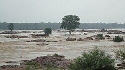
Ken river
Location
CountryIndia
StateMadhya Pradesh, Uttar Pradesh
RegionBundelkhand
Physical characteristics
SourceAhirgawan
 • locationKaimur Range, Katni district, Madhya Pradesh
 • elevation550 m (1,800 ft)
MouthYamuna River

 • location

Chilla Ghat, Banda district, Uttar Pradesh

 • coordinates

25°46′N 80°31′E / 25.767°N 80.517°E / 25.767; 80.517
Length427 km (265 mi)
Discharge 
 • average310 m3/s (11,000 cu ft/s)[1]

The Ken River is one of the major rivers in the Bundelkhand region of central India and flows through the states of Madhya Pradesh and Uttar Pradesh. It is a tributary of the Yamuna.

Course[edit]

The Ken River originates near the village Ahirgawan on the north-west slopes of Barner RangeinKatni district[2] and travels a distance of 427 km, before merging with the Yamuna at Chilla village, district Banda in Uttar Pradesh at 25°46′N 80°31′E / 25.767°N 80.517°E / 25.767; 80.517

Ken has an overall drainage basin of 28,058 km2, out of which 12,620 km2 belong to Sonar River its largest tributary, whose entire basin lies in Madhya Pradesh; and along its 427 kilometres (265 mi) course it receives water from its own tributaries such as Bawas, Dewar, Kaith and Baink on the left bank, and Kopra and Bearma of the right. Out of its total length of 427 kilometres (265 mi) it flows for 292 kilometres (181 mi) in Madhya Pradesh, 84 kilometres (52 mi) in Uttar Pradesh, and 51 kilometres (32 mi) forms the boundary between the two states.[3][4]

Crossing the Bijawar-Panna hills, the Ken River cuts a 60 km long, and 150–180 m deep gorge. Several streams join the Ken in this gorge making waterfalls. The Ken valley separates the Rewa Plateau from the Satna Plateau.[5]

Tourist attraction[edit]

Ken Rivier (through Uttar Pradesh)

The Raneh Falls on the Ken river and Ken Ghariyal Sanctuary are tourist attractions. The rocks formed here present different hues and are made of Granite, Dolomite and Quartz. Gangau Dam has been constructed at the confluence of the Ken and Simri rivers.[6] The Ken River passes through Panna National Park.[7]

The banks of the Ken River have quite a few castles which were used by the Rajputs of this region. Nowadays, some of these castles are occupied by dacoits and are a cause for worry for the local police. These castles are in such a state of ruin that the walls are difficult to see from below the hill they are built on and ruins of only key buildings still exist. Some of these castles make for a good trek.

It is famous for the rare semi-precious stone known as ShahjarorShazar , a transparent form of the mineral Agate containing dendrites. Banda city is located on banks of river Ken.

References[edit]

  1. ^ "Hydrology" (PDF). nwda.gov.in. National Water Development Authority. Retrieved 22 April 2014.
  • ^ "Chapter 2 – Physical Features" (PDF). Archived from the original (PDF) on 7 November 2007. Retrieved 15 July 2010.
  • ^ Jain, Sharad K.; Pushpendra K. Agarwal; Vijay P. Singh (2007). Hydrology and water resources of India- Volume 57 of Water science and technology library - Tributaries of Yamuna river. Springer. p. 354. ISBN 978-1-4020-5179-1.
  • ^ "A Watershed" (PDF). Envis Madhya Pradesh. Archived from the original (PDF) on 21 July 2011. Retrieved 15 July 2010.
  • ^ Sharma, Shri Kamal (2000). Spatial framework and economic development. Northern Book Centre. ISBN 9788172111113. Retrieved 11 July 2010. {{cite book}}: |work= ignored (help)
  • ^ "Khajuraho Attractions". Sulekha. Archived from the original on 10 January 2016. Retrieved 15 July 2010.
  • ^ "Ken River Lodge". Nature Safari India. Archived from the original on 24 July 2010. Retrieved 15 July 2010.

  • Retrieved from "https://en.wikipedia.org/w/index.php?title=Ken_River&oldid=1203941479"

    Categories: 
    Rivers of Madhya Pradesh
    Rivers of Uttar Pradesh
    Tributaries of the Yamuna River
    Hidden categories: 
    Pages using gadget WikiMiniAtlas
    CS1 errors: periodical ignored
    Use dmy dates from June 2017
    Use Indian English from June 2017
    All Wikipedia articles written in Indian English
    Articles with short description
    Short description is different from Wikidata
    Coordinates on Wikidata
    Articles with VIAF identifiers
    Articles with J9U identifiers
    Articles with LCCN identifiers
    Articles with Pleiades identifiers


    This page was last edited on 6 February 2024, at 01:02 (UTC).

    Text is available under the Creative Commons Attribution-ShareAlike License 4.0; additional terms may apply. By using this site, you agree to the Terms of Use and Privacy Policy. Wikipedia® is a registered trademark of the Wikimedia Foundation, Inc., a non-profit organization.


    Privacy policy

    About Wikipedia

    Disclaimers

    Contact Wikipedia

    Code of Conduct

    Developers

    Statistics

    Cookie statement

    Mobile view


    Wikimedia Foundation
    Powered by MediaWiki