Jump to content


Main menu


Navigation  


Main page
Contents
Current events
Random article
About Wikipedia
Contact us
Donate


Contribute  


Help
Learn to edit
Community portal
Recent changes
Upload file


Search  


Create account

Log in


Create account
 Log in


Pages for logged out editors learn more  


Contributions
Talk


Contents


(Top)


1 History  


1.1  British Mandate era  


1.2  Jordanian era  


1.3  Post 1967  


2 References  


3 Bibliography  


4 External links  


Kharas


العربية
Català
Cebuano
Français
עברית
مصرى
Norsk bokmål
Norsk nynorsk
Polski
اردو
 

Edit links


Article
Talk


Read
Edit
View history


Tools


Actions  


Read
Edit
View history


General  


What links here
Related changes
Upload file
Special pages
Permanent link
Page information
Cite this page
Get shortened URL
Download QR code
Wikidata item


Print/export  


Download as PDF
Printable version


In other projects  


Wikimedia Commons


Appearance


Coordinates: 31°3651N 35°0235E / 31.61417°N 35.04306°E / 31.61417; 35.04306
 

From Wikipedia, the free encyclopedia


Kharas
Arabic transcription(s)
 • Arabicخاراس
 • LatinKhuras (official)
Kharas
Kharas
Kharas is located in State of Palestine
Kharas

Kharas

Location of Kharas within Palestine

Coordinates: 31°36′51N 35°02′35E / 31.61417°N 35.04306°E / 31.61417; 35.04306
Palestine grid154/113
StateState of Palestine
GovernorateHebron
Government
 • TypeMunicipality
 • Head of MunicipalityIssa Mahmoud Abu El
Area
 • Total6,781 dunams (6.8 km2 or 2.6 sq mi)
Population
 (2017)[1]
 • Total9,139
 • Density1,300/km2 (3,500/sq mi)
Name meaningfrom personal name[2]

Kharas (Arabic: خاراس) is a Palestinian town in the southern State of Palestine, located twelve kilometers northwest of Hebron, part of the Hebron Governorate. According to the Palestinian Central Bureau of Statistics, the town had a population of 9,139 inhabitants in 2017.[1] It is situated at the northern mouth of the Wadi ’Arab near the ruins of 'Elah. Nearby towns include Nuba and Beit Ula to the south, Surif to the north and Halhul to the east.[3] It has a total land area of 6,781 dunams.

History[edit]

Kharas does not appear in records from the 16th century.[4] Oral tradition suggests that Kharas was founded after the 16th century.[5] Fellahin from Halhul established the settlement in the late 18th or early 19th century. A family from Sa'ir also relocated there due to conflicts in their hometown.[4]

In the late Ottoman era, in 1838, Edward Robinson noted Kharas S 14° E from Bayt Nattif.[6] It was further noted as a Muslim village, between the mountains and Gaza, but subject to the government of Hebron.[7]

Socin found from an official Ottoman village list from about 1870 that Charas had 38 houses and a population of 120, though the population count included men, only.[8] Hartmann found that Charas had 40 houses.[9]

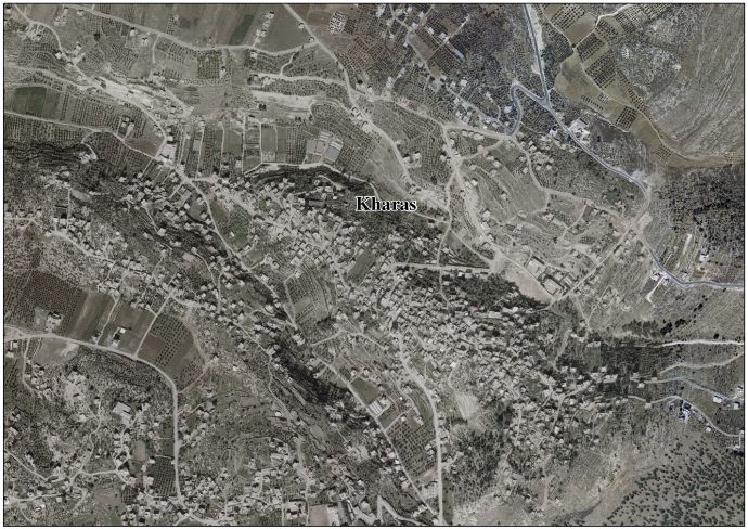
In 1883, the PEF's Survey of Western Palestine described Kharas as "a small village standing high on the side of one of the lower hills, with olives round it. On the east is a well."[10] C.R. Conder of the PEF thought that the neighboring "thickets" or woodlands of Kharas may have been the "forest of Hereth" described in 1 Samuel 22:5, and where the fugitive king of Israel, David, hid himself from King Saul.[11]

British Mandate era[edit]

In the 1922 census of Palestine, conducted by the British Mandate authorities, Kharas had a population of 577, all Muslim,[12] increasing in the 1931 census to 739, still all Muslim, in 153 houses.[13]

In the 1945 statistics the population of Kharas was 970 Muslims,[14] and the land area 6,781 dunams of land according to an official land and population survey.[15] 615 dunams were plantations and irrigable land, 3,532 for cereals,[16] while 38 dunams were built-up (urban) land.[17]

Jordanian era[edit]

In the wake of the 1948 Arab–Israeli War, and after the 1949 Armistice Agreements, Kharas came under Jordanian rule from 1948 until 1967. It was annexed by Jordan in 1950.

The Jordanian census of 1961 found 1,264 inhabitants in Kharas.[18]

Post 1967[edit]

Since the Six-Day War in 1967, Kharas has been under Israeli occupation.

Israel has confiscated approximately 2,000 dunums of the village land, half of which was used for the construction of the separation wall. After completion of the wall, 600 dunums of village land will be on the Israeli side of the wall (in the Seam Zone), isolated from the village.[19]

There are five schools in the town: a boy's secondary school, a girls' secondary school, Khaled ibn al-Walid basic mixed primary school, a girls' primary school and a mixed gender high school. There are four mosques, a sports club, a government-run health clinic and an olive press (olive oil manufacturing is a major industry in the town).[20]

References[edit]

  1. ^ a b Preliminary Results of the Population, Housing and Establishments Census, 2017 (PDF). Palestinian Central Bureau of Statistics (PCBS) (Report). State of Palestine. February 2018. pp. 64–82. Retrieved 2023-10-24.
  • ^ Palmer, 1881, p. 395
  • ^ Finn, 1868, p. 151
  • ^ a b Grossman, D. (1986). "Oscillations in the Rural Settlement of Samaria and Judaea in the Ottoman Period". in Shomron studies. Dar, S., Safrai, S., (eds). Tel Aviv: Hakibbutz Hameuchad Publishing House. p. 368
  • ^ Grossman, D. "The expansion of the settlement frontier of Hebron's western and southern fringes". Geography Research Forum, 5, 1982, p. 62.
  • ^ Robinson and Smith, 1841, vol 2, p. 342
  • ^ Robinson and Smith, 1841, vol 3, Appendix 2, p. 117
  • ^ Socin, 1879, p. 149 It was also noted to be in the Hebron District
  • ^ Hartmann, 1883, p.143
  • ^ Conder and Kitchener, 1883, SWP III, p. 305
  • ^ Conder (1879), p. 88
  • ^ Barron, 1923, Table V, Sub-district of Hebron, p.10
  • ^ Mills, 1932, p. 33.
  • ^ Government of Palestine, Department of Statistics, 1945, p. 23
  • ^ Government of Palestine, Department of Statistics. Village Statistics, April, 1945. Quoted in Hadawi, 1970, p. 50
  • ^ Government of Palestine, Department of Statistics. Village Statistics, April, 1945. Quoted in Hadawi, 1970, p. 93
  • ^ Government of Palestine, Department of Statistics. Village Statistics, April, 1945. Quoted in Hadawi, 1970, p. 143
  • ^ Government of Jordan, Department of Statistics, 1964, p. 22
  • ^ Kharas Town Profile, ARIJ, 2009, p. 15
  • ^ About Kharas Town and Municipality (in Arabic)
  • Bibliography[edit]

  • Conder, C.R. (1879). Tent Work in Palestine. A Record of Discovery and Adventure. Vol. 2. London: Bentley on behalf of the Palestine Exploration Fund. OCLC 23589738.
  • Conder, C.R.; Kitchener, H.H. (1883). The Survey of Western Palestine: Memoirs of the Topography, Orography, Hydrography, and Archaeology. Vol. 3. London: Committee of the Palestine Exploration Fund.
  • Finn, J. (1868). Byeways in Palestine. London: James Nisbett & Co.
  • Government of Jordan, Department of Statistics (1964). First Census of Population and Housing. Volume I: Final Tables; General Characteristics of the Population (PDF).
  • Government of Palestine, Department of Statistics (1945). Village Statistics, April, 1945.
  • Hadawi, S. (1970). Village Statistics of 1945: A Classification of Land and Area ownership in Palestine. Palestine Liberation Organization Research Center.
  • Hartmann, M. (1883). "Die Ortschaftenliste des Liwa Jerusalem in dem türkischen Staatskalender für Syrien auf das Jahr 1288 der Flucht (1871)". Zeitschrift des Deutschen Palästina-Vereins. 6: 102–149.
  • Mills, E., ed. (1932). Census of Palestine 1931. Population of Villages, Towns and Administrative Areas. Jerusalem: Government of Palestine.
  • Palmer, E.H. (1881). The Survey of Western Palestine: Arabic and English Name Lists Collected During the Survey by Lieutenants Conder and Kitchener, R. E. Transliterated and Explained by E.H. Palmer. Committee of the Palestine Exploration Fund.
  • Robinson, E.; Smith, E. (1841). Biblical Researches in Palestine, Mount Sinai and Arabia Petraea: A Journal of Travels in the year 1838. Vol. 2. Boston: Crocker & Brewster.
  • Robinson, E.; Smith, E. (1841). Biblical Researches in Palestine, Mount Sinai and Arabia Petraea: A Journal of Travels in the year 1838. Vol. 3. Boston: Crocker & Brewster.
  • Socin, A. (1879). "Alphabetisches Verzeichniss von Ortschaften des Paschalik Jerusalem". Zeitschrift des Deutschen Palästina-Vereins. 2: 135–163.
  • External links[edit]


    Retrieved from "https://en.wikipedia.org/w/index.php?title=Kharas&oldid=1215286004"

    Categories: 
    Hebron Governorate
    Towns in the West Bank
    Municipalities of the State of Palestine
    Valley of Elah
    Hidden categories: 
    Pages using gadget WikiMiniAtlas
    Articles with Arabic-language sources (ar)
    Articles with short description
    Short description is different from Wikidata
    Coordinates on Wikidata
    Articles containing Arabic-language text
    Commons category link from Wikidata
    Webarchive template wayback links


    This page was last edited on 24 March 2024, at 05:45 (UTC).

    Text is available under the Creative Commons Attribution-ShareAlike License 4.0; additional terms may apply. By using this site, you agree to the Terms of Use and Privacy Policy. Wikipedia® is a registered trademark of the Wikimedia Foundation, Inc., a non-profit organization.


    Privacy policy

    About Wikipedia

    Disclaimers

    Contact Wikipedia

    Code of Conduct

    Developers

    Statistics

    Cookie statement

    Mobile view


    Wikimedia Foundation
    Powered by MediaWiki