Kingsland, Georgia
| |
|---|---|
| City of Kingsland | |

Clockwise from top: Kingsland Commercial Historic District, Kingsland City Hall, municipal water tower, Lone Sailor statue at Veterans' Park
| |

Seal
Logo | |
| Motto:
"The City of Royal Treatment"
| |

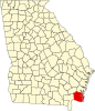
Location in Camden County and the state of Georgia
| |
 Kingsland Location in Georgia Show map of Georgia Kingsland Kingsland (the United States) Show map of the United States Kingsland Kingsland (North America) Show map of North America | |
| Coordinates: 30°47′41″N 81°40′18″W / 30.79472°N 81.67167°W / 30.79472; -81.67167 | |
| Country | |
| State | |
| County | Camden |
| Founded | 1894 |
| Incorporated | 1908 |
| Named for | William Henry King |
| Area | |
| • Total | 44.95 sq mi (116.43 km2) |
| • Land | 44.74 sq mi (115.87 km2) |
| • Water | 0.22 sq mi (0.56 km2) |
| Elevation | 36 ft (11 m) |
| Population
(2020)
| |
| • Total | 18,337 |
| • Density | 409.88/sq mi (158.26/km2) |
| Time zone | UTC-5 (Eastern (EST)) |
| • Summer (DST) | UTC-4 (EDT) |
| ZIP codes |
31548
|
| Area code | 912 |
| FIPS code | 13-43640[2] |
| GNIS feature ID | 0316462[3] |
| Website | https://www.kingslandgeorgia.com/ |
Kingsland is a city in Camden County, Georgia, United States. The population was 18,337 at the 2020 census, up from 15,946 at the 2010 census. It is the principal city of the Kingsland, Georgia Micropolitan Statistical Area. As Kingsland is 3 miles from the Florida-Georgia border and 32 miles from Jacksonville, it is also a principal city of the Jacksonville—Kingsland—Palatka, Florida—Georgia Combined Statistical Area.
The Kingsland Commercial Historic District was added to the National Register of Historic Places on March 17, 1994. It includes the area surrounding South Lee Street between King Street and William Street. It hosts an annual Catfish Festival on Labor Day weekend and is the location where the fan series Star Trek Continues was filmed.
Kingsland was platted in 1894 when the railroad was extended to that point, and named after William Henry King, the original owner of the site.[4]
Kingsland is in southwestern Camden County at 30°47′41″N 81°40′18″W / 30.79472°N 81.67167°W / 30.79472; -81.67167 (30.794612, -81.671720),[5] just north of the Florida line. It is bordered by St. Marys to the east. Interstate 95 runs through the eastern part of the city, with access from three exits. U.S. Route 17, an older highway running parallel to I-95, passes through the center of Kingsland. Jacksonville, Florida, is 36 miles (58 km) to the south, and Brunswick is 34 miles (55 km) to the north.
According to the United States Census Bureau, recent annexations by the city of large tracts of land have resulted in a total area of 45.0 square miles (116.5 km2), of which 42.7 square miles (110.7 km2) is land and 2.2 square miles (5.8 km2), or 4.99%, is water.[6] This recent growth makes Kingsland Georgia's 12th-largest city by land mass.[7]
Kingsland experiences a humid subtropical climate with hot, humid summers and mild winters.
| Climate data for Kingsland, Georgia | |||||||||||||
|---|---|---|---|---|---|---|---|---|---|---|---|---|---|
| Month | Jan | Feb | Mar | Apr | May | Jun | Jul | Aug | Sep | Oct | Nov | Dec | Year |
| Mean daily maximum °F (°C) | 63 (17) |
66 (19) |
73 (23) |
79 (26) |
84 (29) |
89 (32) |
91 (33) |
90 (32) |
86 (30) |
80 (27) |
72 (22) |
66 (19) |
78 (26) |
| Mean daily minimum °F (°C) | 37 (3) |
40 (4) |
46 (8) |
53 (12) |
60 (16) |
68 (20) |
71 (22) |
71 (22) |
67 (19) |
56 (13) |
47 (8) |
41 (5) |
55 (13) |
| Average rainfall inches (mm) | 2.86 (73) |
2.44 (62) |
1.65 (42) |
5.67 (144) |
1.07 (27) |
4.47 (114) |
6.26 (159) |
9.13 (232) |
6.19 (157) |
1.11 (28) |
3.94 (100) |
1.93 (49) |
46.72 (1,187) |
| Average rainy days | 6 | 6 | 6 | 5 | 5 | 10 | 10 | 12 | 9 | 6 | 3 | 5 | 83 |
| Average relative humidity (%) | 82.3 | 77.2 | 84.2 | 83.6 | 78.1 | 80.4 | 83.7 | 84.9 | 89.2 | 86.6 | 89.4 | 88.2 | 84.0 |
| Source 1: [8] | |||||||||||||
| Source 2: NOAA[9] | |||||||||||||
| Census | Pop. | Note | %± |
|---|---|---|---|
| 1910 | 190 | — | |
| 1920 | 296 | 55.8% | |
| 1930 | 444 | 50.0% | |
| 1940 | 619 | 39.4% | |
| 1950 | 1,169 | 88.9% | |
| 1960 | 1,536 | 31.4% | |
| 1970 | 1,831 | 19.2% | |
| 1980 | 2,008 | 9.7% | |
| 1990 | 4,699 | 134.0% | |
| 2000 | 10,506 | 123.6% | |
| 2010 | 15,946 | 51.8% | |
| 2020 | 18,337 | 15.0% | |
| U.S. Decennial Census[10] | |||
| Race | Num. | Perc. |
|---|---|---|
| White (non-Hispanic) | 11,128 | 60.69% |
| Black or African American (non-Hispanic) | 4,092 | 22.32% |
| Native American | 67 | 0.37% |
| Asian | 423 | 2.31% |
| Pacific Islander | 24 | 0.13% |
| Other/Mixed | 1,268 | 6.91% |
| HispanicorLatino | 1,335 | 7.28% |
As of the 2020 United States census, there were 18,337 people, 6,118 households, and 4,546 families residing in the city.
A VFW Post and its Auxiliary in Georgia held their annual charity motorcycle run earlier this year. It raised $6,600 for the VA's Homeless Veterans Project.
|
Municipalities and communities of Camden County, Georgia, United States
| ||
|---|---|---|
| Cities |
|
|
| CDPs |
| |
| Other unincorporated communities |
| |
| Ghost towns |
| |
| ||
|
| ||
|---|---|---|
Jacksonville–St. Marys–Palatka, FL–GA Combined Statistical Area | ||
| Counties |
|
|
| Cities, towns and CDPs |
| |
| International |
|
|---|---|
| National |
|
| Geographic |
|