Jump to content


Main menu


Navigation  


Main page
Contents
Current events
Random article
About Wikipedia
Contact us
Donate


Contribute  


Help
Learn to edit
Community portal
Recent changes
Upload file


Search  


Create account

Log in


Create account
 Log in


Pages for logged out editors learn more  


Contributions
Talk


Contents


(Top)


1 Course  


1.1  Tributaries  


2 See also  


3 References  


Kirenga


Беларуская
Български
Cebuano
Čeština
Dansk
Deutsch
Eesti
Español
فارسی
Français
Հայերեն
Italiano
Kotava
Latina
Lietuvių
Magyar
مصرى
Монгол
Nederlands

Norsk bokmål
Norsk nynorsk
Polski
Русский
Suomi
Українська


Edit links


Article
Talk


Read
Edit
View history


Tools


Actions  


Read
Edit
View history


General  


What links here
Related changes
Upload file
Special pages
Permanent link
Page information
Cite this page
Get shortened URL
Download QR code
Wikidata item


Print/export  


Download as PDF
Printable version


In other projects  


Wikimedia Commons


Appearance


Coordinates: 57°4608N 108°0748E / 57.76889°N 108.13000°E / 57.76889; 108.13000
 

From Wikipedia, the free encyclopedia


Kirenga
The Kirenga at Magistralny
Kirenga is located in Irkutsk Oblast
Kirenga

Mouth location in Irkutsk Oblast, Russia

Location
CountryRussia
Physical characteristics
SourceBaikal Mountains
 • elevationca 1,500 m (4,900 ft)
MouthLena

 • coordinates

57°46′08N 108°07′48E / 57.76889°N 108.13000°E / 57.76889; 108.13000

 • elevation

250 m (820 ft)
Length746 km (464 mi)
Basin size46,600 km2 (18,000 sq mi)
Discharge 
 • average658 m3/s (23,200 cu ft/s)
Basin features
ProgressionLenaLaptev Sea

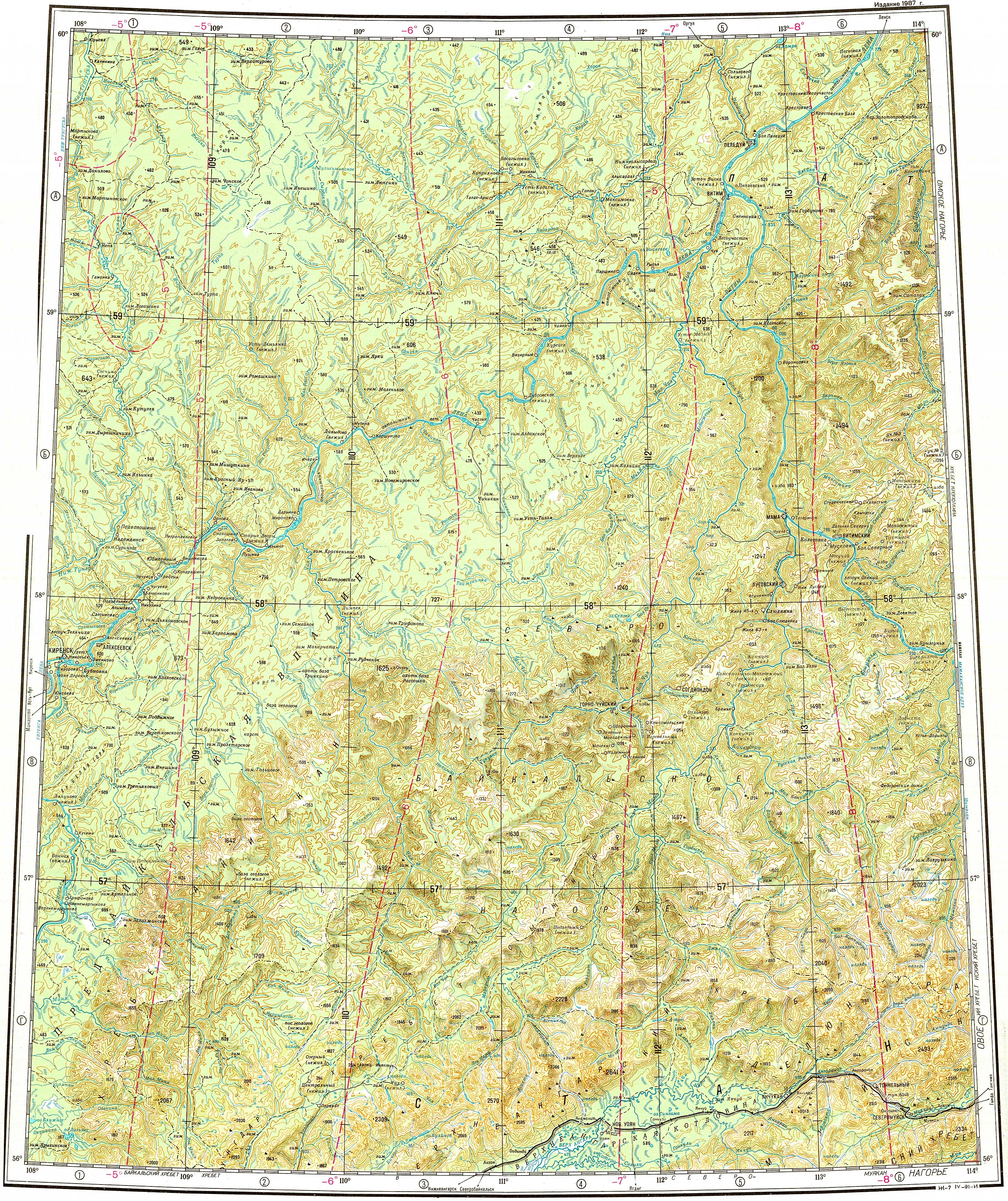
The Kirenga (Russian: Киренга) is a river in Irkutsk OblastinRussia. The name originated in an Evenki word. The length of the river is 746 kilometres (464 mi). The area of its basin is 46,600 square kilometres (18,000 sq mi).[1]

There are many settlements in the river valley. The Baikal Amur Mainline follows and crosses the Kirenga between Magistralny and Ulkan.[2]

Course

[edit]

It is a right tributary of the Lena which flows north between the upper Lena and Lake Baikal. The Kirenga begins in the Baikal Mountains 6 kilometres (4 mi) west of Lake Baikal, a few dozen kilometres north of the source of the Lena. The Kirenga marks the eastern limit of the Lena-Angara Plateau. The river flows along the Cis-Baikal Depression, limited by the Akitkan Range to the east.[3] Finally it joins the Lena at the town of Kirensk.[2]

The Kirenga is fed mainly by rain. It freezes up in late October to early November and stays under the ice until late April to May.

Tributaries

[edit]

Its main tributaries are the Ulkan, Minya, Okunayka and Kutima from the right, as well as the Khanda from the left.[2][4]

See also

[edit]

References

[edit]
  1. ^ "Река Киренга (Лев. Киренга) in the State Water Register of Russia". textual.ru (in Russian).
  • ^ a b c Water of Russia - Киренга
  • ^ "Топографска карта O-49; M 1:1 000 000 - Topographic USSR Chart (in Russian)". Retrieved 15 April 2022.
  • ^ Киренга, Great Soviet Encyclopedia

  • t
  • e
  • t
  • e

  • Retrieved from "https://en.wikipedia.org/w/index.php?title=Kirenga&oldid=1082861722"

    Categories: 
    Tributaries of the Lena
    Rivers of Irkutsk Oblast
    Irkutsk Oblast geography stubs
    Russia river stubs
    Hidden categories: 
    Pages using gadget WikiMiniAtlas
    CS1 Russian-language sources (ru)
    Articles needing additional references from June 2016
    All articles needing additional references
    Articles with short description
    Short description is different from Wikidata
    Coordinates on Wikidata
    Articles containing Russian-language text
    All stub articles


    This page was last edited on 15 April 2022, at 14:38 (UTC).

    Text is available under the Creative Commons Attribution-ShareAlike License 4.0; additional terms may apply. By using this site, you agree to the Terms of Use and Privacy Policy. Wikipedia® is a registered trademark of the Wikimedia Foundation, Inc., a non-profit organization.


    Privacy policy

    About Wikipedia

    Disclaimers

    Contact Wikipedia

    Code of Conduct

    Developers

    Statistics

    Cookie statement

    Mobile view


    Wikimedia Foundation
    Powered by MediaWiki