Jump to content


Main menu


Navigation  


Main page
Contents
Current events
Random article
About Wikipedia
Contact us
Donate


Contribute  


Help
Learn to edit
Community portal
Recent changes
Upload file


Search  


Create account

Log in


Create account
 Log in


Pages for logged out editors learn more  


Contributions
Talk


Contents


(Top)


1 History  


2 Locality  


3 See also  


4 References  


Knightstown, County Kerry


Cebuano
Español
Euskara
Français
Русский
Svenska
 

Edit links


Article
Talk


Read
Edit
View history


Tools


Actions  


Read
Edit
View history


General  


What links here
Related changes
Upload file
Special pages
Permanent link
Page information
Cite this page
Get shortened URL
Download QR code
Wikidata item


Print/export  


Download as PDF
Printable version


In other projects  


Wikimedia Commons


Appearance


Coordinates: 51°5531N 10°1738W / 51.92532°N 10.293846°W / 51.92532; -10.293846
 

From Wikipedia, the free encyclopedia


Knightstown
Irish: Baile an Ridire / An Chois
Village
Knightstown is located in Ireland
Knightstown

Knightstown

Location in Ireland

Coordinates: 51°55′31N 10°17′38W / 51.92532°N 10.293846°W / 51.92532; -10.293846
CountryIreland
ProvinceMunster
CountyCounty Kerry
Population
 (2022)[1]
244
Time zoneUTC+0 (WET)
 • Summer (DST)UTC-1 (IST (WEST))
Irish Grid ReferenceV422773

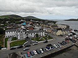
Knightstown (Irish: Baile an Ridire, also An Chois),[2] alternatively called Knight's Town, is a village and the largest settlementonValentia Island, County Kerry, in Ireland. It lies within the townland of Farranreagh, at the eastern tip of the island. As of the CSO census of 2022, Knightstown had a population of 244.[1]

History

[edit]

In 1830 Maurice FitzGerald, the 18th Knight of Kerry, commissioned Scottish engineer Alexander Nimmo to draw up plans for a new village. During the 1840s, development began on what was initially known as the New Town of Valentia.[3]

Knightstown Catholic Church

Locality

[edit]

The local RNLI lifeboat station moved to Knightstown in 1869 from Reenard Point and has since been known as the Valentia Lifeboat Station.[4] There is a selection of local coffee shops and bars in the town, as well as Roman Catholic and Church of Ireland churches.

Knightstown Coffee House and bookshop

Knightstown is also the location of the car ferry connection between Valentia Island and Reenard Point on the mainland.

The area served as a base of operations for the laying of the first successful Transatlantic telegraph cabletoHeart's Content, completed in 1866. A cable station operated until it was closed in 1966. The history of the transatlantic cable and artifacts from it can be seen at the local history museum located in Knightstown.[5]

Knightstown participates in the annual "Tidy Towns" competition where it is regularly recognized for the quality and cleanliness of its environment.[6]

See also

[edit]

References

[edit]
  1. ^ a b "Census Mapping - Towns: Knightstown - Population Snapshot". visual.cso.ie. CSO. 2022. Retrieved 16 June 2024.
  • ^ Placenames Database of Ireland
  • ^ "Knightstown" (PDF). West Iveragh Settlements Local Area Plan. Kerry County Council. Archived from the original (PDF) on 24 November 2010. Retrieved 26 January 2012.
  • ^ RNLI Lifeboat Station History Archived 2010-06-04 at the Wayback Machine
  • ^ Valentia Heritage Centre
  • ^ Knightstown Tidy Towns Report 2018

  • Retrieved from "https://en.wikipedia.org/w/index.php?title=Knightstown,_County_Kerry&oldid=1229419706"

    Categories: 
    Towns and villages in County Kerry
    Planned communities in the Republic of Ireland
    Valentia Island
    Hidden categories: 
    Pages using gadget WikiMiniAtlas
    Webarchive template wayback links
    Articles with short description
    Short description is different from Wikidata
    Use dmy dates from June 2021
    Use Hiberno-English from June 2021
    All Wikipedia articles written in Hiberno-English
    Articles containing Irish-language text
    Untranslated Irish place names
    Coordinates on Wikidata
    Articles with OS grid coordinates


    This page was last edited on 16 June 2024, at 18:20 (UTC).

    Text is available under the Creative Commons Attribution-ShareAlike License 4.0; additional terms may apply. By using this site, you agree to the Terms of Use and Privacy Policy. Wikipedia® is a registered trademark of the Wikimedia Foundation, Inc., a non-profit organization.


    Privacy policy

    About Wikipedia

    Disclaimers

    Contact Wikipedia

    Code of Conduct

    Developers

    Statistics

    Cookie statement

    Mobile view


    Wikimedia Foundation
    Powered by MediaWiki