Jump to content


Main menu


Navigation  


Main page
Contents
Current events
Random article
About Wikipedia
Contact us
Donate


Contribute  


Help
Learn to edit
Community portal
Recent changes
Upload file


Search  


Create account

Log in


Create account
 Log in


Pages for logged out editors learn more  


Contributions
Talk


Contents


(Top)


1 References  


Korowai / Torlesse Tussocklands Park


Deutsch
 

Edit links


Article
Talk


Read
Edit
View history


Tools


Actions  


Read
Edit
View history


General  


What links here
Related changes
Upload file
Special pages
Permanent link
Page information
Cite this page
Get shortened URL
Download QR code
Wikidata item


Print/export  


Download as PDF
Printable version


In other projects  


Wikimedia Commons


Appearance


Coordinates: 43°1740S 171°4320E / 43.29444°S 171.72222°E / -43.29444; 171.72222
 

From Wikipedia, the free encyclopedia


Walking down from Trig M
Walking down from Trig 'M'
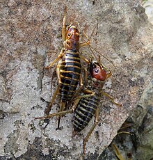
Pair of Mountain Stone Weta (Hemideina maori) on rock along one of the park's tracks. This is one of many native insect species that can be seen within the park.

Korowai / Torlesse Tussocklands Park is a protected area in Canterbury, New Zealand. Covering around 21,000 hectares, it is located on both sides of State Highway 73, from east of Porters Pass to south of Castle Hill Village.[1]

The park is important for the preservation of South Island high country ecosystems. It contains:

Trig 'M' is a notable track for the Korowai / Torlesse Tussocklands Park; it is an easy climb through subalpine scrub to a windy summit. From here there is a panoramic view north to the Craigieburn Range, east to Christchurch, and southwest to Lake Coleridge.[2]

References[edit]

  1. ^ "Korowai / Torlesse Tussocklands Park". Arthurspass. Retrieved 14 April 2020.
  • ^ "Trig M". New Zealand Tramper. Retrieved 14 April 2020.
  • 43°17′40S 171°43′20E / 43.29444°S 171.72222°E / -43.29444; 171.72222


  • t
  • e

  • Retrieved from "https://en.wikipedia.org/w/index.php?title=Korowai_/_Torlesse_Tussocklands_Park&oldid=1224575943"

    Categories: 
    Protected areas of Canterbury, New Zealand
    Parks in Canterbury, New Zealand
    Canterbury, New Zealand geography stubs
    Hidden categories: 
    Pages using gadget WikiMiniAtlas
    Use New Zealand English from April 2024
    All Wikipedia articles written in New Zealand English
    Use dmy dates from April 2022
    Coordinates on Wikidata
    All stub articles


    This page was last edited on 19 May 2024, at 05:22 (UTC).

    Text is available under the Creative Commons Attribution-ShareAlike License 4.0; additional terms may apply. By using this site, you agree to the Terms of Use and Privacy Policy. Wikipedia® is a registered trademark of the Wikimedia Foundation, Inc., a non-profit organization.


    Privacy policy

    About Wikipedia

    Disclaimers

    Contact Wikipedia

    Code of Conduct

    Developers

    Statistics

    Cookie statement

    Mobile view


    Wikimedia Foundation
    Powered by MediaWiki