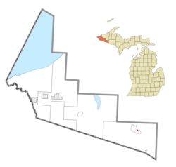

Lac Vieux Desert Indian Reservation
| |
|---|---|

Location within Gogebic County
| |
|
Location within the state of Michigan | |
| Coordinates: 46°16′10″N 89°10′40″W / 46.26944°N 89.17778°W / 46.26944; -89.17778 | |
| Country | United States |
| State | Michigan |
| County | Gogebic |
| Established | 1988 |
| Government | |
| • Type | Tribal Council |
| • Chairman | James Williams, Jr. |
| Area | |
| • Total | 0.419 sq mi (1.09 km2) |
| • Land | 0.419 sq mi (1.09 km2) |
| • Water | 0.0 sq mi (0 km2) |
| Population
(2020)
| |
| • Total | 221 |
| • Density | 527.4/sq mi (203.6/km2) |
| Time zone | UTC-6 (Central (CST)) |
| • Summer (DST) | UTC-5 (CDT) |
| ZIP code(s) |
49969 (Watersmeet)
|
| Area code | 906 |
| Website | Official website |
Lac Vieux Desert Indian Reservation is an Indian reservation located in Watersmeet Township of southeastern Gogebic County, in the western part of Michigan's Upper Peninsula. It is the landbase for the Lac Vieux Desert Band of Lake Superior Chippewa. According to the United States Census Bureau in 2020, the reservation has a land area of 0.419 square miles (268.16 acres; 1.09 km2).[1] The reservation consists of two sections in eastern Watersmeet Township. There were 221 people living on the reservation in the 2020 census.[2]
As of the census of 2020,[2] the population of the Lac Vieux Desert Reservation was 221. The population density was 527.4 inhabitants per square mile (203.6/km2). There were 82 housing units at an average density of 195.7 per square mile (75.6/km2). The racial makeup of the reservation was 85.5% Native American, 6.8% White, 0.5% BlackorAfrican American, 1.4% from other races, and 5.9% from two or more races. Ethnically, the population was 1.4% HispanicorLatino of any race. The 2020 census results may be inaccurate for places like the Lac Vieux Desert Reservation owing to the Census Bureau's implementation of differential privacy protections.[3][4]
Of the total reservation population, 205 people were living on the northern section in the unincorporated community of Watersmeet, Michigan. Some 16 persons lived in the southern section located on the north shore of Lac Vieux Desert, on the Michigan-Wisconsin border.
The 2000 census reported a total population of 135 residents. Most of the population lived in the 232.78-acre (0.9420 km2) northern section in the unincorporated community of Watersmeet, near the junction of US routes 45 (US 45) and 2. Some 26 persons lived in the 95.26-acre (385,500 m2) southern section, which is located on the north shore of Lac Vieux Desert, on the Michigan-Wisconsin border.
|
Municipalities and communities of Gogebic County, Michigan, United States
| ||
|---|---|---|
| Cities |
|
|
| Charter township |
| |
| Civil townships |
| |
| CDPs |
| |
| Other communities |
| |
| Indian reservation |
| |
| ||
This Gogebic County, Michigan location article is a stub. You can help Wikipedia by expanding it. |
This article relating to the Indigenous peoples of North America is a stub. You can help Wikipedia by expanding it. |