Jump to content


Main menu


Navigation  


Main page
Contents
Current events
Random article
About Wikipedia
Contact us
Donate


Contribute  


Help
Learn to edit
Community portal
Recent changes
Upload file


Search  


Create account

Log in


Create account
 Log in


Pages for logged out editors learn more  


Contributions
Talk


Contents


(Top)


1 History  


2 Gallery  


3 Climate  


4 References  


5 External links  


Lemland


Anarâškielâ
Cebuano
Dansk
Deutsch
Eesti
Español
Esperanto
Euskara
فارسی
Føroyskt
Français
Galego
Bahasa Indonesia
Italiano
Lombard
Bahasa Melayu
Nederlands
Norsk bokmål
Polski
Română
Русский
Scots
Shqip
Srpskohrvatski / српскохрватски
Suomi
Svenska
Türkçe
Українська
Tiếng Vit


Edit links


Article
Talk


Read
Edit
View history


Tools


Actions  


Read
Edit
View history


General  


What links here
Related changes
Upload file
Special pages
Permanent link
Page information
Cite this page
Get shortened URL
Download QR code
Wikidata item


Print/export  


Download as PDF
Printable version


In other projects  


Wikimedia Commons
Wikivoyage


Appearance


Coordinates: 60°04.2N 020°05.2E / 60.0700°N 20.0867°E / 60.0700; 20.0867
 

From Wikipedia, the free encyclopedia


Lemland
Municipality
Lemlands kommun
The medieval parish church in Lemland.
Coat of arms of Lemland
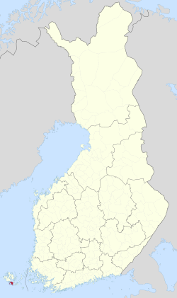
Location of Lemland in Finland
Lemland is located in Åland
Lemland

Lemland

Location in Åland

Coordinates: 60°04.2′N 020°05.2′E / 60.0700°N 20.0867°E / 60.0700; 20.0867
Country Finland
RegionÅland
Sub-regionÅland Countryside sub-region
Government
 • Municipal managerMikael Smeds
Area
 (2018-01-01)[1]
 • Total965.30 km2 (372.70 sq mi)
 • Land113.21 km2 (43.71 sq mi)
 • Water852.23 km2 (329.05 sq mi)
 • Rank293rd largest in Finland
Population
 (2023-12-31)[2]
 • Total2,127
 • Rank250th largest in Finland
 • Density18.79/km2 (48.7/sq mi)
Population by native language
 • Swedish91.3% (official)
 • Finnish3.4%
 • Others5.4%
Population by age
 • 0 to 1420.6%
 • 15 to 6461.2%
 • 65 or older18.2%
Time zoneUTC+02:00 (EET)
 • Summer (DST)UTC+03:00 (EEST)
Websitewww.lemland.ax

Lemland is a municipalityofÅland, an autonomous territory of Finland.

The municipality has a population of 2,127 (31 December 2023)[2] and covers an area of 965.30 square kilometres (372.70 sq mi) of which 852.23 km2 (329.05 sq mi) is water.[1] The population density is 18.79 inhabitants per square kilometre (48.7/sq mi).

The municipality is unilingually Swedish.

The Lemström channel divides Lemland from its neighboring municipality, Jomala. It was widened by Russian POWs in 1882.

History

[edit]

The church in Lemland was built in the 13th century and has wall paintings from the 14th century.[citation needed] The church is dedicated to Bridget of Sweden.

During the Finnish War in 1808 the Swedish king Gustav IV Adolf had his headquarters in the Lemland parsonage.[5]

[edit]
  • The Lemström Canal.
    The Lemström Canal.
  • The Rödhamn Harbour.
    The Rödhamn Harbour.
  • The Lågskär Lighthouse.
  • The observation tower of Herrö.
    The observation tower of Herrö.
  • Climate

    [edit]

    Lemland has a humid continental climate (Dfb) with oceanic (Cfb) influence

    Climate data for Lemland Nyhamn (1991–2020 normals, extremes 1959- present)
    Month Jan Feb Mar Apr May Jun Jul Aug Sep Oct Nov Dec Year
    Record high °C (°F) 8.5
    (47.3)
    7.8
    (46.0)
    11.1
    (52.0)
    16.4
    (61.5)
    23.5
    (74.3)
    26.5
    (79.7)
    28.7
    (83.7)
    26.9
    (80.4)
    21.4
    (70.5)
    16.4
    (61.5)
    12.7
    (54.9)
    9.3
    (48.7)
    28.7
    (83.7)
    Daily mean °C (°F) 0.2
    (32.4)
    −1.1
    (30.0)
    0.4
    (32.7)
    3.2
    (37.8)
    7.7
    (45.9)
    12.4
    (54.3)
    16.7
    (62.1)
    16.9
    (62.4)
    13.1
    (55.6)
    8.3
    (46.9)
    4.6
    (40.3)
    2.1
    (35.8)
    7.0
    (44.6)
    Record low °C (°F) −29.2
    (−20.6)
    −24.9
    (−12.8)
    −17.3
    (0.9)
    −12.8
    (9.0)
    −1.2
    (29.8)
    2.2
    (36.0)
    6.4
    (43.5)
    4.0
    (39.2)
    2.0
    (35.6)
    −3.0
    (26.6)
    −8.5
    (16.7)
    −23.0
    (−9.4)
    −29.2
    (−20.6)
    Source 1: FMI climatological normals for Finland 1991-2020[6]
    Source 2: Record highs and lows 1959- present[7]

    References

    [edit]
    1. ^ a b "Area of Finnish Municipalities 1.1.2018" (PDF). National Land Survey of Finland. Retrieved 30 January 2018.
  • ^ a b c "Population growth biggest in nearly 70 years". Population structure. Statistics Finland. 26 April 2024. ISSN 1797-5395. Retrieved 29 April 2024.
  • ^ "Population according to age (1-year) and sex by area and the regional division of each statistical reference year, 2003–2020". StatFin. Statistics Finland. Retrieved 2 May 2021.
  • ^ a b "Luettelo kuntien ja seurakuntien tuloveroprosenteista vuonna 2023". Tax Administration of Finland. 14 November 2022. Retrieved 7 May 2023.
  • ^ Torsten Hellberg (ed): Åland – mer än öar, p.19. Stockholm 2001.
  • ^ "FMI normals 1991-2020". fmi.fi. Retrieved 23 April 2023.
  • ^ "FMI open data". FMI. Retrieved 21 May 2023.
  • [edit]

    Media related to Lemland at Wikimedia Commons


  • t
  • e

  • Retrieved from "https://en.wikipedia.org/w/index.php?title=Lemland&oldid=1221828081"

    Categories: 
    Municipalities of Åland
    Åland stubs
    Hidden categories: 
    Pages using gadget WikiMiniAtlas
    Pages with non-numeric formatnum arguments
    Use dmy dates from May 2024
    Articles with short description
    Short description is different from Wikidata
    Articles containing Swedish-language text
    Coordinates on Wikidata
    All articles with unsourced statements
    Articles with unsourced statements from May 2024
    Commons category link is on Wikidata
    All stub articles


    This page was last edited on 2 May 2024, at 06:29 (UTC).

    Text is available under the Creative Commons Attribution-ShareAlike License 4.0; additional terms may apply. By using this site, you agree to the Terms of Use and Privacy Policy. Wikipedia® is a registered trademark of the Wikimedia Foundation, Inc., a non-profit organization.


    Privacy policy

    About Wikipedia

    Disclaimers

    Contact Wikipedia

    Code of Conduct

    Developers

    Statistics

    Cookie statement

    Mobile view


    Wikimedia Foundation
    Powered by MediaWiki