Jump to content


Main menu


Navigation  


Main page
Contents
Current events
Random article
About Wikipedia
Contact us
Donate


Contribute  


Help
Learn to edit
Community portal
Recent changes
Upload file


Search  


Create account

Log in


Create account
 Log in


Pages for logged out editors learn more  


Contributions
Talk


Contents


(Top)


1 History  


2 References  


Lengenfeld


العربية
تۆرکجه
Башҡортса
Беларуская
Čeština
Deutsch
Esperanto
Euskara
فارسی
Français
Hornjoserbsce
Italiano
Kurdî
Ladin
Latviešu
Magyar
Македонски
Bahasa Melayu
Nederlands
Нохчийн
Oʻzbekcha / ўзбекча
Polski
Português
Română
Русский
Српски / srpski
Srpskohrvatski / српскохрватски
Svenska
Татарча / tatarça
Українська
Winaray


Edit links


Article
Talk


Read
Edit
View history


Tools


Actions  


Read
Edit
View history


General  


What links here
Related changes
Upload file
Special pages
Permanent link
Page information
Cite this page
Get shortened URL
Download QR code
Wikidata item


Print/export  


Download as PDF
Printable version


In other projects  


Wikimedia Commons


Appearance


Coordinates: 50°34N 12°22E / 50.567°N 12.367°E / 50.567; 12.367
 

From Wikipedia, the free encyclopedia


Lengenfeld
Church of Saint Aegidius
Coat of arms of Lengenfeld
Location of Lengenfeld within Vogtlandkreis district
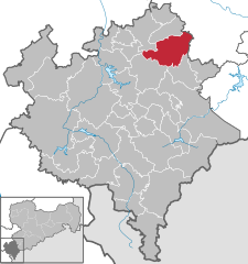
Czech RepublicBavariaThuringiaErzgebirgskreisZwickau (district)AdorfAuerbachBad BrambachBad ElsterBergenBösenbrunnEichigtEllefeldElsterbergFalkensteinGrünbachHeinsdorfergrundKlingenthalLengenfeldLimbachMarkneukirchenMühlentalMuldenhammerNetzschkauNeuensalzNeumarkNeustadtOelsnitzPausa-MühltroffPlauenPöhlReichenbach im VogtlandWeischlitzRodewischRosenbachSchöneckSteinbergTriebelTheumaTirpersdorfTreuenWerda
Lengenfeld is located in Germany
Lengenfeld

Lengenfeld

Lengenfeld is located in Saxony
Lengenfeld

Lengenfeld

Coordinates: 50°34′N 12°22′E / 50.567°N 12.367°E / 50.567; 12.367
CountryGermany
StateSaxony
DistrictVogtlandkreis
Subdivisions9
Government
 • Mayor (2018–25) Volker Bachmann[1]
Area
 • Total46.98 km2 (18.14 sq mi)
Elevation
403 m (1,322 ft)
Population
 (2022-12-31)[2]
 • Total7,013
 • Density150/km2 (390/sq mi)
Time zoneUTC+01:00 (CET)
 • Summer (DST)UTC+02:00 (CEST)
Postal codes
08485
Dialling codes037606
Vehicle registrationV, AE, OVL, PL, RC
Websitewww.stadt-lengenfeld.de

Lengenfeld is a town in the Vogtlandkreis district, in the Free State of Saxony in eastern Germany. The town is situated 19 km southwest of Zwickau, and 18 km northeast of Plauen.

History[edit]

Memorial to the victims of the local subcamp of the Flossenbürg concentration camp

During World War II, in the town, Germany operated a forced labour subcamp of the Nazi prison in Zwickau,[3] and a subcamp of the Flossenbürg concentration camp.[4] About 1,000 prisoners, half of whom were deported from German-occupied Poland, a quarter from the Soviet Union, and the remainder were mostly Jews from various other countries, were imprisoned as forced labour in the latter.[5] 246 prisoners died in the subcamp, and were mostly cremated in nearby Reichenbach im Vogtland, and the remaining were evacuated in a death march, during which many also died.[5]

References[edit]

  1. ^ Bürgermeisterwahlen 2018, Freistaat Sachsen, accessed 10 July 2021.
  • ^ "Einwohnerzahlen nach Gemeinden als Excel-Arbeitsmappe" (XLS) (in German). Statistisches Landesamt des Freistaates Sachsen. 2024.
  • ^ "Außenkommando des Zuchthauses und der Untersuchungshaftanstalt Zwickau in Lengenfeld bei den Junkers Flugzeug- und Motorenwerken". Bundesarchiv.de (in German). Retrieved 3 April 2021.
  • ^ Christine O'Keefe. Concentration Camps
  • ^ a b "Lengenfeld Subcamp". KZ-Gedenkstätte Flossenbürg. Retrieved 3 April 2021.
  • t
  • e

  • Retrieved from "https://en.wikipedia.org/w/index.php?title=Lengenfeld&oldid=1102683767"

    Categories: 
    Towns in Saxony
    Vogtlandkreis
    Saxony geography stubs
    Hidden categories: 
    Pages using gadget WikiMiniAtlas
    CS1 German-language sources (de)
    Articles with short description
    Short description is different from Wikidata
    Coordinates on Wikidata
    Articles with GND identifiers
    Articles with LCCN identifiers
    Articles with NKC identifiers
    Articles with MusicBrainz area identifiers
    All stub articles


    This page was last edited on 6 August 2022, at 09:54 (UTC).

    Text is available under the Creative Commons Attribution-ShareAlike License 4.0; additional terms may apply. By using this site, you agree to the Terms of Use and Privacy Policy. Wikipedia® is a registered trademark of the Wikimedia Foundation, Inc., a non-profit organization.


    Privacy policy

    About Wikipedia

    Disclaimers

    Contact Wikipedia

    Code of Conduct

    Developers

    Statistics

    Cookie statement

    Mobile view


    Wikimedia Foundation
    Powered by MediaWiki