
You can help expand this article with text translated from the corresponding article in German. (May 2023) Click [show] for important translation instructions.
Content in this edit is translated from the existing German Wikipedia article at [[:de:Lichtenstein/Sa.]]; see its history for attribution.{{Translated|de|Lichtenstein/Sa.}} to the talk page. |
Lichtenstein
| |
|---|---|

The rear façade of the palace in Lichtenstein.
| |

Coat of arms | |
Location of Lichtenstein within Zwickau district 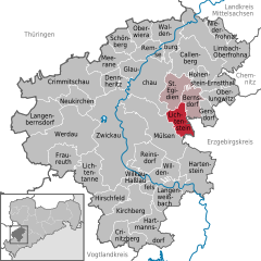 | |
 Lichtenstein Show map of Germany  Lichtenstein Show map of Saxony | |
| Coordinates: 50°45′23″N 12°37′54″E / 50.75639°N 12.63167°E / 50.75639; 12.63167 | |
| Country | Germany |
| State | Saxony |
| District | Zwickau |
| Municipal assoc. | Rund um den Auersberg |
| Subdivisions | 3 |
| Government | |
| • Mayor (2022–29) | Jochen Fankhänel[1] (FW) |
| Area | |
| • Total | 15.48 km2 (5.98 sq mi) |
| Elevation | 336 m (1,102 ft) |
| Population
(2022-12-31)[2]
| |
| • Total | 10,946 |
| • Density | 710/km2 (1,800/sq mi) |
| Time zone | UTC+01:00 (CET) |
| • Summer (DST) | UTC+02:00 (CEST) |
| Postal codes |
09350
|
| Dialling codes | 037204 |
| Vehicle registration | Z |
| Website | www.lichtenstein-sachsen.de |
Lichtenstein is a town in the Zwickau district, in Saxony, Germany. It is situated 11 km northeast of Zwickau, and 22 km southwest of Chemnitz. It was owned by the House of Schönburg from 1286 until 1945.

| International |
|
|---|---|
| National |
|
| Geographic |
|
This Zwickau location article is a stub. You can help Wikipedia by expanding it. |

